- Mound House, Nevada
-
Mound House, Nevada — Unincorporated community — Location within the state of Nevada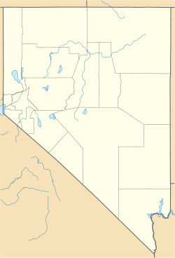
 Mound House, Nevada
Coordinates: 39°13′02″N 119°40′31″W / 39.21722°N 119.67528°WCoordinates: 39°13′02″N 119°40′31″W / 39.21722°N 119.67528°W Country United States State Nevada County Lyon Elevation 4,974 ft (1,516 m) Time zone Pacific (PST) (UTC-8) - Summer (DST) PDT (UTC-7) ZIP codes FIPS code GNIS feature ID 856321 Mound House, Nevada is a small unincorporated community in Lyon County, Nevada on U.S. Route 50 that is situated between Nevada's capital, Carson City, and Dayton, Nevada. Its elevation is 4,974 feet (1,516 m).[1] It is in Lyon County, one of 8 Nevada counties that allow for legalized prostitution, and is home to four brothels.
Situated adjacent to Carson City, the community of Mound House lies just east of the county line and is the first community in Lyon County as one travels east on U.S. Route 50 from Carson City. Mound House came into being as a community in the 19th century as settlers traveled west toward California along the Carson River route. The famed Pony Express (1860-1861) once had a stop here, now commemorated by a Historical Marker located on the grounds of the Moonlite BunnyRanch legal brothel.
Mound House grew in importance with the Comstock silver strike and the famed Virginia and Truckee Railroad passed through the community. It grew in population during the mining boom with a railroad station (1871) and post office (1877) as the center of the community. Upon construction of the Carson & Colorado (narrow gauge) Railroad in 1880, Mound House became and important multi-gauge transfer depot for both freight and passengers. The original community suffered the fate of many of the Comstock tied communities, population and commerce fading with the demise of the silver boom. Completion of the Hazen branch (1905) of the Southern Pacific Railroad, which had purchased the C&C the previous year, allowed traffic bound for the transcontinental railroad to bypass the V&T entirely, and Mound House suffered as a result.
At the turn of the 20th century, a large gypsum mill with its adjacent mine became the primary structures in the Mound House area. Gypsum mining and a mill still operate today in the community. However, the community's railroads eventually fell victim to economic forces, with the C&C abandoning its line between Mound House and Fort Churchill in 1934, and the V&T closing its Carson City-Virginia City line in 1938. The rails were removed for scrap in 1941.
With the reconstruction of the Virginia & Truckee Railway currently under way, Mound House residents and visitors can now once again hear the sound of trains nearby. However, the 2009 version of the V&T had to deviate from the historical alignment down what is now Red Rock Road and Highland Drive due to the development that had taken place over the last 68 years. As a result, the new trains will not pass through the site of the original Mound House depot and yards.[2]
Significant industrial enterprises, small commercial businesses, mining, and several residential areas make up the community of Mound House today. Mound House is once again a vibrant community contributing to the diversity and vitality of Nevada.
References
- ^ U.S. Geological Survey Geographic Names Information System: Mound House, Nevada, Geographic Names Information System, 1980-12-12. Accessed 2008-06-11.
- ^ Nevada Commission for the Reconstruction of the Virginia & Truckee Railway "website". http://www.VTRailway.com/.
Preceded by
Hawthorne (Present Mineral County Seat—Former Esmeralda County Seat)Nevada Historical Markers
61Succeeded by
Truckee River – WestMunicipalities and communities of Lyon County, Nevada County seat: Yerington Cities 
CDPs Unincorporated
communitiesMason | Mound House | Silver City | Simpson | Smith | Stagecoach | Wabuska | Weed Heights | Wellington
Indian reservation Categories:- Unincorporated communities in Nevada
- Populated places in Lyon County, Nevada
- Pony Express stations


Wikimedia Foundation. 2010.