- Chappell Hill, Texas
-
Not to be confused with Chapel Hill, North Carolina.
Chappell Hill, Texas — Settlement — Location of Chappell Hill, Texas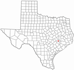
Coordinates: 30°08′07″N 96°15′25″W / 30.13528°N 96.25694°WCoordinates: 30°08′07″N 96°15′25″W / 30.13528°N 96.25694°W Country United States State Texas County Washington Area – Water 0.0 sq mi (0.0 km2) Population (2000) – Total 600 Time zone Central (CST) (UTC-6) – Summer (DST) CDT (UTC-5) ZIP code 77426 Area code(s) 979 Chappell Hill is a small rural community in the eastern portion of Washington County, Texas, United States. It is located along U.S. Highway 290 roughly halfway between Brenham and Hempstead. Chappell Hill is located inside Stephen F. Austin's original colony and the land is some of the oldest-settled in the state.
Contents
Geography
Chappell Hill is located at the junction of US Highway 290 and Farm to Market Road 1155. Chappell Hill is located within the Brazos River watershed. The area is part of the Gulf Coastal Plain and terrain is rolling hills.
History
The town was established in 1847 by a Mary Hargrove Haller who founded the town on 100 acres (0.40 km2) of land she bought. She then named the town after her grandfather Robert Wooding Chappell.[1] The area around the town was settled by planters from the Deep South and thanks to the fertile soil of the Brazos river valley, cotton became the area's main crop.
Jacob and Mary Haller also built the Stagecoach Inn of Chappell Hill in 1850, which they operated until 1859 and continued under new ownership until 1871. Because the Inn was about halfway between Houston and Austin, it was a frequent stopping place for travelers along two major stagecoach lines.[2]
The town became an important part of the Republic of Texas and later the State of Texas before the Civil War. The population reached a maximum of about 3,000 people; at the time, San Antonio and Galveston were the largest towns at around 8,000 people. A sawmill, a railroad line, five churches, and a Masonic Lodge were built in the area. Two colleges, Soule University for men and Chappell Hill Female College for women, were founded in 1856.[3]
The men of Chappell Hill formed part of the First Texas Lancers cavalry regiment during the Civil War and fought in Missouri, Louisiana, and Arkansas. Men from Chappell Hill served in numerous renowned Confederate units, including The Texas Brigade and Terry's Texas Rangers, and saw action in most of the major engagements of the Civil War. In addition, the Soule University building was used as a field hospital. The men of Chappell Hill saw action in a number of renowned Confederate units, including The Texas Brigade and Terry's Texas Rangers.
A yellow fever epidemic, the result of the town's proximity to the Brazos River, decimated the town in 1867. Many men who survived combat in the war lost their lives just two years after the war's end. The town never recovered and faded into obscurity. Polish immigrants, mostly from the German partition, began to appear in the 1870s and the area was re-settled, though it did not reach the status of before. In 1889, Father Grabinger from Brenham's St. Mary's established St. Stanislaus Roman Catholic Church. Denizens of Polish ancestry can still be found in the area surrounding the church and throughout Washington and Austin counties.
In 1933, the Farmers Bank of Chappell Hill refused to close its doors when so ordered by President Franklin Delano Roosevelt during a March 6 to March 10 banking freeze. The owner of the bank took out an ad in a Boston newspaper protesting the order.
Chappell Hill today has a tourist economy, attracting visitors with restored homes, Bluebonnet Festival, Scarecrow Festival and a museum. Main Street has been designated as a National Register Historic District by the National Register of Historic Places. Chappell Hill remains one of the best historically preserved towns in Texas.
On May 10, 2008, an election was held to incorporate Chappell Hill into its own town government. 201 ballots were cast out of a possible 297 eligible voters. Incorporation was rejected by almost 3 to 1 voters; 148 votes against and just 53 for. 90 votes were cast in the mayoral poll; Julie Edwards received 55 votes and Mary Tom Middlebrooks won 35. For the two unopposed council positions, Travis Bevers received 62 votes while Larry C. Wiese received 60. The results of these contests were immediately invalidated by the anti-incorporation outcome.
Chappell Hill buildings on the National Register of Historic Places
- Chappell Hill Circulating Library
- Chappell Hill Methodist Episcopal Church
- Chappell Hill Public School and Chappell Hill Female College Bell
- Isaac Applewhite House
- Stagecoach Inn of Chappell Hill
Demographics
As of the 2000 US Census, there were approximately 300 people living in the town itself. There are 1,319 people, 532 households, and 377 families living in the Chappell Hill zipcode, 77426.[4] Of the 1,319 people, 925 are white, 343 are black, and 34 are of another race. Most people are Roman Catholic, Methodist, or Southern Baptist in religion.
External links
- Chappell Hill Historical Society
- Chappell Hill Sausage Company, a regionally known sausage producer
- The Confederates of Chappell Hill, Texas: Prosperity, Civil War and Decline, a 2004 book detailing antebellum Chappell Hill authored by Stephen Chicoine
- Handbook of Texas Online, Chappell Hill entry
References
- ^ Handbook of Texas Online, Chappell Hill. http://www.tshaonline.org/handbook/online/articles/CC/hlc21.html.
- ^ Jewett, Clayton. 2006 The Confederates of Chappell Hill, Texas: Prosperity, Civil War, and Decline The Free Library (May, 1), http://www.thefreelibrary.com/The Confederates of Chappell Hill, Texas: Prosperity, Civil War, and...-a0146628887
- ^ Southwestern University Historical Page. http://www.southwestern.edu/library/how-we-remember/root-institutions/Soulerevised.htm
- ^ Census Factfinder, Zipcode 77426. (Link)
Municipalities and communities of Washington County, Texas City 
Town Unincorporated
communitiesChappell Hill | Greenvine | Independence | Latium | Prairie Hill | Quarry | Washington-on-the-Brazos
Ghost towns Gay Hill | Goodwill | Graball | La Bahia | Tigertown | William Penn
Categories:- Populated places in Washington County, Texas
- Unincorporated communities in Texas


Wikimedia Foundation. 2010.