- Clanfield, Hampshire
-
Coordinates: 50°56′49″N 1°00′29″W / 50.94700°N 1.00814°W
Clanfield 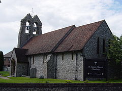
Church of St. James
 Clanfield
Clanfield shown within HampshirePopulation c.4500 (2002) OS grid reference SU697168 Parish Clanfield District East Hampshire Shire county Hampshire Region South East Country England Sovereign state United Kingdom Post town WATERLOOVILLE Postcode district PO8 Dialling code 023 Police Hampshire Fire Hampshire Ambulance South Central EU Parliament South East England UK Parliament Meon Valley List of places: UK • England • Hampshire Clanfield is a village and civil parish in the East Hampshire district of Hampshire, England. It is 2.4 miles (3.8 km) north of Horndean, just west of the A3 road.
The surrounding villages are Horndean, Catherington, Hinton Daubney, Chalton, East Meon, and Hambledon.
It is in the very south of the district of East Hampshire. It has a semi-rural character with 3 sides of the village being adjoined by fields including Queen Elizabeth Country Park.
It is situated about 12 miles north of Portsmouth and six miles south of Petersfield and sits to the west of the main A3 road, just north of where the A3(M) (Motorway) ends. It is in the far east of the county of Hampshire.
Clanfield is overlooked from the other side of the A3 road by Windmill Hill and Chalton Windmill which stands at 193 metres above sea level. Many references in Clanfield feature the windmill, such as Windmill Garage.
The population of Clanfield is c. 4500 (estimated 2002).
Clanfield consists of two parts, "Old" Clanfield and "New" Clanfield. Old Clanfield has been around for roughly 250 years and New Clanfield about 30 years. Starting with Old Clanfield, the smaller part, but has more takeaway restaurants than most similar sized communities. It is on (next to) a main road which means it is very easy to access and buses run through it frequently. It also has a skatepark and children's play area in Peel Park. New Clanfield is slightly larger than its elder sibling, yet still much smaller than the neighbouring village of Horndean. However, the New Clanfield shopping facilities contain a newsagent, greengrocer, Chinese takeaway, butcher, optician, hardware store, Costcutter, two hairdressers, and the Co-Op as well as an Indian Restaurant, and, in a recent redevelopment, a wine-bar & Pharmacy.
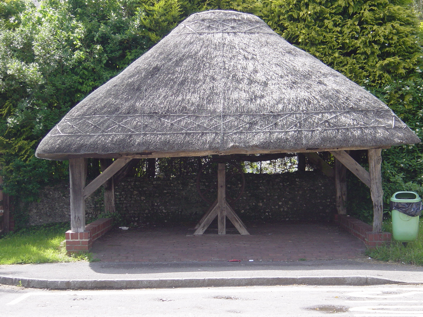
Clanfield is a popular area for walkers, with Queen Elizabeth Country Park being next to the village. The old village also has a recently restored pond, a thatched village well, and the church of St. James.
There are two schools. Petersgate Infant in Clanfield and Clanfield Junior School in old Clanfield.
Clanfield is twinned with Val d'Oison, France
 Clanfield Well and Thatched Cover
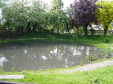 Clanfield Pond
Contents
History
The name Clanfield is derived from the Old English and means "field clean of weeds".
Clanfield was historically a small farming community centred about the church of St James, that dates from 1305 and was rebuilt in 1875 and contains two ancient mediaeval bells. From December 2007 till November 2008 it had scaffolding around the outside as a fire in December 2007 damaged the inside and holes had to be cut in the roof to release the heat. It is suspected that it was arson. This is now repaired. The community in 1929 recorded the population as 129, by the late 1940s almost 500, and in 1998 over 4500, with almost 1700 households and growing.
The new South Downs National Park borders Clanfield on three sides (east, north and west) and includes a large part of the undeveloped part of the village to the north (the former Area of Outstanding Natural Beauty).
Politics
Clanfield has a parish council, two councillors for the Clanfield and Finchdean ward of East Hampshire District Council, and one councillor for the Petersfield Butser electoral division of Hampshire County Council.
Clanfield is in the newly (2007) created Meon Valley constituency for elections to the House of Commons and the South East England constituency for elections to the European Parliament.
Public transport
The number 41 bus from First buses runs to Southsea and Portsmouth from Clanfield and the 37 (Changed from 38 in September 2007), a Stagecoach bus, goes to Petersfield, which is the nearest larger Railway station. The nearest slow train railway station is Rowlands Castle railway station
Community, and sport
There are two parks in Clanfield. Both have swings and other child play items and one (Peel Park) has a skateboard park. South Lane Meadow has a cricket ground, and Peel Park has football pitches set up. There is a new changing room at Peel Park. Clanfield has a large football club called Clanfield (Hampshire) F.C.
Clanfield's major community centres are Clanfield Memorial Hall, in South Lane, Clanfield, the St James Church Hall and Leader Hall, Little Hyden Lane (For the Scouts), although this was burned down in 2008 and is now replaced with a new building.
There are three public houses and one 'wine-bar'. The rebuilt Rising Sun in the old village, the Hampshire Hog (previously Hogs Lodge) on the outskirts of the parish near the A3 and the famous Bat and Ball Inn, in Hyden Farm Lane, opposite the 'Home of Cricket', Broadhalfpenny Down cricket ground. The boundary between Clanfield and Hambledon used to run through the Bat & Ball and you can still see the brass strip marking the old boundary running across the floor. There is also the 'Pure' wine-bar in New Clanfield.
Great use is also made of the neighbouring villages facilities.
Also in (near) Clanfield is the Clanfield Observatory run by the Hampshire Astronomical Group, who have open days. The observatory is next to one of Portsmouth Water's reservoirs.
Papers
The local newspapers and publications are
Business
Business of note are
- Bolwextric Slot Car racing
- Gibson and Gamon Estate Agents
- Pearsons Estate Agent (was Saltmarsh)
- Horndean Business Centre
- Windmill Garage
- New China House
External links
- Hampshire County Council
- East Hampshire District Council
- Clanfield Joggers
- Petersgate Infant School
- Clanfield Footbal Club
- Clanfield Weather
- Hampshire Astronomical Group
- Portsmouth Water
References
Towns, villages and hamlets in the East Hampshire District of Hampshire, England 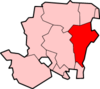 Adhurst · Alton · Arford · Ashley · Barford · Beech · Bentley · Bentworth · Binsted · Blackmoor · Blacknest · Blendworth · Bordean · Bordon · Bradley · Bramshott · Bucks Horn Oak · Buriton · Burkham · Catherington · Chalton · Chawton · Clanfield · Cold Ash Hill · Colemore · Conford · Ditcham · Durford Wood · East Meon · East Tisted · East Worldham · Empshott · Farringdon · Finchdean · Flexcombe · Four Marks · Froxfield Green · Froyle · Golden Pot · Grayshott · Greatham · Griggs Green · Hartley Mauditt · Hawkley · Headley · Headley Down · High Cross · Holybourne · Hollywater · Horndean · Idsworth · Isington · Kingsley · Kitwood · Langrish · Lasham · Lindford · Liphook · Liss · Liss Forest · Longmoor · Lovedean · Lower Wield · Medstead · Monkwood · Neatham · Newton Valence · North Street · Nursted · Oakhanger · Oakshott · Passfield · Petersfield · Priors Dean · Privett · Ramsdean · Ropley · Ropley Dean · Rowland's Castle · Selborne · Shalden · Sheet · Sleaford · Soldridge · South Hay · Southrope · Standford · Stansted · Steep · Steep Marsh · Stroud · Thedden · Upper Wield · West Liss · West Tisted · West Worldham · Weston · Wheatley · Whitehill · Wivelrod · WyckCategories:
- East Hampshire
- Villages in Hampshire
- Civil parishes in Hampshire


Wikimedia Foundation. 2010.