- Conford
-
Coordinates: 51°05′N 0°50′W / 51.08°N 0.83°W
Conford 
 Conford
Conford shown within HampshireOS grid reference SU8232 Shire county Hampshire Region South East Country England Sovereign state United Kingdom Post town LIPHOOK Postcode district GU30 Dialling code 01428 Police Hampshire Fire Hampshire Ambulance South Central EU Parliament South East England List of places: UK • England • Hampshire Conford is a hamlet in the civil parish of Passfield in the East Hampshire district of Hampshire, England. It lies near the large village of Liphook.
External links
Towns, villages and hamlets in the East Hampshire District of Hampshire, England 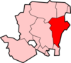 Adhurst · Alton · Arford · Ashley · Barford · Beech · Bentley · Bentworth · Binsted · Blackmoor · Blacknest · Blendworth · Bordean · Bordon · Bradley · Bramshott · Bucks Horn Oak · Buriton · Burkham · Catherington · Chalton · Chawton · Clanfield · Cold Ash Hill · Colemore · Conford · Ditcham · Durford Wood · East Meon · East Tisted · East Worldham · Empshott · Farringdon · Finchdean · Flexcombe · Four Marks · Froxfield Green · Froyle · Golden Pot · Grayshott · Greatham · Griggs Green · Hartley Mauditt · Hawkley · Headley · Headley Down · High Cross · Holybourne · Hollywater · Horndean · Idsworth · Isington · Kingsley · Kitwood · Langrish · Lasham · Lindford · Liphook · Liss · Liss Forest · Longmoor · Lovedean · Lower Wield · Medstead · Monkwood · Neatham · Newton Valence · North Street · Nursted · Oakhanger · Oakshott · Passfield · Petersfield · Priors Dean · Privett · Ramsdean · Ropley · Ropley Dean · Rowland's Castle · Selborne · Shalden · Sheet · Sleaford · Soldridge · South Hay · Southrope · Standford · Stansted · Steep · Steep Marsh · Stroud · Thedden · Upper Wield · West Liss · West Tisted · West Worldham · Weston · Wheatley · Whitehill · Wivelrod · WyckCategories:
- Villages in Hampshire
- East Hampshire
- Hampshire geography stubs


Wikimedia Foundation. 2010.