- Chico, Washington
-
Chico — CDP — Location within the state of Washington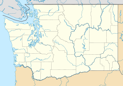
 Chico
ChicoCoordinates: 47°36′42″N 122°42′33″W / 47.61167°N 122.70917°WCoordinates: 47°36′42″N 122°42′33″W / 47.61167°N 122.70917°W Country United States State Washington County Kitsap Population (2010) – Total 2,259 Time zone Pacific (PST) (UTC-8) – Summer (DST) PDT (UTC-7) ZIP codes 98312 Area code(s) 360 FIPS code GNIS feature ID Chico is an CDP in Kitsap County, Washington, United States. Named in 1889 for a local Indian,[1] Chico is located on the Dyes Inlet waterfront to the southeast of Silverdale. Most of Chico's residents commute to work in nearby Silverdale or Bremerton. At the 2010 census the community had a population of 2,259.
Because of Chico's status as an unincorporated community, its borders are loosely defined, however, the United States Census now has recognized the community. The northern border is generally understood to be delineated by Newberry Hill Road, which separates Chico from Silverdale. Chico Creek is the boundary between Chico on the north and Erlands Point-Kitsap Lake to the south. Washington State Route 3 serves as Chico's western border, and Dyes Inlet lies to its east.
References
- ^ Majors, Harry M. (1975). Exploring Washington. Van Winkle Publishing Co. p. 82. ISBN 9780918664006. http://books.google.com/books?id=CoWrPQAACAAJ.
Municipalities and communities of Kitsap County, Washington Cities 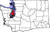
CDPs Bangor Trident Base | East Port Orchard | Erlands Point-Kitsap Lake | Indianola | Kingston | Manchester | Navy Yard City | Parkwood | Silverdale | Suquamish | Tracyton
Unincorporated
communitiesBethel | Brownsville | Burley | Chico | Eglon | Fragaria | Glenwood | Gorst | Hansville | Holly | Illahee | Keyport | Little Boston | Olalla | Port Gamble | Retsil | Seabeck | South Colby | Southworth
Indian reservation Categories:- Unincorporated communities in Washington (state)
- Populated places in Kitsap County, Washington
- Kitsap County, Washington geography stubs


Wikimedia Foundation. 2010.