- Ochsenfurt
-
Ochsenfurt Townhall in Ochsenfurt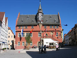


 OchsenfurtLocation of the town of Ochsenfurt within Würzburg district
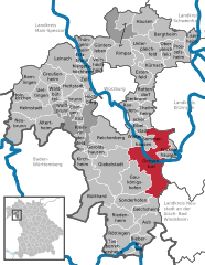
Coordinates 49°39′N 10°04′E / 49.65°N 10.06667°ECoordinates: 49°39′N 10°04′E / 49.65°N 10.06667°E Administration Country Germany State Bavaria Admin. region Lower Franconia District Würzburg Town subdivisions 9 Stadtteile/Stadtbezirke Mayor Friedrich Rainer (CSU) Basic statistics Area 63.55 km2 (24.54 sq mi) Elevation 187 m (614 ft) Population 11,223 (31 December 2010)[1] - Density 177 /km2 (457 /sq mi) Other information Time zone CET/CEST (UTC+1/+2) Licence plate WÜ Postal code 97199 Area code 09331 Website www.ochsenfurt.de Ochsenfurt is a town in the district of Würzburg, in Bavaria, Germany. It is situated on the left bank of the River Main, here crossed by a stone bridge, 13 miles south from Würzburg by the railway to Munich, and at the junction of a line to Röttingen. Pop. 11,600. Like Oxford, the town of Ochsenfurt is called after a ford where oxen crossed the river.
It contained in 1911 an Evangelical and five Roman Catholic churches, among them that of St Michael, a fine Gothic edifice. There is a considerable trade in wine and agricultural products, other industries being brewing and malting.
It was one of the places in Germany that King Richard I of England was detained in 1193 while the king was returning to England from the Third Crusade.[2]
The premises of the former Carthusian monastery here, Tückelhausen Charterhouse, secularised in 1803 and largely converted for private residential use, contain a museum of Carthusian life. The monastery, dedicated to Saints Lambert, John the Baptist and George, was founded in 1138 by Otto I, Bishop of Bamberg, as a double canonry of the Premonstratensians. From 1351 it belonged to the Carthusians.
Contents
International relations
Twin towns - Sister cities
Ochsenfurt is twinned with:
References
 This article incorporates text from a publication now in the public domain: Chisholm, Hugh, ed (1911). Encyclopædia Britannica (11th ed.). Cambridge University Press.
- Klöster in Bayern: Tückelhausen - Vom Prämonstratenserstift zum Kartäusermuseum (German)
- Website of the Diocese of Würzburg: the Carthusian Museum (German)
Bibliography
- Die Kunstdenkmäler von Unterfranken, Bd. 1: Bezirksamt Ochsenfurt. 2. Auflage 1983. ISBN 978-3-486-50455-2
- Halbleib, Volker; Kretzer, Heinz (2006). Ochsenfurt. Sutton. ISBN 9783866800007. http://books.google.com/books?id=YHvaAAAACAAJ. Retrieved 4 March 2010.
Notes
- ^ "Fortschreibung des Bevölkerungsstandes" (in German). Bayerisches Landesamt für Statistik und Datenverarbeitung. 31 December 2010. https://www.statistikdaten.bayern.de/genesis/online?language=de&sequenz=tabelleErgebnis&selectionname=12411-009r&sachmerkmal=QUASTI&sachschluessel=SQUART04&startjahr=2010&endjahr=2010.
- ^ Stacey, Robert C. "Walter, Hubert (d. 1205)" Oxford Dictionary of National Biography Oxford University Press, 2004 Online Edition accessed November 8, 2007
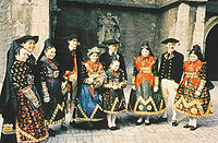 Tradition local costumes in Ochsenfurt
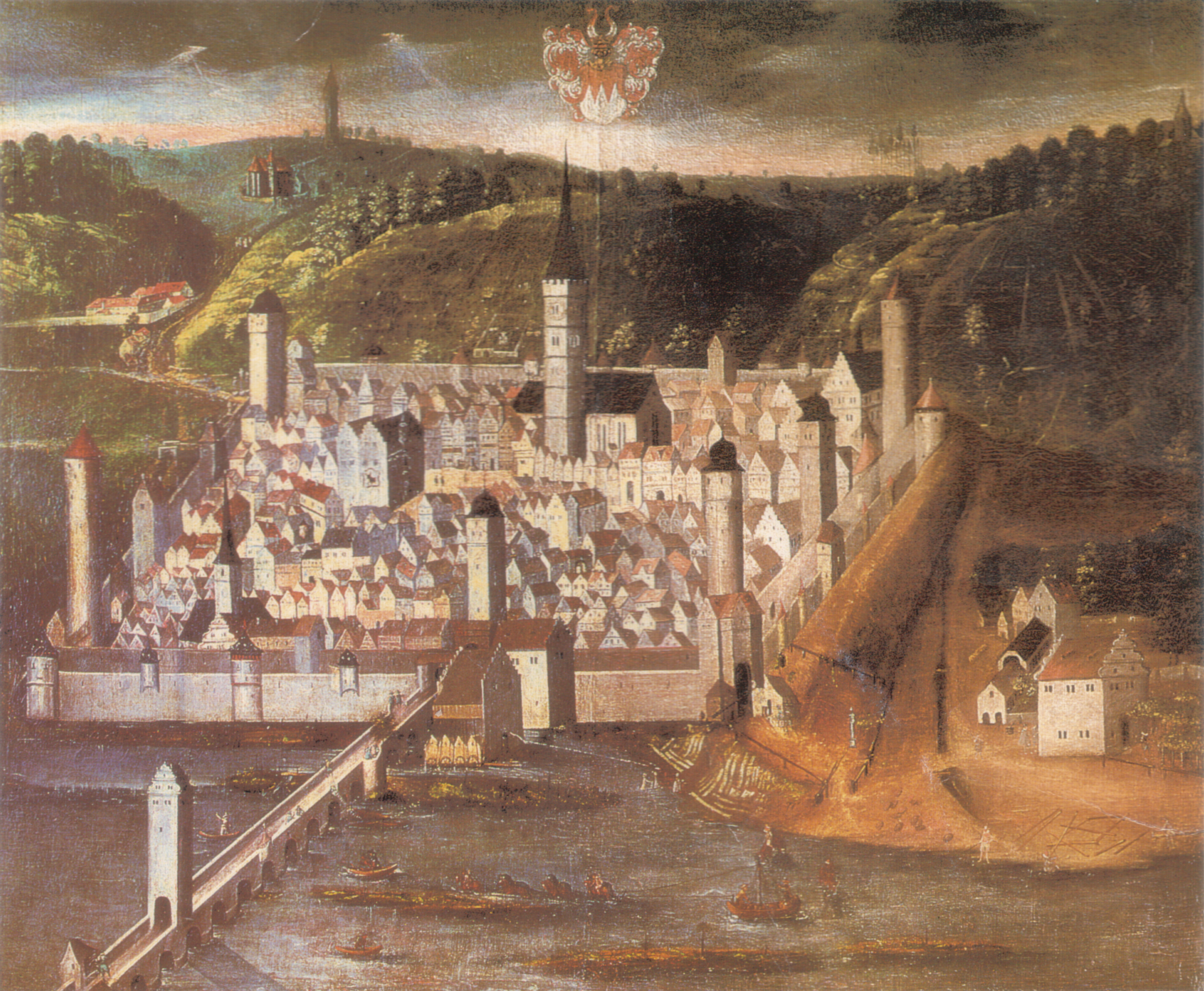
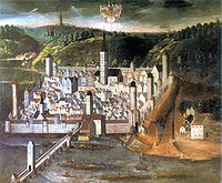 Painting of Ochsenfurt - 1623
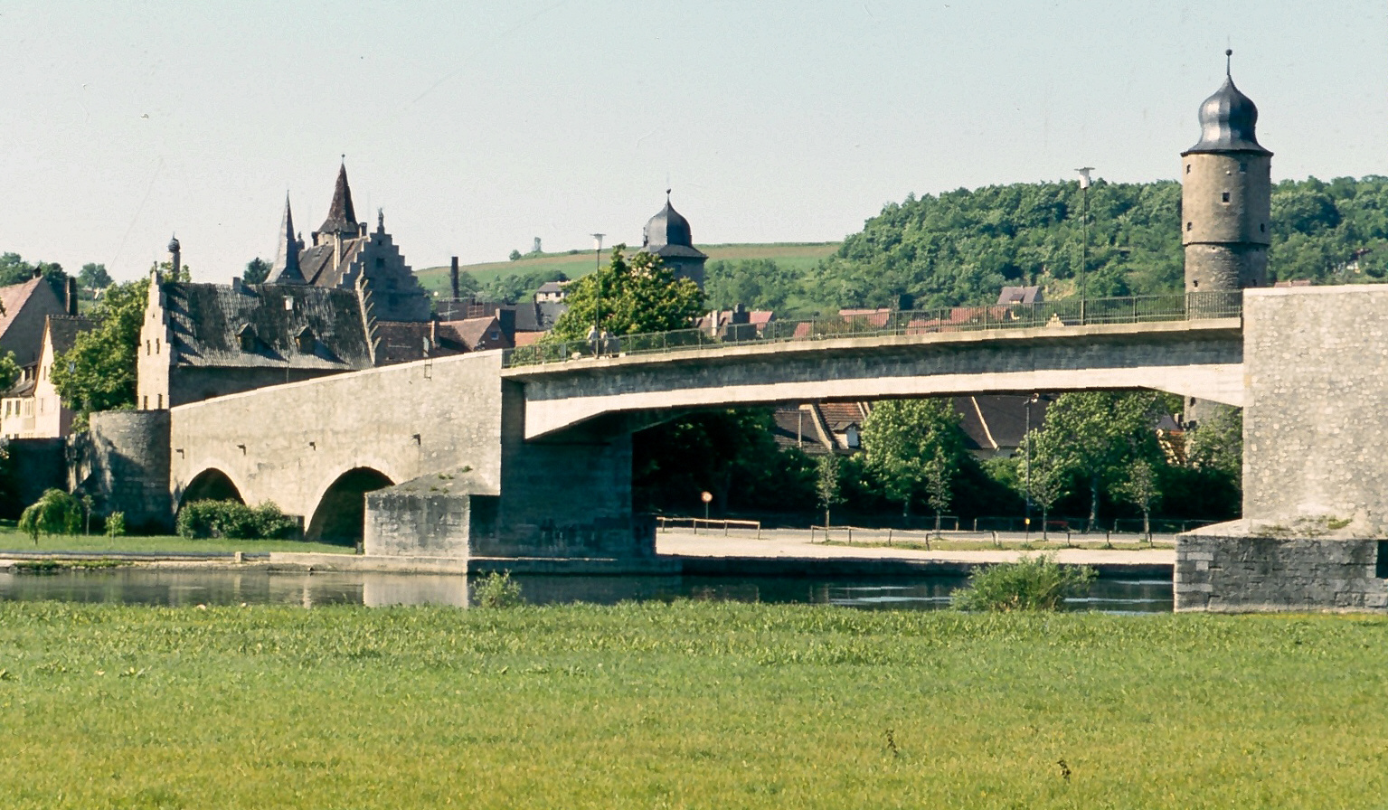
 Alte Mainbrücke, after the post-WW II rebuilding
Altertheim · Aub · Bergtheim · Bieberehren · Bütthard · Eibelstadt · Eisenheim · Eisingen · Erlabrunn · Estenfeld · Frickenhausen am Main · Gaukönigshofen · Gelchsheim · Gerbrunn · Geroldshausen · Giebelstadt · Greußenheim · Güntersleben · Hausen bei Würzburg · Helmstadt · Hettstadt · Höchberg · Holzkirchen · Kirchheim · Kist · Kleinrinderfeld · Kürnach · Leinach · Margetshöchheim · Neubrunn · Oberpleichfeld · Ochsenfurt · Prosselsheim · Randersacker · Reichenberg · Remlingen · Riedenheim · Rimpar · Rottendorf · Röttingen · Sommerhausen · Sonderhofen · Tauberrettersheim · Theilheim · Thüngersheim · Uettingen · Unterpleichfeld · Veitshöchheim · Waldbrunn · Waldbüttelbrunn · Winterhausen · Zell am Main
 Categories:
- Towns in Bavaria
- Würzburg district
- Lower Franconia geography stubs


Wikimedia Foundation. 2010.