- Oberpleichfeld
-
Oberpleichfeld 

 OberpleichfeldLocation of Oberpleichfeld within Würzburg district
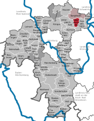
Coordinates 49°53′N 10°5′E / 49.88333°N 10.08333°ECoordinates: 49°53′N 10°5′E / 49.88333°N 10.08333°E Administration Country Germany State Bavaria Admin. region Lower Franconia District Würzburg Municipal assoc. Bergtheim Mayor Raimund Hammer (Unabhängige Liste) Basic statistics Area 8.66 km2 (3.34 sq mi) Elevation 263 m (863 ft) Population 1,074 (31 December 2010)[1] - Density 124 /km2 (321 /sq mi) Other information Time zone CET/CEST (UTC+1/+2) Licence plate WÜ Postal code 97241 Area code 09367 Website www.oberpleichfeld.de Oberpleichfeld is a municipality in the district of Würzburg in Bavaria, Germany.
References
- ^ "Fortschreibung des Bevölkerungsstandes" (in German). Bayerisches Landesamt für Statistik und Datenverarbeitung. 31 December 2010. https://www.statistikdaten.bayern.de/genesis/online?language=de&sequenz=tabelleErgebnis&selectionname=12411-009r&sachmerkmal=QUASTI&sachschluessel=SQUART04&startjahr=2010&endjahr=2010.
Altertheim · Aub · Bergtheim · Bieberehren · Bütthard · Eibelstadt · Eisenheim · Eisingen · Erlabrunn · Estenfeld · Frickenhausen am Main · Gaukönigshofen · Gelchsheim · Gerbrunn · Geroldshausen · Giebelstadt · Greußenheim · Güntersleben · Hausen bei Würzburg · Helmstadt · Hettstadt · Höchberg · Holzkirchen · Kirchheim · Kist · Kleinrinderfeld · Kürnach · Leinach · Margetshöchheim · Neubrunn · Oberpleichfeld · Ochsenfurt · Prosselsheim · Randersacker · Reichenberg · Remlingen · Riedenheim · Rimpar · Rottendorf · Röttingen · Sommerhausen · Sonderhofen · Tauberrettersheim · Theilheim · Thüngersheim · Uettingen · Unterpleichfeld · Veitshöchheim · Waldbrunn · Waldbüttelbrunn · Winterhausen · Zell am Main
 Categories:
- Municipalities in Bavaria
- Würzburg district
- Lower Franconia geography stubs


Wikimedia Foundation. 2010.