- Durham (provincial electoral district)
-
Durham  Ontario electoral district
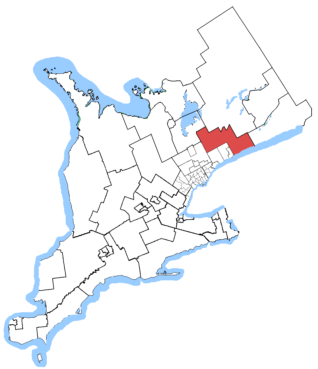
Durham in relation to other Greater Toronto Area electoral districts Provincial electoral district Legislature Legislative Assembly of Ontario MPP
John O'Toole
Progressive ConservativeDistrict created 1999 First contested 1999 Last contested 2011 Demographics Population (2006) 118,500 Electors (2007) 83,221 Area (km²) 1,625 Pop. density (per km²) 72.9 Census divisions Durham Census subdivisions Clarington, Mississaugas of Scugog Island, Scugog, Uxbridge - For information on the Durham federal electoral district, see Durham (electoral district).
Durham is a provincial electoral district in Ontario, Canada, that has been represented in the Legislative Assembly of Ontario since 1999 and from 1926 to 1975.
The Durham provincial riding was created in 1999 when Ontario adopted federal riding boundaries for provincial elections purposes. It was created from Durham East and Oshawa
It consisted initially of the Township of Scugog, Scugog Indian Reserve No. 34, the Town of Clarington, and the part of the City of Oshawa lying north of a line drawn from west to east along Taunton Road, south along Ritson Road North, east along Rossland Road East, south along Harmony Road North, and east along King Street East.
In 2007, the riding gained the Township of Uxbridge but lost all of its territory in Oshawa.
Contents
Members of Provincial Parliament
Assembly Years Member Party 17th 1926 − 1929 John Bragg Liberal 18th 1929 − 1934 19th 1934 − 1937 20th 1937 − 1943 Cecil Mercer 21st 1943 − 1945 Percival Vivian Progressive Conservative 22nd 1945 − 1948 23rd 1948 − 1951 John Foote 24th 1951 − 1955 25th 1955 − 1959 26th 1959 − 1963 Hugh Carruthers 27th 1963 − 1967 28th 1967 − 1971 29th 1971 − 1975 37th 1999 − 2003 John O'Toole Progressive Conservative 38th 2003 − 2007 39th 2007 − 2011 40th 2011 − Present Election results
Ontario general election, 2011 Party Candidate Votes % ±% Progressive Conservative John O'Toole 22,392 49.1 +2.2 Liberal Betty Somerville 13,356 29.3 -2.9 New Democrat James Terry 7,990 17.5 +5.4 Green Edward Yaghledjian 1,208 2.6 -6.2 Libertarian Blaize Barnicoat 421 0.9 +0.9 Freedom David Strutt 240 0.5 +0.5 Total valid votes 100.00 Note: the 2011 election was held on October 6, 2011.
** Preliminary Results - Not Official Yet. **Ontario general election, 2007 Party Candidate Votes % ±% Progressive Conservative John O'Toole 21,485 46.93 -0.16 Liberal Betty Louise Somerville 14,733 32.18 -4.58 New Democrat Catherine Robinson 5,519 12.06 -0.35 Green June Davies 4,044 8.83 +6.49 Total valid votes 45,781 100.00 Ontario general election, 2003 Party Candidate Votes % ±% Progressive Conservative John O'Toole 23,814 47.09 -9.98 Liberal Garry Minnie 18,590 36.76 +4.64 New Democrat Teresa Williams 6,274 12.41 +3.15 Green Gordon H. Macdonald 1,183 2.34 +1.32 Freedom Cathy McKeever 707 1.4 +1.4 Total valid votes 50,568 100.00 Ontario general election, 1999 Party Candidate Votes % ±% Progressive Conservative John O'Toole 26,103 57.07 - Liberal Garry Minnie 14,694 32.12 - New Democrat Jim Morrison 4,235 9.26 - Green Gail Thompson 467 1.02 - Natural Law Jacinthe Millaire 242 0.53 - Total valid votes 45,741 100.00 2007 electoral reform referendum
Ontario electoral reform referendum, 2007 Side Votes % First Past the Post 30,290 67.3 Mixed member proportional 14,750 32.7 Total valid votes 45,040 100.0 Sources
- Elections Ontario Past Election Results
- "Elections Ontario - 2011 General Election Results By District". Elections Ontario. 2011-10-07. http://www.wemakevotingeasy.ca/en/general-election-district-results.aspx?d=019. Retrieved 2011-10-08.
Provincial ridings in Ontario Northern Eastern Glengarry—Prescott—Russell • Kingston and the Islands • Lanark—Frontenac—Lennox and Addington • Leeds—Grenville • Prince Edward—Hastings • Renfrew—Nipissing—Pembroke • Stormont—Dundas—South GlengarryCentral Barrie • Bruce—Grey—Owen Sound • Dufferin—Caledon • Durham • Haliburton—Kawartha Lakes—Brock • Newmarket—Aurora • Northumberland—Quinte West • Peterborough • Simcoe—Grey • Simcoe North • York—SimcoeMidwestern Brant • Cambridge • Guelph • Haldimand—Norfolk • Huron—Bruce • Kitchener Centre • Kitchener—Conestoga • Kitchener—Waterloo • Oxford • Perth—Wellington • Wellington—Halton HillsSouthwestern Chatham-Kent—Essex • Elgin—Middlesex—London • Essex • Lambton—Kent—Middlesex • London North Centre • London—Fanshawe • London West • Sarnia—Lambton • Windsor—Tecumseh • Windsor WestBrampton, Mississauga
& OakvilleHamilton, Burlington
& NiagaraAncaster—Dundas—Flamborough—Westdale • Burlington • Halton • Hamilton Centre • Hamilton East—Stoney Creek • Hamilton Mountain • Niagara Falls • Niagara West—Glanbrook • St. Catharines • WellandOttawa Carleton—Mississippi Mills • Nepean—Carleton • Ottawa Centre • Ottawa—Orléans • Ottawa South • Ottawa—Vanier • Ottawa West—NepeanSouth Durham, York Ajax—Pickering • Markham—Unionville • Oak Ridges—Markham • Oshawa • Pickering—Scarborough East • Richmond Hill • Thornhill • Vaughan • Whitby—OshawaToronto Beaches—East York • Davenport • Don Valley East • Don Valley West • Eglinton—Lawrence • Etobicoke Centre • Etobicoke—Lakeshore • Etobicoke North • Parkdale—High Park • Scarborough—Agincourt • Scarborough Centre • Scarborough—Guildwood • Scarborough—Rouge River • Scarborough Southwest • St. Paul's • Toronto Centre • Toronto—Danforth • Trinity—Spadina • Willowdale • York Centre • York South—Weston • York WestCategories:- Ontario provincial electoral districts
Wikimedia Foundation. 2010.