- Niedere Tauern
-
Niedere Tauern Range  Rottenmanner Tauern with Mt. Großer Bösenstein (2,448m/8,031ft)
Country Austria States Salzburg, Styria Part of Central Eastern Alps Highest point Hochgolling - elevation 2,863 m (9,393 ft) - coordinates 47°16′0″N 13°45′42″E / 47.266667°N 13.76167°E  Location within the Eastern Alps
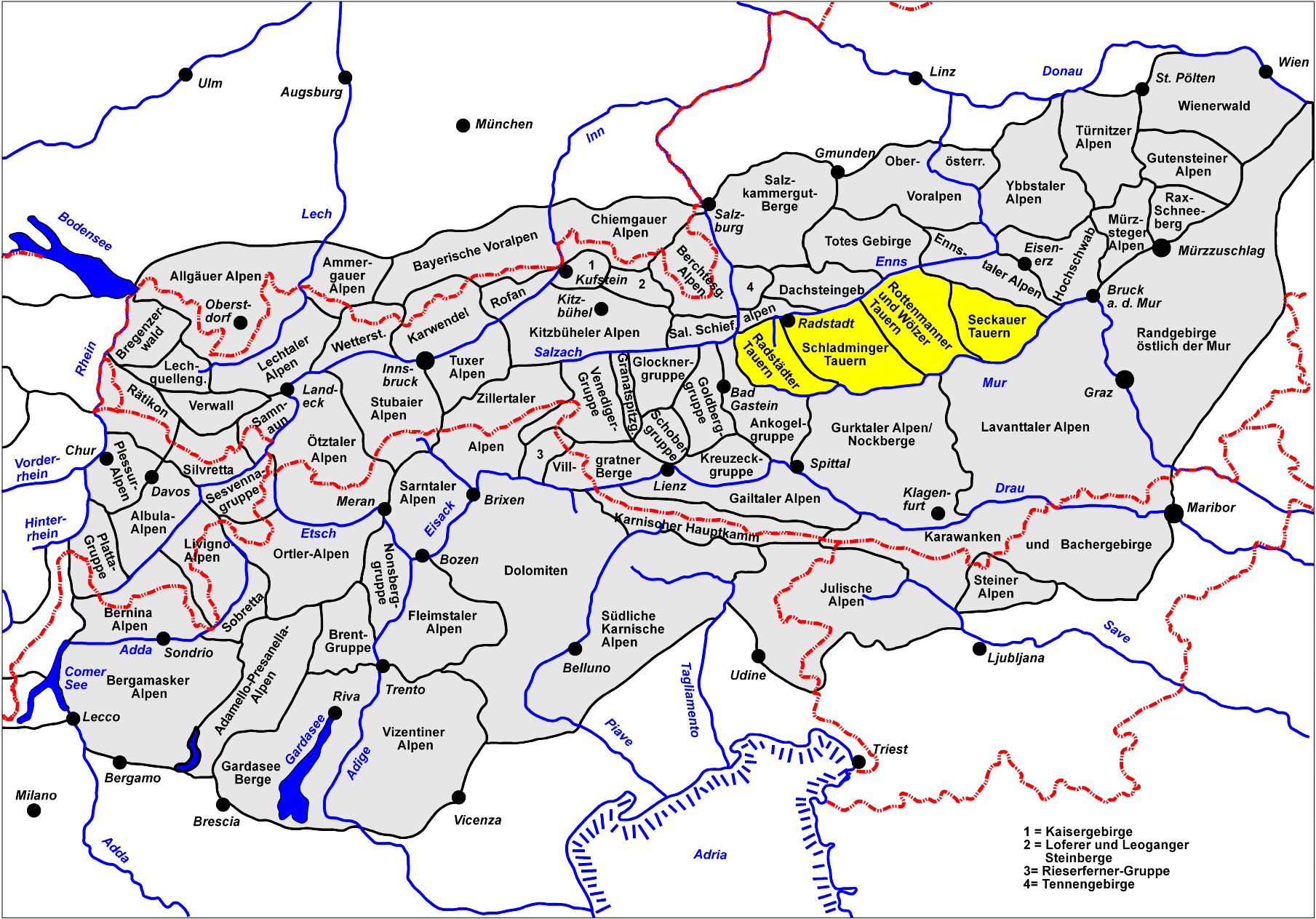
The Niedere Tauern or Low Tauern (Slovene: Nizke Ture ) are a mountain range in central Austria, part of the Central Eastern Alps. They lie on the main chain of the Alps in in the states of Salzburger Land and Styria. In the west and south the Murtörl mountain pass and the Mur River separate them from the Hohe Tauern mountain range, while in the east and north the Enns River and the Schober Pass marks the border to the Northern Limestone Alps.
The Niedere Tauern mark the approximate eastern limit of the continuous ice sheet in the Alps during the Würm glaciation. Eastern parts of the group were therefore unglaciated, and served as an important refugium for silicicolous plants.
According to the Österreichischer Alpenverein (Austrian Alpine Club) the Niedere Tauern may be divided into four groups (from west to east):
- Radstädter Tauern
- Schladminger Tauern
- Rottenmanner and Wölzer Tauern
- Seckauer Alpen.
The highest mountain in the Niedere Tauern is the Hochgolling, part of the Schladminger Tauern at 2,863 m (9,393 ft).
A number of skiing resorts are situated in the Niedere Tauern, including Obertauern and Schladming.
Coordinates: 47°18′N 14°00′E / 47.3°N 14°E
Albula Alps | Pohorje (Bachergebirge) | Bernina Alps | Gurktal Alps | Lavanttal Alps | Livigno Alps | Ortler Alps | Ötztal Alps | Oberhalbstein Range | Plessur Alps | Foothills east of the Mur |
Rätikon | Samnaun Alps | Sarntal Alps | Salzburg and Tyrolean Slate Alps (Kitzbühel Alps) | Sesvenna Range | Silvretta Alps | Sobretta-Gavia Group | Stubai Alps | Tux Alps | High Tauern |
Low Tauern | Verwall Alps | Zillertal Alps Categories:
- Mountain ranges of the Alps
- Central Alps
- Mountain ranges of Austria


Wikimedia Foundation. 2010.