- Dronfield Woodhouse
-
Coordinates: 53°18′14″N 1°30′11″W / 53.304°N 1.503°W
Dronfield Woodhouse 
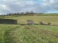
Fields at Dronfield Woodhouse.
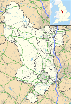
 Dronfield Woodhouse shown within Derbyshire
OS grid reference SK332786 District North East Derbyshire Shire county Derbyshire Region East Midlands Country England Sovereign state United Kingdom Post town DRONFIELD Postcode district S18 Police Derbyshire Fire Derbyshire Ambulance East Midlands EU Parliament East Midlands List of places: UK • England • Derbyshire Dronfield Woodhouse is a district of Dronfield, in northeast Derbyshire, England. Its habitation has existed as early as the 11th century (Cowley Farm, to the south) and its main road features a 13th century house and a 19th century Primary School (now an elderly care home).
Although Dronfield Woodhouse today constitutes the western half of the town of Dronfield, until the 1970s (when rapid development took place) practically all of the area consisted of woodland, farmland, and grassland. The 1970s development ("Gosforth Valley") made the district the largest privately owned housing estate in Europe at the time, and is now largely a quiet dormitory settlement for nearby Sheffield and Chesterfield. The surrounding countryside is still readily accessible however, and the boundary of the Peak District National Park is less than 2 miles to the west.
An item of interest for passing tourists is that the Victorian street lamp from the BBC adaptation of The Lion, The Witch and The Wardrobe illuminates the garden of a minor stately home next door to the main public house, 'The Hearty Oak'.
References
Categories:- Towns in Derbyshire
- Towns and villages of the Peak District
- Derbyshire geography stubs
Wikimedia Foundation. 2010.

