McQuesten Airport

McQuesten Airport
McQuesten Airport
IATA: noneICAO: noneTC LID: CFP4
Summary
Airport type Public
Operator Government of Yukon
Location McQuesten, Yukon
Elevation AMSL 1,500 ft / 457 m
Coordinates 63°36′N 137°34′W / 63.6°N 137.567°W / 63.6; -137.567Coordinates: 63°36′N 137°34′W / 63.6°N 137.567°W / 63.6; -137.567
Map
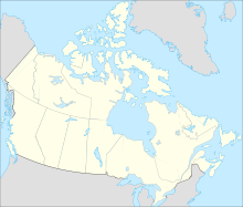
CEP4 is located in Canada
CEP4
Location in Yukon
Runways
Direction Length Surface
ft m
09/27 2,800 850 Gravel/Turf
Source: Canada Flight Supplement[1]

McQuesten Airport (TC LID: CFP4) is located on the banks of the Stewart River near McQuesten, Yukon, Canada and receives no maintenance.

References

  1. ^ Canada Flight Supplement. Effective 0901Z 20 October 2011 to 0901Z 15 December 2011


Wikimedia Foundation. 2010.

Игры ⚽ Нужно решить контрольную?

Look at other dictionaries:

  • FP4 — may refer to: * Ilford FP, a black and white photographic film by Ilford Photo, latest version being called FP4 Plus or FP4+. * McQuesten Airport (ICAO number CFP4) …   Wikipedia

  • Ontario Highway 401 — Highway 401 redirects here. For other uses, see List of highways numbered 401 …   Wikipedia

  • Hamilton, Ontario — For Hamilton Township in Northumberland County, see Hamilton, Ontario (township). Hamilton   City   City of Hamilton …   Wikipedia

  • Queen Elizabeth Way — Route information …   Wikipedia

  • Historical timeline of events in Hamilton, Ontario — Below is a timeline of events in Hamilton, Ontario Canada.Beginning 1799* According to all records from local historians, this district was inhabited by the Neutral Indians who called it ATTIWANDARONIA. cite book|title=Saga of a City|first=Milton …   Wikipedia

  • List of people from Hamilton, Ontario — The following people were born in, residents of, or are otherwise closely connected to the city of Hamilton, Ontario. Arts Architecture and design * Lida Baday, (1957 ), fashion designer. Her namesake label is sold at Holt Renfrew across Canada,… …   Wikipedia

  • List of neighbourhoods in Hamilton, Ontario — In 2001, the new city of Hamilton was formed. The Regional Municipality of Hamilton Wentworth and its six local municipalities; Ancaster, Dundas, Flamborough, Glanbrook, Hamilton and Stoney Creek amalgamated. (January 1) cite web| title… …   Wikipedia

  • History of Hamilton, Ontario — From the beginning, what is now Hamilton has benefited from its geographical proximity to major land and water transportation routes along the Niagara Peninsula and Lake Ontario. Its strategic importance has created, by Canadian standards, a rich …   Wikipedia

  • Cootes Paradise — A small beach on the Cootes Paradise south shore. Poor water clarity is a result of mud bottoms. See also: Geography of Hamilton, Ontario Cootes Paradise is the largest wetland at the western end of Lake Ontario, on the west side of Hamilton… …   Wikipedia

  • Main Street (Hamilton, Ontario) — Main Street, looking East Main Street, is a Lower City arterial road in Hamilton, Ontario, Canada. It starts east of Wilson Street in Ancaster at White Chapel Cemetery as a two way street and switches over to a one way street (Eastbound) at… …   Wikipedia

Share the article and excerpts

Direct link
Do a right-click on the link above
and select “Copy Link”