- Mount Tom (Massachusetts)
-
This article is about Mount Tom of the Connecticut River Valley, Massachusetts. For other mountains by the same name, see Mount Tom (disambiguation).
Mount Tom 
1865 painting by Thomas Charles Farrer (1839–1891), oil on canvasElevation 1,202 ft (366 m) Location Location Holyoke, Massachusetts, USA Range Mount Tom Range/ Metacomet Ridge Coordinates 42°14′30″N 72°38′53″W / 42.24167°N 72.64806°WCoordinates: 42°14′30″N 72°38′53″W / 42.24167°N 72.64806°W Geology Type Fault-block; igneous Age of rock 200 Ma Climbing Easiest route Metacomet-Monadnock Trail Mount Tom, 1,202 feet (366 m), is a steep, rugged traprock mountain peak on the west bank of the Connecticut River 4.5 miles (7 km) northwest of downtown Holyoke, Massachusetts. The mountain is the southernmost and highest peak of the Mount Tom Range and the highest traprock peak of the 100-mile (160 km) long Metacomet Ridge. A popular outdoor recreation resource, the mountain is known for its continuous line of cliffs and talus slopes visible from the south and west, its dramatic 1,100-foot (340 m) rise over the surrounding Connecticut River Valley, and its rare plant communities and microclimate ecosystems.[1][2]
Located in Easthampton and Holyoke, Mount Tom is traversed by the 110-mile (180 km) Metacomet-Monadnock Trail and is the transmitter location for three Springfield–Holyoke television stations: WGBY, WGGB, and WSHM-LP, and for radio stations WHYN-FM and WVEI-FM. The name "Mount Tom" is sometimes used to describe the entire Mount Tom Range.[1]
Contents
History
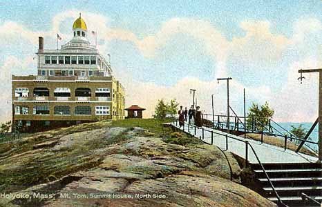
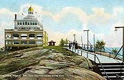 The Mount Tom Summit House. Postcard dated 1898–1900.
According to popular folklore, Mount Tom takes its name from Rowland Thomas, a surveyor who worked for the settlement of Springfield, Massachusetts in the 1660s. Thomas supposedly named Mount Tom after himself while his fellow surveyor working on the opposite side of the Connecticut River, Elizur Holyoke, gave his name to Mount Holyoke.[3]
The Mount Tom Hotel was constructed on the summit of Mount Tom in 1897, but it burned down three years later. Subsequently rebuilt, it burned again in 1929 and was never rebuilt; in 1902 the property became the first parcel to become the Mount Tom State Reservation. Ruins of the old hotel foundations are still visible today. In 1933 the Civilian Conservation Corps assisted with the construction of reservation structures and park roads; their work also remains visible today.
In 1897 the Holyoke Street Railway Company began constructing what would become known as "Mountain Park", a trolley park and later an amusement park on the east side of the mountain. The project changed hands several times until its closure in 1988 when competition from larger amusement parks gradually sapped business away from what had become affectionately known by local residents as "The Queen of the Mountain".[4][5]
In July 1946 a US military transport plane hit the northern flank of the mountain. All 25 on board died instantly in a large fireball. Most of the men were Public Health employees of the US military who had worked in Europe in WW2. Tiny pieces of the plane are still on the mountainside. The site is accessible on a road made to access the antennae. This road is directly over the old trolley tracks to the mountain. A memorial site is at the location and is lit at all times.[6]
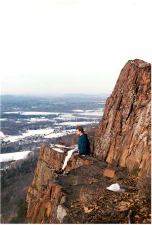
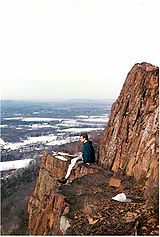 Cliffs of Mount Tom
Geology and ecology
Mount Tom, like much of the Metacomet Ridge, is composed of basalt, also called traprock, a volcanic rock. The mountain formed near the end of the Triassic Period with the rifting apart of the North American continent from Africa and Eurasia. Lava welled up from the rift and solidified into sheets of strata hundreds of feet thick. Subsequent faulting and earthquake activity tilted the strata, creating the dramatic cliffs and ridges of Mount Tom.[7] Hot, dry upper slopes, cool, moist ravines, and mineral-rich ledges of basalt talus produce a combination of microclimate ecosystems on the mountain that support plant and animal species uncommon in greater Massachusetts.[2] (See Metacomet Ridge for more information on the geology and ecosystem of Mount Nonotuck.)
Recreation
Mount Tom is a popular outdoor recreation resource; the summit is crossed by the 110-mile (180 km) Metacomet-Monadnock Trail as well as a network of shorter hiking trails and a park road that passes beneath the western cliff face. The road is used for bicycling, running, and mountain biking, and in the winter, cross country skiing and ski touring. Geocaching is popular. The mountain is also well known as a place to watch seasonal raptor migrations; an observation tower on nearby Goat Peak is maintained for that purpose.[1][8] Mount Tom is registered in Amateur Radio as SOTA W1/MB-006.[9]
Conservation
Most of Mount Tom has been conserved as part of Massachusetts' Mount Tom State Reservation, conservation easement, or watershed protection land. The mountain was also once home to the Mount Tom Ski Area that operated from 1962 to 1998;[10] although the ski area is closed, the slopes are still used for backcountry skiing, and the defunct ski area has been conserved by the concerted efforts of several non-profit organizations and the Commonwealth of Massachusetts. These groups do not plan on re-opening the ski area.[11]
Cultural references
- Mount Tom is mentioned by the eponymous protagonist in Henry James's 1875 novel Roderick Hudson, chapter IX.
See also
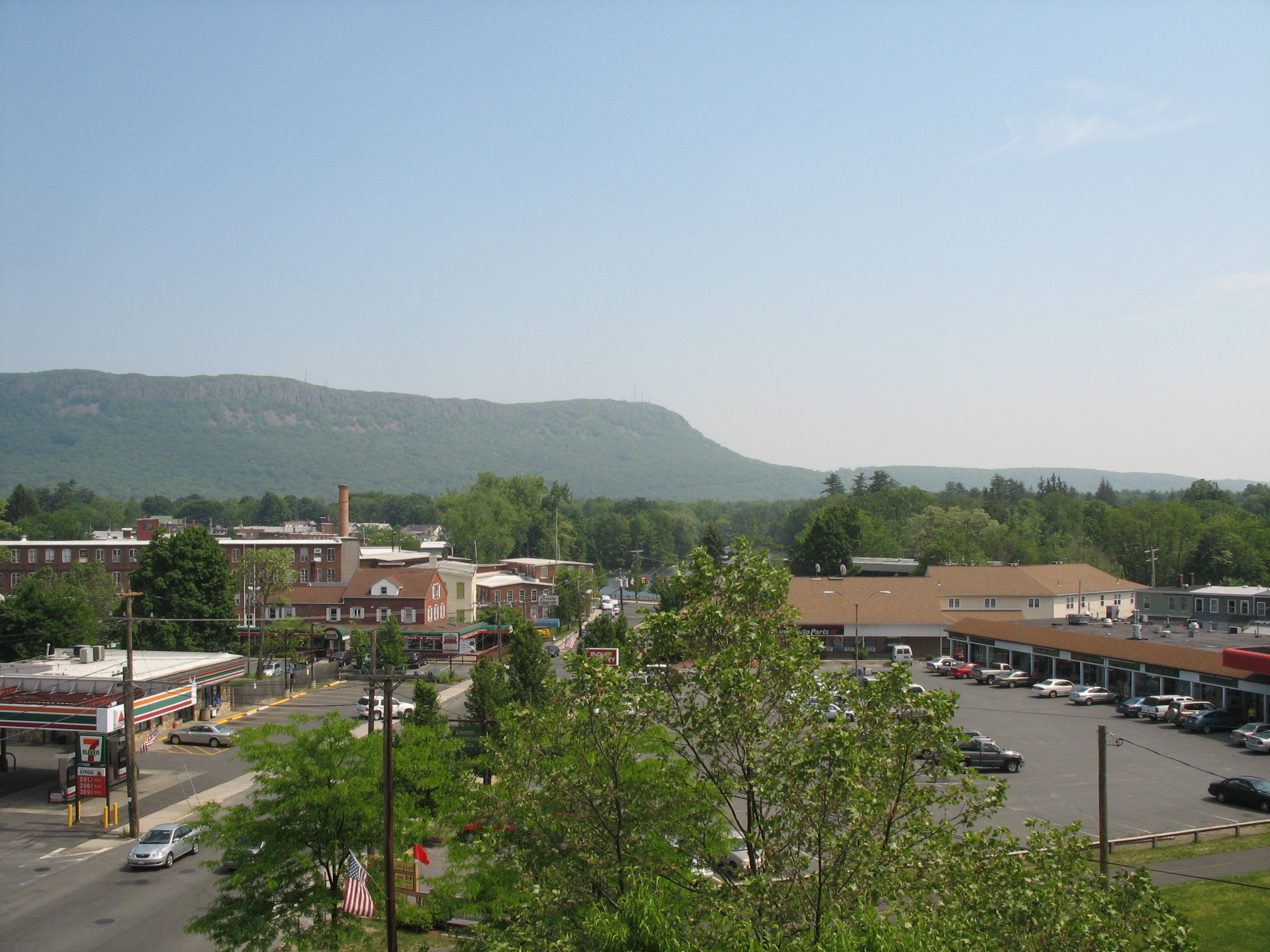
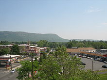 Mount Tom from Easthampton
- Mount Tom is also the name of 42 other mountains in the United States. Other regional examples with which it may be confused include:
- Mount Tom (Connecticut)
- Mount Tom (New Hampshire)
- Mount Tom (Rhode Island)
- Tom Ball Mountain (Massachusetts)
References
- ^ a b c The Metacomet-Monadnock Trail Guide. 9th Edition. The Appalachian Mountain Club. Amherst, Massachusetts, 1999.
- ^ a b Farnsworth, Elizabeth J. "Metacomet-Mattabesett Trail Natural Resource Assessment." 2004. PDF wefile cited November 1, 2007.
- ^ Harper, Wyatt. The Story of Holyoke. Holyoke Centennial Committee, Holyoke, Massachusetts 1973.
- ^ "Queen of the Mountain" Defunctparks.com cited Dec. 21, 2007.
- ^ Mt. Holyoke Range Historical Timeline Website cited November 12, 2007.
- ^ http://www3.gendisasters.com/massachusetts/5499/mt-tom-ma-bomber-crashes-mount-tom-july-1946
- ^ Raymo, Chet and Maureen E. Written in Stone: A Geologic History of the Northeastern United States. Globe Pequot, Chester, Connecticut, 1989.
- ^ Massachusetts DCR. Cited Dec. 1, 2007.
- ^ Mt. Tom SOTA page
- ^ New England Lost Ski Area Project. Cited. Dec. 2, 2007.
- ^ The Trustees of the Reservation. Cited Dec. 21, 2007.
External links
Categories:- Holyoke, Massachusetts
- Mountains of Massachusetts
- Massachusetts natural resources
- Mount Tom Range
- Landforms of Hampden County, Massachusetts
- Civilian Conservation Corps in Massachusetts
- Visitor attractions in Hampden County, Massachusetts

Wikimedia Foundation. 2010.