Morsø Municipality

Morsø Municipality
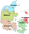
Location in Denmark

Morsø municipality is a municipality (Danish, kommune) in Region Nordjylland in northern Denmark. The municipality is located on the island of Morsø or Mors, an island in the Limfjord, the sound that separates the island of Vendsyssel-Thy from the rest of Jutland Peninsula. The municipality includes the smaller island of Agerø, and covers an area of 368 km². It has a total population of 22,091 (2008). Its mayor is Egon Pleidrup Poulsen, a member of the Social Democrats (Socialdemokraterne) political party.

The main town and the site of its municipal council is the town of Nykøbing Mors.

Because Morsø municipality comprises the entirety of the island, all municipal neighbors are separated by a body of water.

The 382 meter long Vilsund Bridge (Vilsundbro) connects the municipality at the town of Sundby over the Vil Strait to the town of Vilsund Vest in Thisted municipality.

The 1,717 meter long Sallingsund Bridge, which opened on 30 May 1978, connects the municipality at the town of Nykøbing Mors over the Salling Strait to the town of Sallingsund. Before the bridge was built there was a train ferry connection over the strait from the town of Nykøbing to Glyngøre, and a car ferry connection between Pinen at Mors and Plagen at Salling (e.g. "The Torment and the Plague").

Morsø municipality was not merged with other municipalities by 1 January 2007 as the result of nationwide Kommunalreformen ("The Municipal Reform" of 2007).

Attractions

  • Dueholm Cloister (Dueholm Kloster)
  • Højris
  • Jesperhus Flower Park (Jesperhus Blomsterpark)
  • Moler Museum (Molermuseum)

External links

References

Coordinates: 56°47′00″N 8°45′00″E / 56.7833°N 8.75°E / 56.7833; 8.75


Wikimedia Foundation. 2010.

Игры ⚽ Нужно сделать НИР?

Look at other dictionaries:

  • Odense Municipality — Coordinates: 55°23′45.48″N 10°23′18.73″E / 55.3959667°N 10.3885361°E / 55.3959667; 10.3885361 …   Wikipedia

  • Copenhagen Municipality — Coordinates: 55°40′31″N 12°34′13″E / 55.67528°N 12.57028°E / 55.67528; 12.57028 …   Wikipedia

  • Odder Municipality — Location of Odder municipality Odder municipality is a municipality in Region Midtjylland on the east coast of the Jutland peninsula in central Denmark just south of Aarhus and is a part of the greater Aarhus area. The municipality includes the… …   Wikipedia

  • Randers Municipality — (Randers Kommune) Municipalities of Denmark The old Town Hall on the square in Randers with statue of Niels Ebbesen in f …   Wikipedia

  • Nyborg Municipality — (Nyborg Kommune) Municipalities of Denmark Country Denmark Region …   Wikipedia

  • Middelfart Municipality — Map of the municipality Middelfart municipality is a municipality (Danish, kommune) in Region of Southern Denmark on the west coast of the island of Funen in southern Denmark. The municipality covers an area of 297 km². It has a total population… …   Wikipedia

  • Dragør Municipality — A narrow street in Dragør The Dragør Strand Hotel in …   Wikipedia

  • Aarhus Municipality — Location map in Denmark Aarhus Municipality, also commonly known by its Danish spelling Århus Municipality, is a municipality (Danish, kommune) on the east coast of the Jutland peninsula in central Denmark. The municipality covers an area of… …   Wikipedia

  • Mariagerfjord Municipality — Location of Mariagerfjord municipality Mariagerfjord is a municipality (Danish, kommune) in North Denmark Region in Denmark. It covers an area of 769 km² and a total population of 42,667 (2008) …   Wikipedia

  • Norddjurs Municipality — Location of Norddjurs municipality Norddjurs is a municipality (Danish, kommune) in Region Midtjylland in Denmark. It covers an area of 661 km² and a total population of 38,581 (2008). The municipality is also a part of the East Jutland… …   Wikipedia

Share the article and excerpts

Direct link
Do a right-click on the link above
and select “Copy Link”