- Old Brooklyn
-
Old Brooklyn — Neighborhoods of Cleveland — The RainForest at Cleveland Metroparks Zoo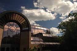
Country United States State Ohio County Cuyahoga County City Cleveland Population (2000) - Total 34,169 2.2% decrease from 1990 Census Demographics - White 91.4% - Black 2.6% - Hispanic 6.3% - Asian >1.2% - Other >2.6% Time zone EST (UTC-5) - Summer (DST) EDT (UTC-4) ZIP Codes parts of 44109, 44144 and 44134 Area code(s) 216 Median income $35,234 Source: 2000 U.S. Census, City Planning Commission of Cleveland [1] Old Brooklyn is a west side neighborhood of Cleveland, Ohio, extending east-to-west from the Cuyahoga River to the City of Brooklyn and north-to-south from the Brookside Park Valley to the City of Parma. Originally a portion of Brooklyn Township, the area was settled permanently in 1814 as the hamlet of Brighton,[2] centered at the present-day intersection of Pearl and Broadview Roads. The Brighton area was incorporated as South Brooklyn Village in 1889 and then annexed with other surrounding villages by the City of Cleveland during the years of 1905-1927.
The first instance of European habitation, here, may have occurred prior to Brighton's founding, when fur trader Joseph Du Shattar established a trading post on the west bank of the Cuyahoga River, across from Newburgh, in about 1790.[3]
During the late 1880s, farmers in the Schaaf Road area (now known as South Hills) were among the first in the Midwest to use greenhouses to cultivate vegetables.[4] By the 1920s the neighborhood was one of the nation's leading producers of greenhouse vegetables, with more than 100 acres (0.40 km2) under glass. Most of the greenhouses were displaced during the past three decades by new housing and the construction of Ohio Rt. 176 (Jennings Freeway).
Old Brooklyn's most notable landmark, the Cleveland Zoo, was created in 1907 when Cleveland's Park Board relocated the Zoo from University Circle on Cleveland's east side to Brookside Park. The 145-acre park lies entirely within Old Brooklyn and is one of the 16 nature preserve reservations of the Cleveland Metroparks system.
Brookside Park also has a place in sporting lore, having hosted the reputedly largest baseball crowd in Cleveland's history, when the White Autos of Cleveland met Omaha in the World Amateur Baseball Championship.[5] On October 10, 1915, a reported crowd of 115,000 sprawled along and below the park's northern bluff, directly west of today's Fulton Road Bridge, and cheered as the home team seized the day.
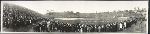 White Autos of Cleveland vs. Luxus of Omaha, 1915
Commercial development in Old Brooklyn reached its apex during the period of 1920-1960.[6] Shopping districts spread along Pearl, Broadview, and State Roads and were followed, after World War II, by the development of shopping plazas at the intersections of Memphis-Fulton, Broadview-Brookpark, and Pearl-Brookpark. The original Honey Hut ice cream shop, a favorite of many West-siders, can be found on State Road near the south end of the community.
The most ambitious period of residential construction extended from the early 20th century to the 1950s. During the 1980s and 1990s, residential development experienced a resurgence, particularly in the South Hills and Jennings Road areas. Housing values in Old Brooklyn, today, are among the highest within Cleveland proper.[7]
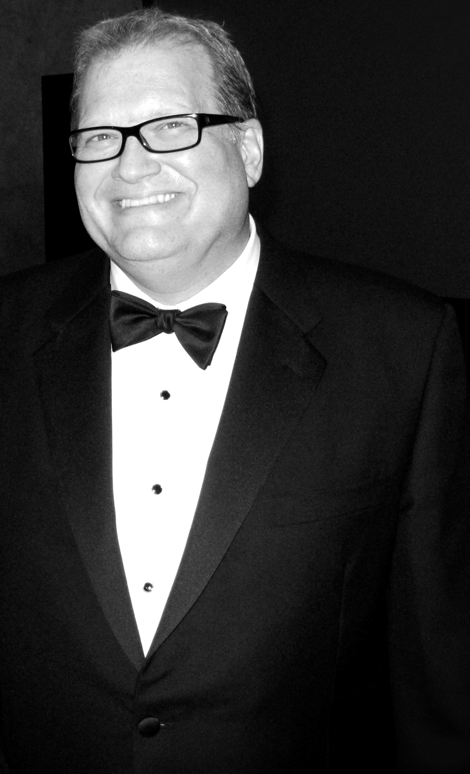
The neighborhood's secondary students generally attend James Ford Rhodes High School, whose most recognizable graduate is Drew Carey of television fame. The Carey program's "Warsaw Tavern" was patterned after a bar near the Memphis-Fulton intersection,[8] which hosts one of the highest concentrations of bars and restaurants in Greater Cleveland. Another Old Brooklyn native, the late Mary Strassmeyer, was the gossip columnist for the Cleveland News and The Plain Dealer.[9]
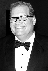 Drew Carey, 2008
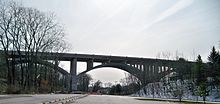 The new Fulton Road Bridge
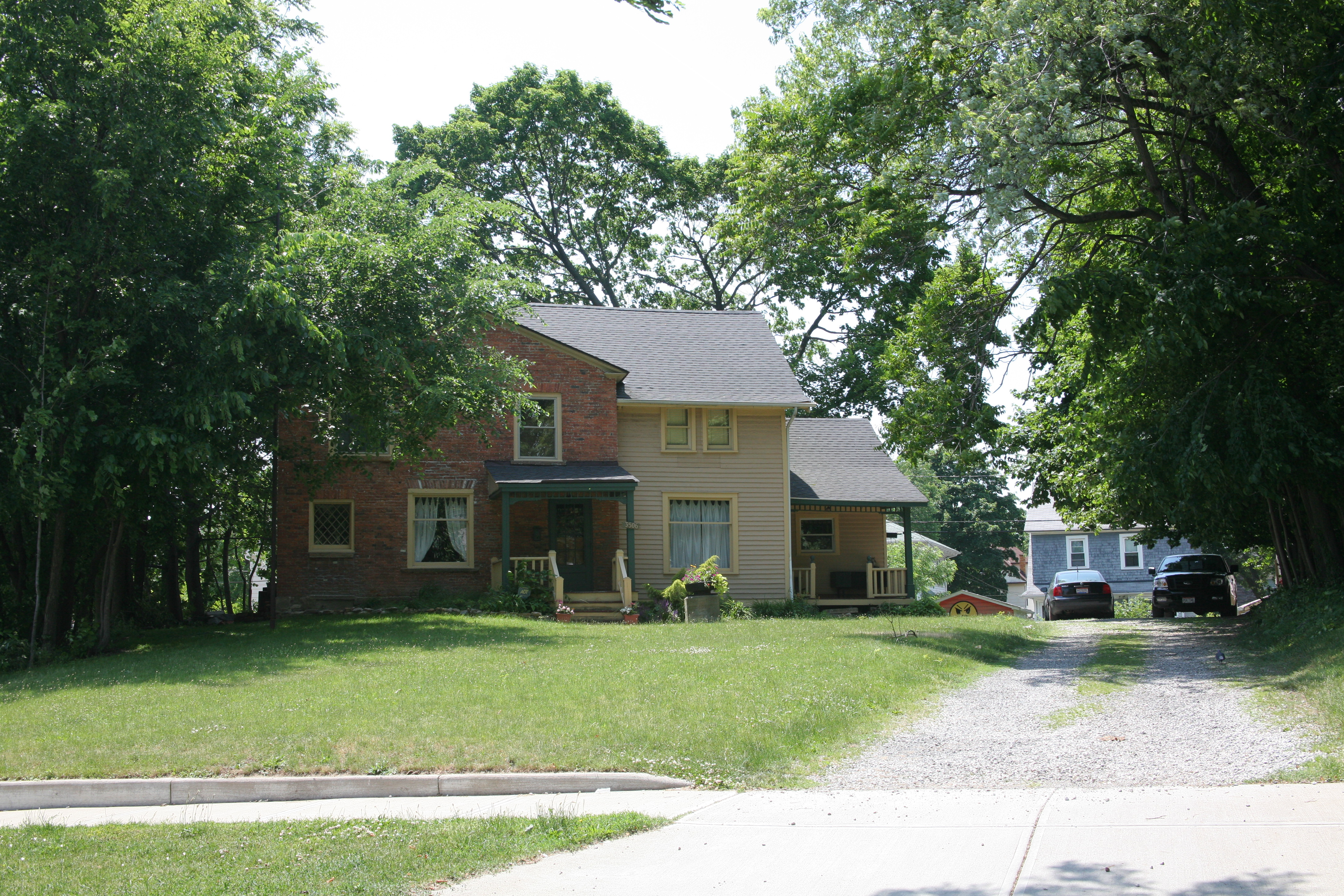
The Jeremiah Gates Home, built in 1820 and located at 3506 Memphis Avenue, is believed to be the oldest residence in Old Brooklyn.[10][11] Other notable landmarks include the Brooklyn-Brighton Bridge, the Estabrook Recreation Center, and the Italian Gothic-style Our Lady of Good Counsel Church (now called Mary Queen of Peace)[12] atop Pearl Road Hill.
Future developments include the Treadway Creek Greenway Restoration project, which is intended to restore and preserve 208 acres (0.84 km2) of riparian corridor as well as to open space along Treadway Creek.[13] The project includes a trail connecting the neighborhood to the Ohio and Erie Canal National Heritage Corridor's Towpath Trail. Additionally, plans also include a possible connection in the trial that would link the Big Creek reservation with the Cleveland Metroparks Zoo.
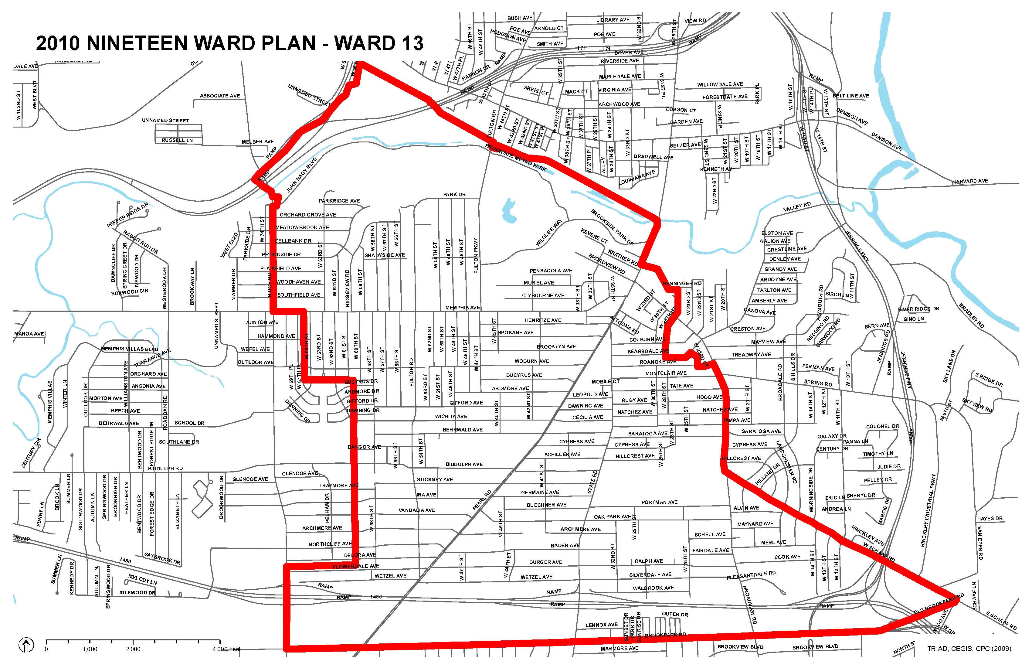
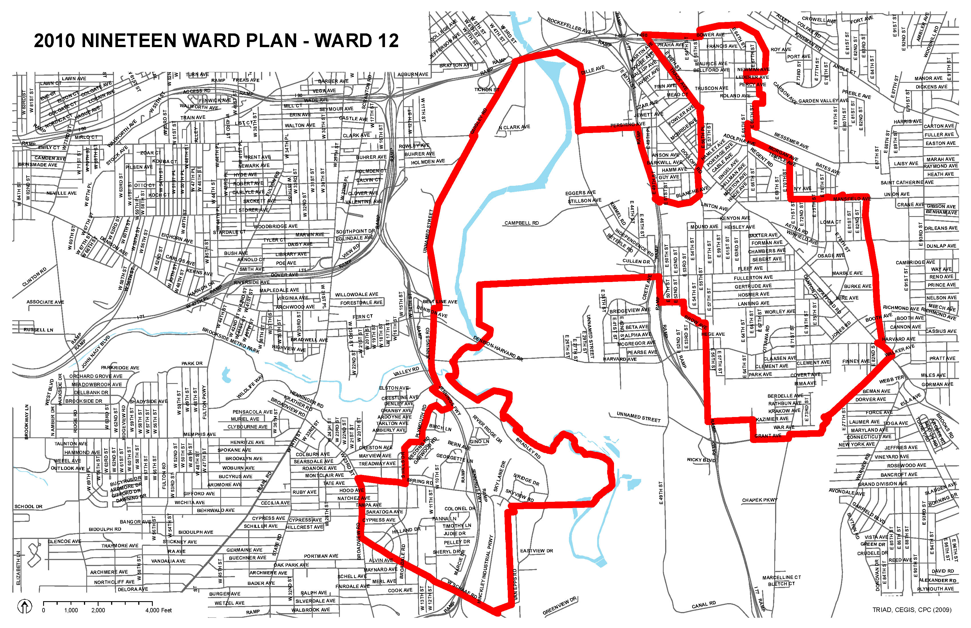
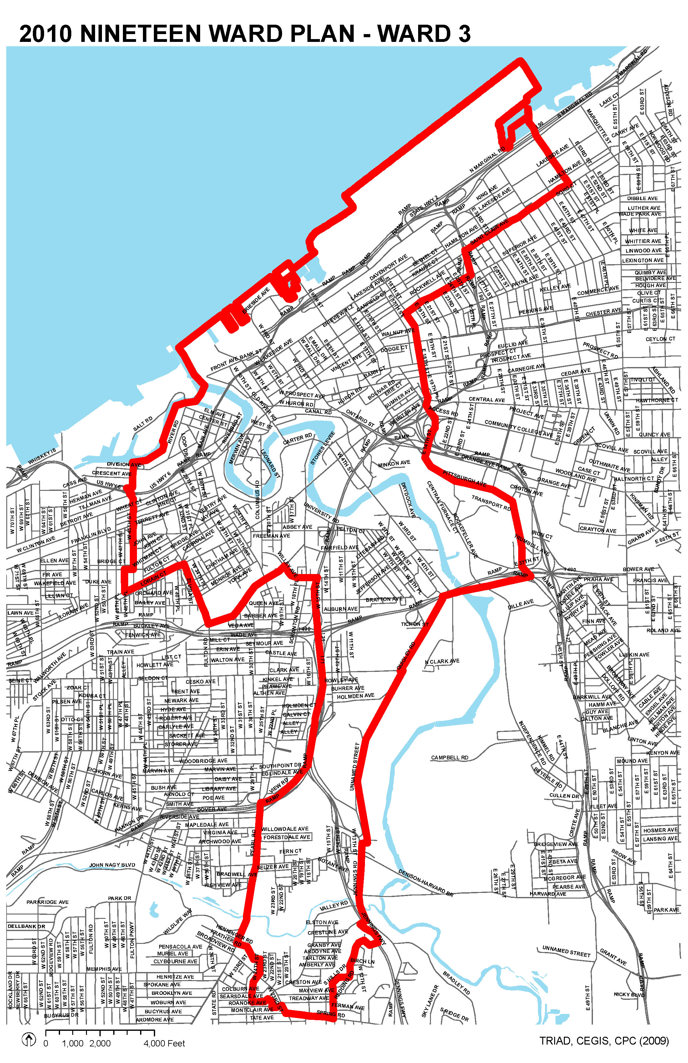
Old Brooklyn encompasses all of Cleveland's Ward 13,[14] the southwestern portion of Ward 12,[15] and the southern tip of Ward 3.[16] Its population, according to the 2000 census, was 34,169.
Boundaries
Old Brooklyn is bounded on the north by Interstate 71 and by Denison Ave. The western boundary is Ridge Road, the southern is Brookpark Road, and the eastern is State Route 176 (the Jennings Freeway).
References
- ^ http://planning.city.cleveland.oh.us/census/factsheets/spa13.pdf
- ^ http://ech.case.edu/ech-cgi/article.pl?id=B20
- ^ http://ech.case.edu/ech-cgi/article.pl?id=DSJ
- ^ http://www.nhlink.net/neighborhoodtournew/history.php?neighborhood=old-brooklyn
- ^ http://www.clevelandcitycouncil.org/Home/News/NewsJanuary2220072/tabid/185/Default.aspx
- ^ http://www.nhlink.net/neighborhoodtournew/history.php?neighborhood=old-brooklyn
- ^ http://www.nhlink.net/neighborhoodtournew/history.php?neighborhood=old-brooklyn
- ^ http://www.imdb.com/title/tt0111945/trivia
- ^ http://ech.case.edu/ech-cgi/article.pl?id=SMA
- ^ http://livingincleveland.nhlink.net/pdf/old_brooklyn.pdf
- ^ http://planning.city.cleveland.oh.us/landmark/landlist/fullsize/IMG_9777.JPG
- ^ http://planning.city.cleveland.oh.us/landmark/listDetail.php?identity=302
- ^ http://www.noaca.org/LBCB05update.pdf
- ^ http://planning.city.cleveland.oh.us/maps/jpg/ward13.jpg
- ^ http://planning.city.cleveland.oh.us/maps/jpg/ward12.jpg
- ^ http://planning.city.cleveland.oh.us/maps/jpg/ward03.jpg
External links
- City Planning Commission (of Cleveland)
- Cleveland Neighborhood Development Coalition
- Cleveland State University's "Neighborhood Link"
- Cuyahoga County Natural Resources Assistance Council
- Ohio and Erie Canal National Heritage Corridor
- Old Brooklyn Community Development Corporation
- Old Brooklyn Blogs
- The Encyclopedia of Cleveland History

Stockyards Brooklyn Centre Cuyahoga Heights, Ohio Brooklyn, Ohio 
 Old Brooklyn

Parma, Ohio Brooklyn Heights, Ohio City of Cleveland City Council · Historic Places · History · Mayors · Media · People · Police · Public schools · Sports · Tallest buildings Neighborhoods Brooklyn Centre · Buckeye-Shaker · Central · Clark-Fulton · Corlett · Cudell · Detroit-Shoreway · Downtown · Edgewater · Euclid-Green · Goodrich-Kirtland Park · Fairfax · Forest Hills · Glenville · Hough · Industrial Valley · Jefferson · Kamm's Corners · Kinsman · Lee-Miles · Mt. Pleasant · North Broadway · North Collinwood · Ohio City · Old Brooklyn · Puritas-Longmead · Riverside · South Broadway · South Collinwood · St. Clair-Superior · Stockyards · Tremont · Union-Miles Park · University · West Boulevard · Woodland HillsCoordinates: 41°25′54″N 81°42′08″W / 41.431559°N 81.702332°W
Categories:- Neighborhoods in Cleveland, Ohio


Wikimedia Foundation. 2010.