- Daniel Campos Province
-
Daniel Campos — Province — Isla del Pescado in Salar de Uyuni, Daniel Campos Province

Flag
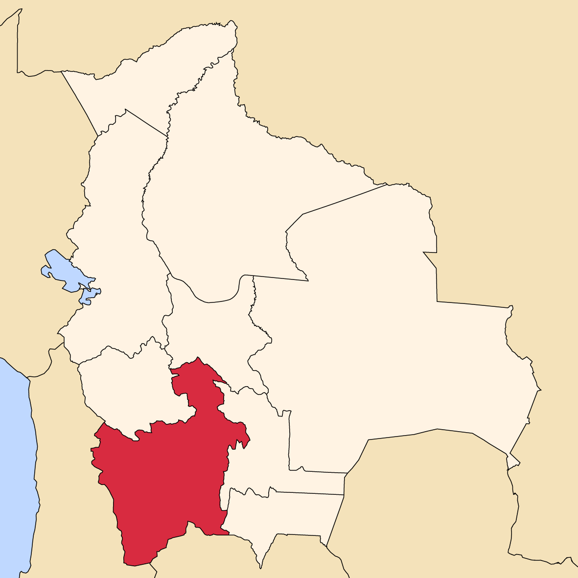
SealLocation of the Daniel Campos Province within Bolivia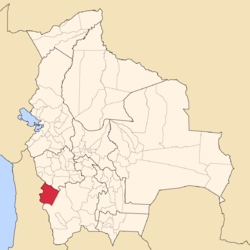 Provinces of the Potosí Department
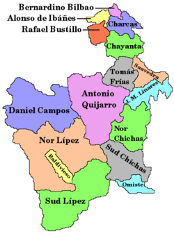
Coordinates: 20°7′S 67°48′W / 20.117°S 67.8°W Country  Bolivia
Department Potosí Department Municipalities 2 Cantons 13 Capital Llica Area – Total 3,995 sq mi (10,347 km2) Population (2001) – Total 5,067 – Density 1.3/sq mi (0.5/km2) – Ethnicities Aymara Area code(s) BO.PO.DC Daniel Campos is a province in the north-western parts of the Bolivian Potosí Department. It is named after the poet Daniel Campos who originated from this area. Its capital is Llica.
Contents
Location
Daniel Campos province is one of sixteen provinces in the Potosí Department. It is located between 19° 25' and 20° 50' South and between 66° 49' and 68° 47' West. It borders Oruro Department in the north, the Republic of Chile in the west, Nor Lípez Province in the south, and Antonio Quijarro Province in the east.
The province extends over 240 km from east to west and 180 km from north to south.
Geography
The province is situated in the salt flats of southern Altiplano, more than 65 % of the province being covered by Salar de Uyuni. Salar de Uyuni is situated at an average level of 3,657 m amsl, the highest point of the province is Alto Totoni (5,740 m) in Cordillera Sillaguay on the Chilenean border. The climate is that of an arid high mountain region, with yearly precipitation of below 200 mm, even less than 100 mm in the extreme west. Average daily temperatures are 0 to 5 °C all over the year.
Division
The province comprises two municipalities which are partly further subdivided into cantons.
Section Municipality Seat 1st Llica Municipality Llica 2nd Tahua Municipality Tahua Population
The main language of the province is Spanish, spoken by 80%, while 59% of the population speak Aymara. The population increased from 4,630 inhabitants (1992 census) to 5,067 (2001 census), an increase of 9.4%.
87% of the population have no access to electricity, 91% have no sanitary facilities. 73% of the population are employed in agriculture, 3% in mining, 2% in industry, 22% in general services. 87% of the population are Catholics, 8% Protestants.
The people are predominantly indigenous citizens of Aymara descent.[1]
Ethnic group Llica Municipality (%) Tahua Municipality (%) Quechua 5.7 6.0 Aymara 86.9 90.5 Guaraní, Chiquitos, Moxos 0.1 0.1 Not indigenous 7.1 3.3 Other indigenous groups 0.3 0.0 Places of interest
- Salar de Uyuni with the islands of Inkawasi and Isla del Pescado which are situated within the province
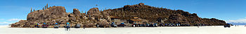 Inkawasi Island in Salar de Uyuni
References
- ^ obd.descentralizacion.gov.bo/municipal/fichas/ (inactive)
Coordinates: 20°07′S 67°48′W / 20.117°S 67.8°W
 Potosí DepartmentCapital: Potosí
Provinces Alonso de Ibáñez • Antonio Quijarro • Bernardino Bilbao • Charcas • Chayanta • Cornelio Saavedra • Daniel Campos • Enrique Baldivieso • José María Linares • Modesto Omiste • Nor Chichas • Nor Lípez • Rafael Bustillo • Sud Chichas • Sur Lípez • Tomás Frías
Municipalities (and seats) Acasio (Acasio) • Arampampa (Arampampa) • Atocha (Atocha) • Betanzos (Betanzos) • Caiza "D" (Caiza "D") • Ckochas (Ckochas) • Caripuyo (Caripuyo) • Chaquí (Chaquí) • Chayanta (Chayanta) • Chuquihuta (Chuquihuta) • Colcha "K" (Colcha "K") • Colquechaca (Colquechaca) • Cotagaita (Cotagaita) • Llallagua (Llallagua) • Llica (Llica) • Mojinete Municipality (Mojinete) Ocurí (Ocurí) • Pocoata (Pocoata) • Porco (Porco) • Potosí (Potosí) • Puna (Puna) • Ravelo (Ravelo) • Sacaca (Sacaca) • San Agustín (San Agustín) • San Antonio de Esmoruco (San Antonio de Esmoruco) • San Pablo de Lípez (San Pablo de Lípez) • San Pedro de Buena Vista (San Pedro de Buena Vista) • San Pedro de Quemes (San Pedro de Quemes) • Tacobamba (Tacobamba) • Tahua (Tahua) • Tinguipaya (Tinguipaya) • Tomave (Tomave) • Toro Toro (Toro Toro) • Tupiza (Tupiza) • Uncía (Uncía) • Urmiri (Urmiri) • Uyuni (Uyuni) • Villazón (Villazón) • Vitichi (Vitichi) • Yocalla (Yocalla)Categories:


Wikimedia Foundation. 2010.