- Chayanta Province
-
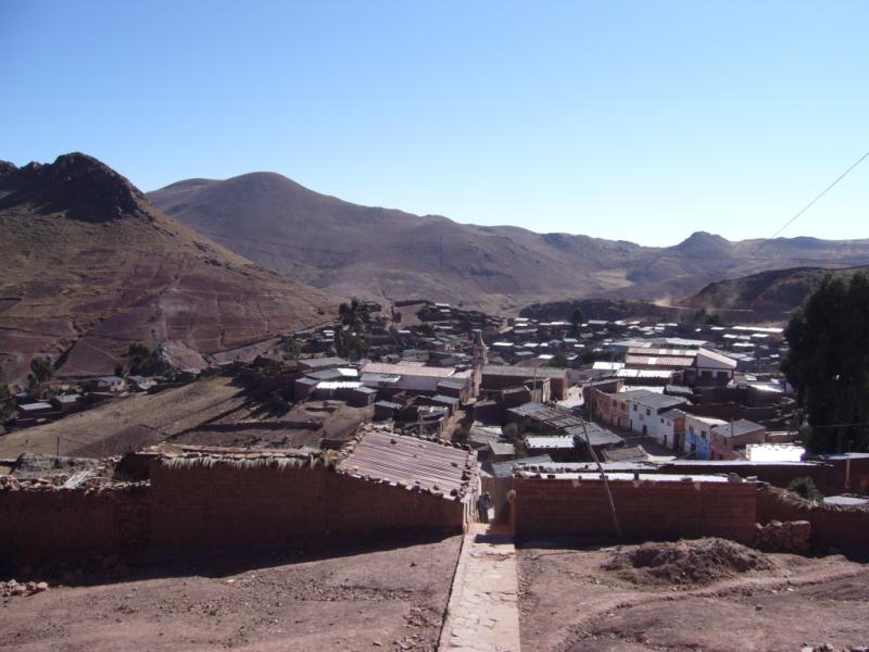
Chayanta — Province — Ocurí, the seat of the Ocurí Municipality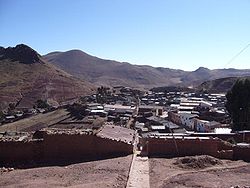
Flag
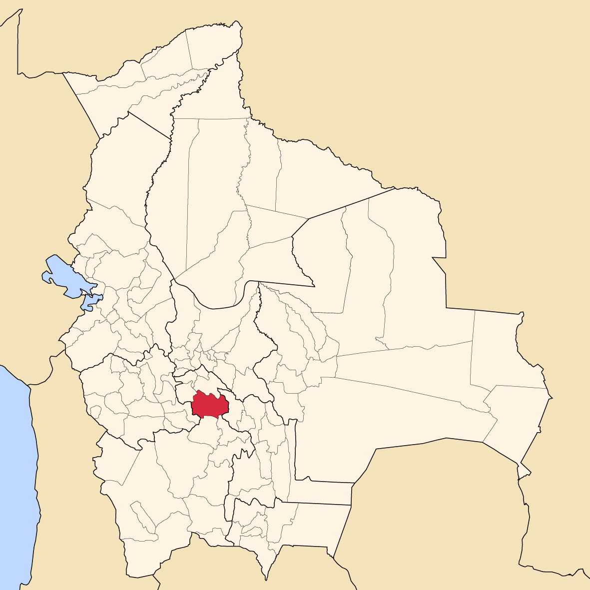
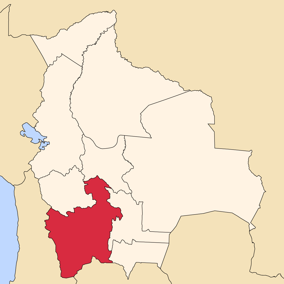
SealLocation of the Chayanta Province within Bolivia Provinces of the Potosí Department
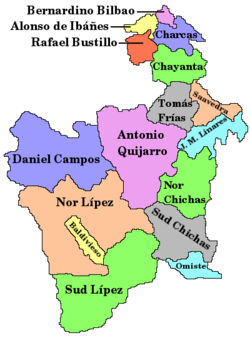
Coordinates: 18°44′S 65°51′W / 18.733°S 65.85°W Country  Bolivia
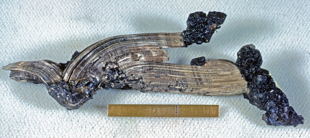
Department Potosí Department Municipalities 4 Cantons 13 Capital Colquechaca Area - Total 1,918.5 sq mi (4,969 km2) Population (2001) - Total 90,205 - Density 47.1/sq mi (18.2/km2) - Ethnicities Quechua Area code(s) BO.PO.CY 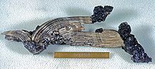 Silver and acanthite, from Colquechaca (Aullagas), Chayanta Province, Bolivia. Scale at bottom is one inch, with a rule at one cm.
Chayanta is a province in the northern parts of the Bolivian Potosí Department. Its capital is Colquechaca.
Contents
Location
Chayanta province is one of sixteen provinces in the Potosí Department. It is located between 18° 23' und 19° 6' South and between 65° 23' und 66° 19' West.
It borders Charcas Province in the north, Rafael Bustillo Province in the northwest, Oruro Department in the west, Tomás Frías Province in the south, Cornelio Saavedra Province in the southeast, and Chuquisaca Department in the east. The province extends over 125 km from east to west and 100 km from north to south.
Division
The province comprises four municipalities, which are partly further subdivided into cantons.
Section Municipality Seat 1st Colquechaca Municipality Colquechaca 2nd Ravelo Municipality Ravelo 3rd Pocoata Municipality Pocoata 4th Ocurí Municipality Ocurí Population
The main language of the province is Quechua, spoken by 79%, while 33% of the population speak Spanish. The population increased from 73,128 inhabitants (1992 census) to 90,205 (2001 census), an increase of 23.4%. The capital of the province is Colquechaca.
97% of the population have no access to electricity, 98% have no sanitary facilities.
74% of the population are employed in agriculture, 1% in mining, 13% in industry, 12% in general services. 93% of the population are Catholics, 5% Protestants.
The people are predominantly indigenous citizens of Quechua descent.[1]
Ethnic group Colquechaca Municipality (%) Ravelo Municipality (%) Pocoata Municipality (%) Ocurí Municipality (%) Quechua 95.3 94.4 89.6 93.4 Aymara 0.9 0.3 3.0 0.2 Guaraní, Chiquitos, Moxos 0.0 0.1 0.0 0.2 Not indigenous 3.8 5.2 7.3 6.1 Other indigenous groups 0.0 0.1 0.0 0.1 History
In the late eighteenth century the province was the scene of a rebellion of the Aymara-speaking population led by Tomás Katari and exacerbated by his assassination in January 1781. It was also the scene of a peasant rebellion in 1927.
Literature
- Sergio Serulnikov, Subverting Colonial Authority: Challenges to Spanish Rule in Eighteenth-Century Southern Andes (Durham: Duke University Press, 2003)
- Sergio Serulnikov, Tomás Catari y la producción de justicia (Buenos Aires: CEDES, 1988)
- Erick D. Langer, "Andean Rituals of Revolt: The Chayanta Rebellion of 1927," Ethnohistory 37(1990): 227–53
- Tristan Platt, Estado boliviano y ayllu andino: tierra y tributo en el norte de Potosi (Lima: Instituto de Estudios Peruanos, 1982)
References
- ^ obd.descentralizacion.gov.bo/municipal/fichas/ (inactive)
Coordinates: 18°44′S 65°51′W / 18.733°S 65.85°W
 Potosí Department
Capital: Potosí Provinces Alonso de Ibáñez • Antonio Quijarro • Bernardino Bilbao • Charcas • Chayanta • Cornelio Saavedra • Daniel Campos • Enrique Baldivieso • José María Linares • Modesto Omiste • Nor Chichas • Nor Lípez • Rafael Bustillo • Sud Chichas • Sur Lípez • Tomás Frías
Municipalities (and seats) Acasio (Acasio) • Arampampa (Arampampa) • Atocha (Atocha) • Betanzos (Betanzos) • Caiza "D" (Caiza "D") • Ckochas (Ckochas) • Caripuyo (Caripuyo) • Chaquí (Chaquí) • Chayanta (Chayanta) • Chuquihuta (Chuquihuta) • Colcha "K" (Colcha "K") • Colquechaca (Colquechaca) • Cotagaita (Cotagaita) • Llallagua (Llallagua) • Llica (Llica) • Mojinete Municipality (Mojinete) Ocurí (Ocurí) • Pocoata (Pocoata) • Porco (Porco) • Potosí (Potosí) • Puna (Puna) • Ravelo (Ravelo) • Sacaca (Sacaca) • San Agustín (San Agustín) • San Antonio de Esmoruco (San Antonio de Esmoruco) • San Pablo de Lípez (San Pablo de Lípez) • San Pedro de Buena Vista (San Pedro de Buena Vista) • San Pedro de Quemes (San Pedro de Quemes) • Tacobamba (Tacobamba) • Tahua (Tahua) • Tinguipaya (Tinguipaya) • Tomave (Tomave) • Toro Toro (Toro Toro) • Tupiza (Tupiza) • Uncía (Uncía) • Urmiri (Urmiri) • Uyuni (Uyuni) • Villazón (Villazón) • Vitichi (Vitichi) • Yocalla (Yocalla)Categories:


Wikimedia Foundation. 2010.