- Ōsu Kannon
-
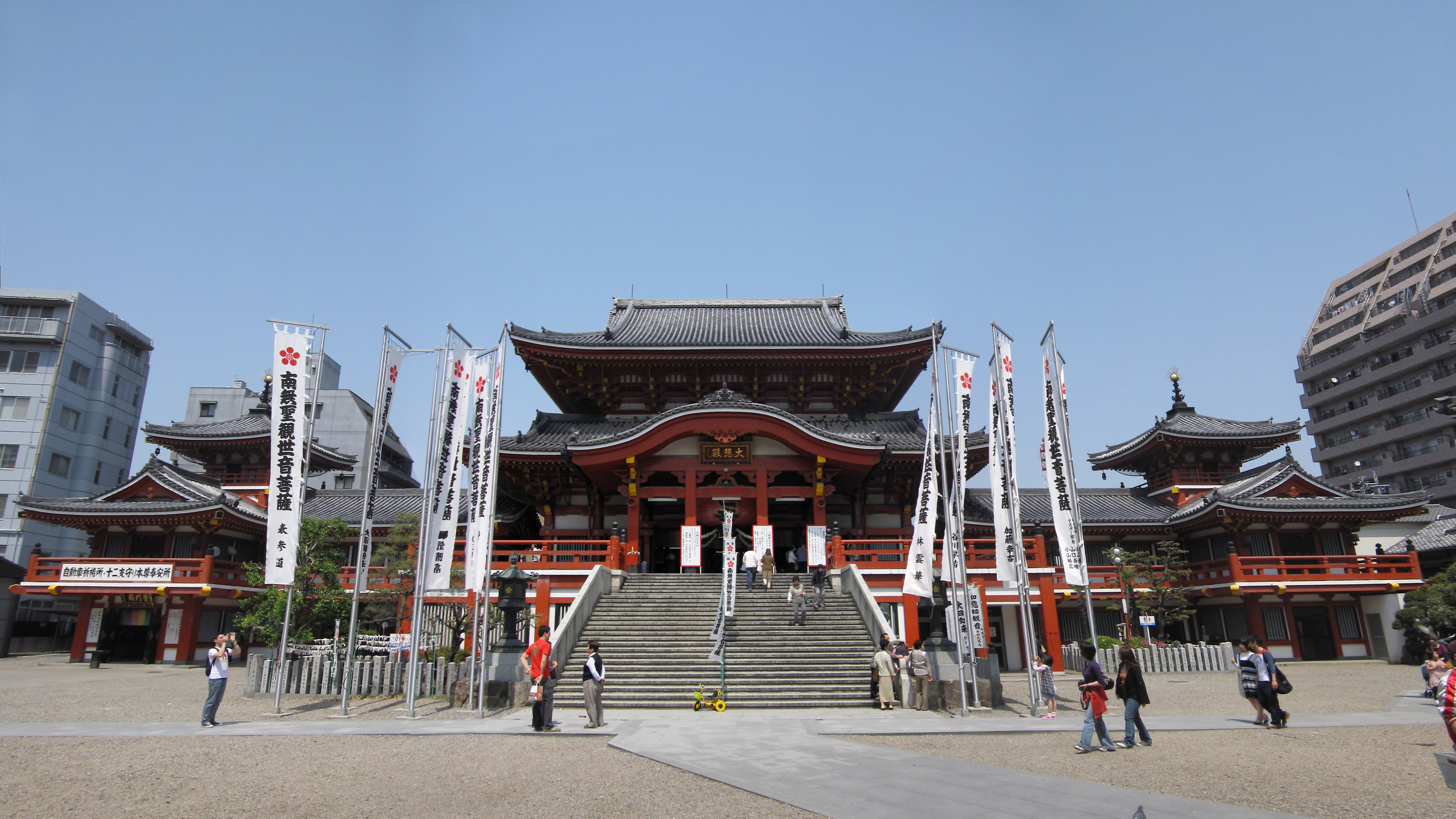
 Ōsu Kannon, also known as Hōshō-in
 Old belfry made out of wood
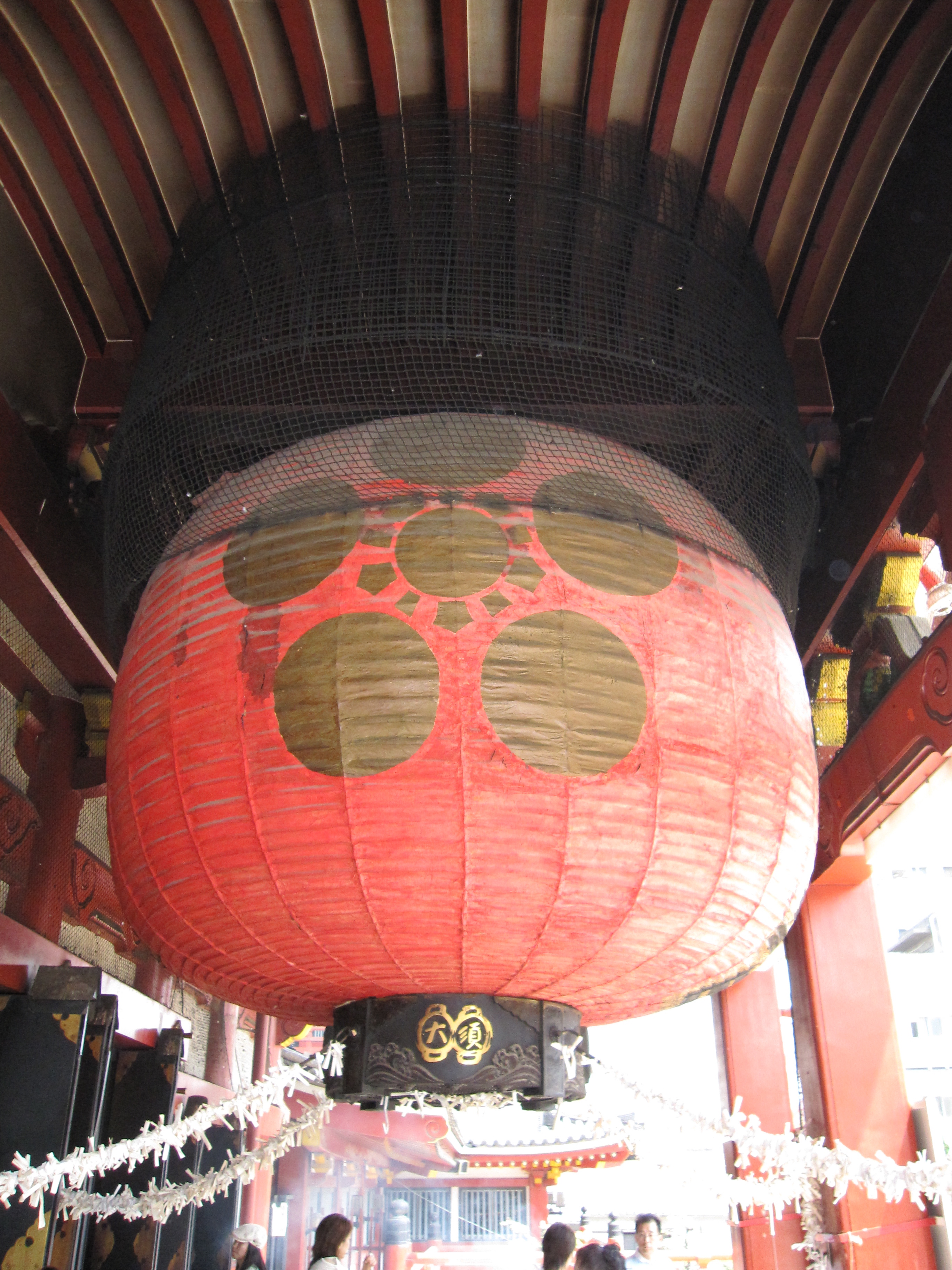
 Giant red paper lantern
Ōsu Kannon (大須観音) is a Buddhist temple of the Shingon sect located in Ōsu in central Nagoya, Japan. It belongs to the Owari Thirty-three Kannon.
Contents
History
The official name is Kitanosan Shinpuku-ji Hōshō-in, but is populary known as Ōsu Kannon.
The temple was originally built in about the year 1333 in Ōsu-gō, Nagaoka village in Owari Province, which is currently known as the city of Hashima in Gifu Prefecture. Construction was sponsored by the Emperor Go-Daigo, who appointed Shōnin Nōshin as the first head priest. Nōshin had a vision in a dream of Avalokitesvara, the Buddha of Compassion, known as Kannon in Japanese.[1] Hence, the name Ōsu (from Ōsu-gō) Kannon. Due to repeated flooding, the temple was moved to its present location in 1612 by Tokugawa Ieyasu. In the 1820s, large parts of the temple were destroyed by fire, but it was rebuilt in the 1970s.[2][3] The main hall has a very large, red paper lantern hanging from the ceiling where worshippers can tie small paper notes with wishes to the holding wires.
The current temple is home to a large collection of books. It houses about 15,000 classic Japanese and Chinese works. Among these is the oldest hand-written copy of the famous Kojiki, describing the ancient mythological history of Japan. The library also has many other books designated as national treasures and important cultural properties.[4]
A street fair is held on the 18th day of each month. The nearest subway is Ōsu Kannon Station.
References
- ^ a flier given to English-speaking visitors, entitled "A Short History of Osu Kannon Temple" with no date or author given.
- ^ "Osu Kannon and Fudo". Daruma Museum Galleries. 2008/01/28. http://darumamuseumgallery.blogspot.com/2008/01/osu-kannon-and-fudo.html.
- ^ "Osu Kannon Temple". japan-guide.com. http://www.japan-guide.com/e/e3306.html.
- ^ "Viewing Japanese Religious Structures and Architecture". Expo 2005 Aichi Japan. http://www.expo2005.or.jp/en/aboutaichi/where/structure.html.
Sources
External links
 Media related to Ōsu Kannon at Wikimedia Commons
Buddhist temples in Japan Japanese Buddhist architecture Architectonic elements Mon (gates) Buildings Chinjusha · chōzuya/temizuya · -dō · main hall (kon-dō, hon-dō, butsuden) · kuri · kyōzō or kyō-dō · shoinTō or Buttō (pagodas) Styles Others A-un · kenSchools and objects of worship Major schools Zen schools Nanto rokushū Objects of worship Amida Nyōrai · Benzaiten · Dainichi Nyorai · Jizō · Kannon · Marishi-ten · Shaka Nyorai · Shitennō (Four Kings) · Twelve Heavenly Generals (Jūni Shinshō) · Yakushi NyoraiOther elements Implements kei (ritual gong) · mokugyōOthers bussokuseki · butsudan · Glossary of Japanese Buddhism · Japanese Buddhist pantheon · jingū-ji · miyadera · saisenbakoCategories:- Buddhist temples in Nagoya
- Ōsu

Wikimedia Foundation. 2010.