- Nong Chik District
-
Nong Chik
หนองจิก— Amphoe — Amphoe location in Pattani Province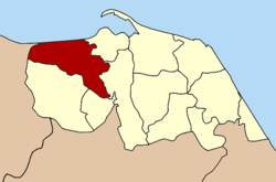
Coordinates: 6°50′40″N 101°10′43″E / 6.84444°N 101.17861°ECoordinates: 6°50′40″N 101°10′43″E / 6.84444°N 101.17861°E Country  Thailand
Province Pattani Seat Tuyong Area – Total 231.5 km2 (89.4 sq mi) Population (2008) – Total 69,510 – Density 296.6/km2 (768.2/sq mi) Time zone THA (UTC+7) Postal code 94170 Geocode 9403 Nong Chik (Thai: หนองจิก) is a district (amphoe) in Pattani Province, southern Thailand.
Contents
History
Nong Chik was one of the seven states (Mueang) into which the Pattani kingdom was split in the early 19th century to diminish the power of the often rebellious tributary kingdom. The capital was located in tambon Nong Mai (Yarang district). 1901 the district office was moved to Tu Yong, where it is still located today.
Due to the district office location in Tu Yong, the district was renamed to Tu Yong in 1917.[1] In 1938 it was renamed back to the historical name Nong Chik.[2]
Geography
Neighboring districts are (from the east clockwise) Mueang Pattani, Yarang, Mae Lan and Khok Pho of Pattani Province, and Thepha of Songkhla Province. To the north is the Gulf of Thailand.
Administration
The district is subdivided into 12 subdistricts (tambon), which are further subdivided into 74 villages (muban). Bo Thong and Nong Chik are two subdistrict municipalities (thesaban tambon). Nong Chik covers parts of tambon Tu Yong, while Bo Thong covers the complete tambon Bo Thong and parts of Bang Khao. There are further 11 Tambon administrative organizations (TAO).
No. Name Thai Villages Inh.[3] 1. Ko Po เกาะเปาะ 3 3,432 2. Kholo Tanyong คอลอตันหยง 8 5,375 3. Don Rak ดอนรัก 7 5,025 4. Dato ดาโต๊ะ 5 2,706 5. Tuyong ตุยง 8 12,272 6. Tha Kamcham ท่ากำชำ 7 6,503 7. Bo Thong บ่อทอง 9 10,073 8. Bang Khao บางเขา 7 7,165 9. Bang Tawa บางตาวา 2 3,260 10. Pulo Puyo ปุโละปุโย 7 6,945 11. Yabi ยาบี 6 3,673 12. Lipa Sa-ngo ลิปะสะโง 5 3,081 References
- ^ "ประกาศกระทรวงมหาดไทย เรื่อง เปลี่ยนชื่ออำเภอ" (in Thai). Royal Gazette 34 (0 ก): 40–68. 1917-04-29. http://www.ratchakitcha.soc.go.th/DATA/PDF/2460/A/40.PDF.
- ^ "พระราชกฤษฎีกาเปลี่ยนนามจังหวัด และอำเภอบางแห่ง พุทธศักราช ๒๔๘๑" (in Thai). Royal Gazette 55 (0 ก): 658–666. 1938-11-14. http://www.ratchakitcha.soc.go.th/DATA/PDF/2481/A/658.PDF.
- ^ "Population statistics 2008". Department of Provincial Administration. http://www.dopa.go.th/xstat/p5194_01.html.
External links
- amphoe.com (Thai)
- http://www.nongjik.blogspot.com/ Official blog of the district office
Categories:- Amphoe of Pattani
- Former provinces of Thailand
- Southern Thailand geography stubs

Wikimedia Foundation. 2010.