Mueang Pattani District

Mueang Pattani District
Mueang Pattani
เมืองปัตตานี
—  Amphoe  —
Amphoe location in Pattani Province
Coordinates: 6°52′7″N 101°15′0″E / 6.86861°N 101.25°E / 6.86861; 101.25Coordinates: 6°52′7″N 101°15′0″E / 6.86861°N 101.25°E / 6.86861; 101.25
Country  Thailand
Province Pattani
Seat
Tambon
Muban
Amphoe established
Area
 - Total 96.869 km2 (37.4 sq mi)
Population (2005)
 - Total 118,302
 - Density 1,221.3/km2 (3,163.2/sq mi)
Time zone THA (UTC+7)
Postal code 94000
Geocode 9401

Mueang Pattani (Thai: เมืองปัตตานี) is the capital district (Amphoe Mueang) of Pattani Province, southern Thailand.

History

This area was the center of the Pattani Kingdom. In the reign of King Rama II, the king ordered to divide the kingdom to 7 cities (Mueang), Pattani, Yaha, Yaring, Nong Chik, Ra-ngae, Raman and Sai Buri. It was officially settled to be a district in 1901. Pattani was the central district of Monthon Pattani when King Rama V created the monthon in 1906.

Geography

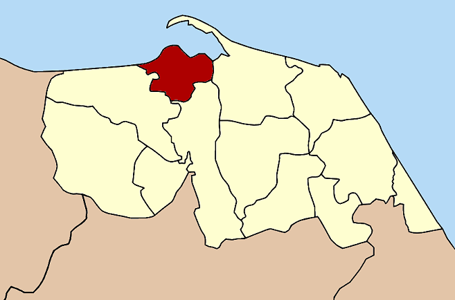
Neighboring districts are (from the east clockwise) Yaring, Yarang and Nong Chik. To the north is the Gulf of Thailand.

The important water resource is the Tani river.

Administration

The district is subdivided into 13 subdistricts (tambon), which are further subdivided into 66 villages (muban). Pattani is a town (thesaban mueang) and covers the complete tambon Sabarang, Anoru and Chabang Tiko. There are further 10 Tambon administrative organizations (TAO).

No. Name Thai name Villages Inh.
1. Sabarang สะบารัง - 24,205
2. Anoru อาเนาะรู - 11,640
3. Chabang Tiko จะบังติกอ - 7,786
4. Bana บานา 11 18,409
5. Tanyong Lulo ตันหยงลุโละ 3 6,170
6. Khlong Maning คลองมานิง 4 2,986
7. Kamiyo กะมิยอ 7 4,297
8. Barahom บาราโหม 3 2,839
9. Paka Harang ปะกาฮะรัง 8 4,759
10. Rusa Milae รูสะมิแล 6 15,764
11. Talubo ตะลุโบะ 9 6,370
12. Baraho บาราเฮาะ 8 6,813
13. Puyut ปุยุด 7 6,264


Wikimedia Foundation. 2010.

Игры ⚽ Поможем решить контрольную работу

Look at other dictionaries:

  • Mueang Narathiwat District — Mueang Narathiwat เมืองนราธิวาส   Amphoe   Amphoe location in Narathiwat Province …   Wikipedia

  • Mueang Yala District — Mueang Yala เมืองยะลา   Amphoe   Amphoe location in Yala Province …   Wikipedia

  • Amphoe Mueang Pattani — Infobox Amphoe name=Mueang Pattani thai=เมืองปัตตานี province=Pattani coordinates=coord|6|52|7|N|101|15|0|E|type:adm2nd region:TH area=96.869 population=118,302 population as of=2005 density=1221.3 postal code=94000 geocode=9401Mueang Pattani (… …   Wikipedia

  • Pattani, Thailand — Pattani is a town ( thesaban mueang ) in the far south of Thailand, near the boundary to Malaysia. It is the capital of the Pattani Province. The city has a population of 43,631 (2005). It covers the whole tambon Sabarang, Anoru and Chabang Tiko… …   Wikipedia

  • Pattani (disambiguation) — Pattani (or Patani in Malay spelling) may refer to * Pattani Province, in southern Thailand * Pattani (town), in southern Thailand * Pattani (region), which includes the above province ** Pattani Kingdom, a former semi independent kingdom **… …   Wikipedia

  • Nong Chik District — Nong Chik หนองจิก   Amphoe   Amphoe location in Pattani Province …   Wikipedia

  • Mae Lan District — Mae Lan แม่ลาน   Amphoe   Amphoe location in Pattani Province …   Wikipedia

  • Mai Kaen District — Mai Kaen ไม้แก่น   Amphoe   Amphoe location in Pattani Province …   Wikipedia

  • Amphoe Mueang Narathiwat — Infobox Amphoe thai=เมืองนราธิวาส name=Mueang Narathiwat province=Narathiwat coordinates=coord|6|25|34|N|101|49|23|E|type:adm2nd region:TH capital=Bang Nak area= 305.115 population=108,644 population as of=2005 density=356.1 postal code=96000… …   Wikipedia

  • Mayo District — Mayo มายอ   Amphoe   Amphoe location in Pattani Province …   Wikipedia

Share the article and excerpts

Direct link
Do a right-click on the link above
and select “Copy Link”