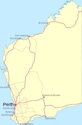
- Needilup, Western Australia
-
Needilup
Western AustraliaEstablished: 1954 Postcode: 6336 Elevation: 292 m (958 ft) Location: LGA: Shire of Jerramungup State District: Wagin Federal Division: O'Connor Coordinates: 33°51′00″S 118°46′01″E / 33.85°S 118.767°E
Needilup is a town in the Great Southern Region of Western Australia that is situated between Ongerup and Jerramungup along the Gnowangerup-Jerramungup Road.
The establishment of a town arose after a local member petitioned the lands department for land to be made available for a townsite in 1951 after settlement in the area lead to a demand for land. Lots were surveyed soon afterward and the townsite was declared in 1954.[1]
The name is Aboriginal in origin and the meaning is unknown. The name is taken from the nearby Needilup River that was first surveyed in 1901 and spelt in a variety of ways.
References
- ^ Western Australian Land Information Authority. "History of country town names". http://www.landgate.wa.gov.au/corporate.nsf/web/History+of+country+town+names. Retrieved 2011-04-25.
Towns in the Great Southern region of Western Australia Amelup · Badgebup · Borden · Bornholm · Boscabel · Bow Bridge · Boxwood Hill · Bremer Bay · Broomehill · Cartmeticup · Chinocup · Cranbrook · Denmark · Elleker · Frankland · Gairdner · Gnowangerup · Jerramungup · Jingalup · Kalgan · Katanning · Kendenup · King River · Kojonup · Kwobrup · Little Grove · Lower King · Manypeaks · Mount Barker · Muradup · Narrikup · Needilup · Nyabing · Ocean Beach · Ongerup · Pingrup · Porongurup · Redmond · Tambellup · Tenterden · Torbay · Tunney · Wellstead · Woodanilling
Categories:- Towns in Western Australia
- Great Southern (Western Australia)
Wikimedia Foundation. 2010.

