- Nagore Durgha, Singapore
-
Coordinates: 1°16′53.1″N 103°50′52.2″E / 1.281417°N 103.847833°E
Nagore Durgha English Nagore Durgha Chinese 纳宫神社 (Pinyin Na Gong Shen She) Malay Nagore Dargha Tamil நாகூர் தர்கா Ruling party Places of Interest 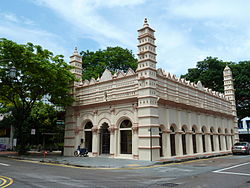 Nagore Durgha Shrine
 For other uses, see Nagore Durgha (disambiguation).
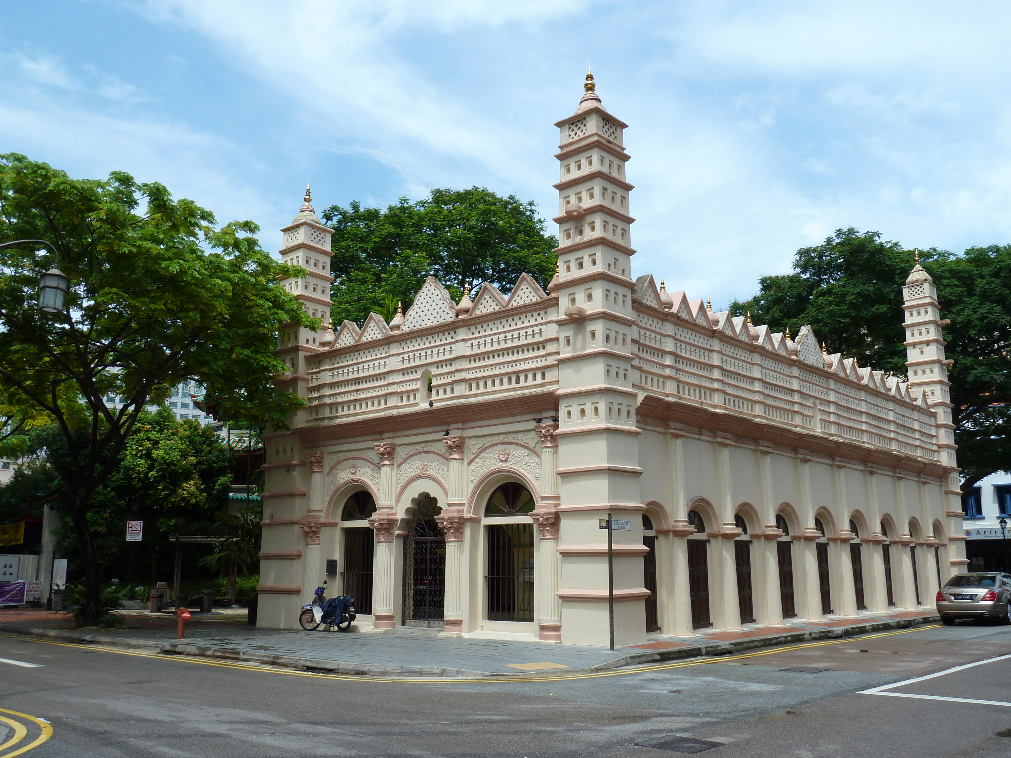
The Nagore Durgha is a shrine in Singapore built by the Muslims of southern India in 1828–1830, and was originally known as Shahul Hamid Dargha. When this shrine was first built, Telok Ayer Street, where the shrine was located, was a sandy beach crowded with sailing craft. While its physical surroundings have changed beyond recognition, the monument itself - save for conservation and preservation work in 2007 - has changed little since the late 19th century. It has a unique blend of Classical and Indian Muslim motifs.
Contents
History
Nagore Dargah was actually built to commemorate a visit to the island by a Muslim holy man of the Chulia people (Muslim merchants and moneylenders from India's Coromandel Coast), who was traveling around Southeast Asia spreading the word of Indian Islam. The land was granted to a certain Kaderpillai in 1827, on condition that it was not to be used for a building of wood and attap.
In 1893, by an order of court, the Nagore Dargah properties came under new trustees who were also appointed for the Masjid Al-Abrar. The building resembles a multi-tiered wedding cake, its sharp arches decorated with intricate moldings. The architectural features of the building blends classical motifs like molded arches and columns with Indian Muslim elements such as perforated grilles at the roof. In 1974, it was gazetted a national monument.
The shrine has been closed since the 1990s due to fears that the structure will weaken. The shrine will be restored as an Indian Muslim heritage centre when it reopens at the end of 2007. Restoration works started in January 2007 and will end in the fourth quarter of the same year at a cost of S$1.8 million. President S.R. Nathan attended an event organised by the Indian Muslims on December 3, 2006. The Indian Muslim community have raised S$200,000 in total so far.[1]
Architecture
The most interesting visual feature is its facade: Two arched windows flank an arched doorway, with columns in between. Above these is a "miniature palace" -- a massive replica of the facade of a palace, with tiny cutout windows and a small arched doorway in the middle. The cutouts in white plaster make it look like lace. From the corners of the facade, two 14-level minarets rise, with three little domed cutouts on each level and onion domes on top. Inside, the prayer halls and two shrines are painted and decorated in shockingly tacky colors.
References
- ^ "New life for monument", The Straits Times, 4 December 2006
External links
Categories:- National Monuments of Singapore
- Mosques in Singapore
- 1820s architecture
- Outram, Singapore
- Chinatown, Singapore
Wikimedia Foundation. 2010.