- Na Khu District
-
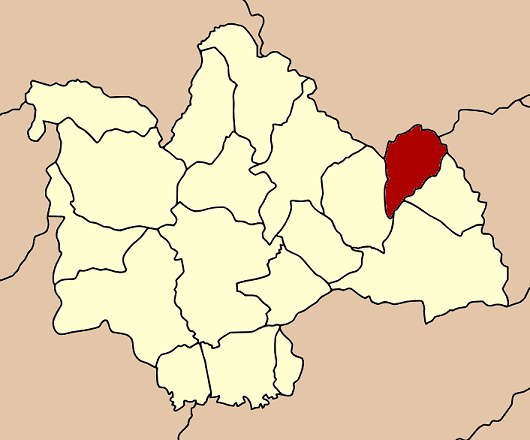
Na Khu
นาคู— Amphoe — Amphoe location in Kalasin Province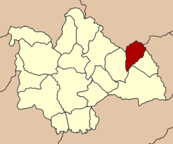
Coordinates: 16°46′48″N 104°1′54″E / 16.78°N 104.03167°ECoordinates: 16°46′48″N 104°1′54″E / 16.78°N 104.03167°E Country  Thailand
Province Kalasin Seat Na Khu Tambon Muban Amphoe established Area – Total 203.0925 km2 (78.4 sq mi) Population (2005) – Total 31,510 – Density 211.2/km2 (547/sq mi) Time zone THA (UTC+7) Postal code 46160 Geocode 4616 Na Khu (Thai: นาคู) is a district (Amphoe) in the eastern part of Kalasin Province, northeastern Thailand.
Contents
Geography
Neighboring districts are (from the south clockwise) Khao Wong, Kuchinarai and Huai Phueng of Kalasin Province, Phu Phan and Tao Ngoi of Sakon Nakhon Province, and Dong Luang of Mukdahan Province.
History
The minor district (King Amphoe) was created on April 1 1995, when it was split off from Khao Wong[1].
Following a decision of the Thai government on May 15 2007, all of the 81 minor districts were to be upgraded to full districts[2]. With the publishing in the Royal Gazette on August 24 the upgrade became official[3].
Administration
The district is subdivided into 5 subdistricts (tambon), which are further subdivided into 54 villages (muban). Na Khu is a township (thesaban tambon) which covers parts of tambon Na Khu. There are further 5 Tambon administrative organizations (TAO).
No. Name Thai name Villages Inh. 1. Na Khu นาคู 13 9,799 2. Sai Na Wang สายนาวัง 8 4,117 3. Non Na Chan โนนนาจาน 9 4,747 4. Bo Kaeo บ่อแก้ว 14 8,780 5. Phu Laen Chang ภูแล่นช้าง 10 4,067 References
- ^ "ประกาศกระทรวงมหาดไทย เรื่อง แบ่งเขตท้องที่อำเภอเขาวง จังหวัดกาฬสินธุ์ ตั้งเป็นกิ่งอำเภอนาคู" (in Thai). Royal Gazette 112 (Special 9 ง): 69. March 22 1995. http://www.ratchakitcha.soc.go.th/DATA/PDF/2538/E/009/69.PDF.
- ^ "แถลงผลการประชุม ครม. ประจำวันที่ 15 พ.ค. 2550" (in Thai). Manager Online. http://www.manager.co.th/Politics/ViewNews.aspx?NewsID=9500000055625.
- ^ "พระราชกฤษฎีกาตั้งอำเภอฆ้องชัย...และอำเภอเหล่าเสือโก้ก พ.ศ. ๒๕๕๐" (in Thai). Royal Gazette 124 (46 ก): 14–21. August 24 2007. http://www.ratchakitcha.soc.go.th/DATA/PDF/2550/A/046/14.PDF.
External links
Mueang Kalasin · Na Mon · Kamalasai · Rong Kham · Kuchinarai · Khao Wong · Yang Talat · Huai Mek · Sahatsakhan · Kham Muang · Tha Khantho · Nong Kung Si · Somdet · Huai Phueng · Sam Chai · Na Khu · Don Chan · Khong Chai
Categories:- Amphoe of Kalasin
- Isan geography stubs
Wikimedia Foundation. 2010.