- Don Chan District
-
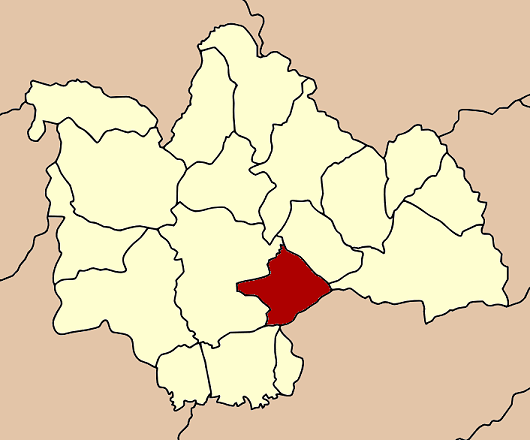
Don Chan
ดอนจาน— Amphoe — Amphoe location in Kalasin Province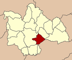
Coordinates: 16°27′30″N 103°41′42″E / 16.45833°N 103.695°ECoordinates: 16°27′30″N 103°41′42″E / 16.45833°N 103.695°E Country  Thailand
Province Kalasin Seat Don Chan Tambon Muban Amphoe established Area – Total 236.6 km2 (91.4 sq mi) Population (2005) – Total 25,164 – Density 106.4/km2 (275.6/sq mi) Time zone THA (UTC+7) Postal code 46000 Geocode 4617 Don Chan (Thai: ดอนจาน) is a district (Amphoe) of Kalasin Province, northeastern Thailand.
Contents
Geography
Neighboring districts are (from the south clockwise) Kamalasai, Mueang Kalasin, Na Mon and Kuchinarai of Kalasin Province, and Pho Chai of Roi Et Province.
History
The minor district (King Amphoe) was created on July 15 1996, when it was split off from Mueang Kalasin district.[1]
Following a decision of the Thai government on May 15 2007, all of the 81 minor districts were to be upgraded to full districts.[2] With the publishing in the Royal Gazette on August 24 the upgrade became official.[3]
Administration
The district is subdivided into 5 subdistricts (tambon), which are further subdivided into 48 villages (muban). There are no municipal (thesaban) areas, and 5 Tambon administrative organizations (TAO).
No. Name Thai name Villages Inh. 1. Don Chan ดอนจาน 9 7,034 2. Sa-at Chai Si สะอาดไชยศรี 8 3,708 3. Dong Phayung ดงพยุง 13 5,441 4. Muang Na ม่วงนา 9 4,348 5. Na Champa นาจำปา 9 4,633 References
- ^ "ประกาศกระทรวงมหาดไทย เรื่อง แบ่งเขตท้องที่อำเภอเมืองกาฬสินธุ์ จังหวัดกาฬสินธุ์ ตั้งเป็นกิ่งอำเภอดอนจาน" (in Thai). Royal Gazette 113 (Special 18 ง): 24. June 26 1996. http://www.ratchakitcha.soc.go.th/DATA/PDF/2539/E/018/24.PDF.
- ^ "แถลงผลการประชุม ครม. ประจำวันที่ 15 พ.ค. 2550" (in Thai). Manager Online. http://www.manager.co.th/Politics/ViewNews.aspx?NewsID=9500000055625.
- ^ "พระราชกฤษฎีกาตั้งอำเภอฆ้องชัย...และอำเภอเหล่าเสือโก้ก พ.ศ. ๒๕๕๐" (in Thai). Royal Gazette 124 (46 ก): 14–21. August 24 2007. http://www.ratchakitcha.soc.go.th/DATA/PDF/2550/A/046/14.PDF.
External links
Mueang Kalasin · Na Mon · Kamalasai · Rong Kham · Kuchinarai · Khao Wong · Yang Talat · Huai Mek · Sahatsakhan · Kham Muang · Tha Khantho · Nong Kung Si · Somdet · Huai Phueng · Sam Chai · Na Khu · Don Chan · Khong Chai
Categories:- Amphoe of Kalasin
- Isan geography stubs
Wikimedia Foundation. 2010.