- Mueang Kalasin District
-
Mueang Kalasin
เมืองกาฬสินธุ์— Amphoe — Amphoe location in Kalasin Province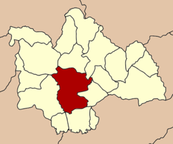
Coordinates: 16°25′57″N 103°30′22″E / 16.4325°N 103.50611°ECoordinates: 16°25′57″N 103°30′22″E / 16.4325°N 103.50611°E Country  Thailand
Province Kalasin Seat Tambon Muban Amphoe established Area - Total 649.9 km2 (250.9 sq mi) Population (2005) - Total 145,579 - Density 224.0/km2 (580.2/sq mi) Time zone THA (UTC+7) Postal code 46000 Geocode 4601 Mueang Kalasin (Thai: เมืองกาฬสินธุ์) is the capital district (Amphoe Mueang) of Kalasin Province, northeastern Thailand.
Contents
Geography
Neighboring districts are (from the north clockwise) Sahatsakhan, Somdet, Na Mon, Don Chan, Kamalasai, Khong Chai, Yang Talat and Nong Kung Si of Kalasin Province.
History
In 1913 the district was renamed from Uthai Kalasin to Mueang Kalasin.[1]
Administration
The district is subdivided into 17 subdistricts (tambon), which are further subdivided into 180 villages (muban). The town (thesaban mueang) covers the whole tambon Kalasin. There are three townships (thesaban tambon) - Nong So covers the whole tambon Lam Pao and parts of Lamkhlong; Na Chan covers the whole tambon Na Chan and parts of Phai and Phu Po; and Huai Pho covers the whole tambon Huai Pho. There are further 16 Tambon administrative organizations (TAO).
No. Name Thai name Villages Inh. 1. Kalasin กาฬสินธุ์ - 37,929 2. Nuea เหนือ 12 7,584 3. Lup หลุบ 15 10,831 4. Phai ไผ่ 9 5,122 5. Lam Pao ลำปาว 11 5,797 6. Lam Phan ลำพาน 16 8,973 7. Chiang Khruea เชียงเครือ 10 7,123 8. Bueng Wichai บึงวิชัย 9 6,052 9. Huai Pho ห้วยโพธิ์ 17 11,222 11. Phu Po ภูปอ 9 6,457 13. Phu Din ภูดิน 14 5,554 15. Nong Kung หนองกุง 8 4,827 16. Klang Muen กลางหมื่น 12 4,697 17. Khamin ขมิ้น 11 6,405 19. Phon Thong โพนทอง 8 5,658 20. Na Chan นาจารย์ 9 6,010 21. Lam Khlong ลำคลอง 10 5,338 Missing numbers are tambon which now form Don Chan district.
References
- ^ "แจ้งความกระทรวงมหาดไทย เรื่อง เปลี่ยนนามอำเภอ" (in Thai). Royal Gazette 30 (0 ง): 1619–1620. October 19 1913. http://www.ratchakitcha.soc.go.th/DATA/PDF/2456/D/1619_1.PDF.
Mueang Kalasin · Na Mon · Kamalasai · Rong Kham · Kuchinarai · Khao Wong · Yang Talat · Huai Mek · Sahatsakhan · Kham Muang · Tha Khantho · Nong Kung Si · Somdet · Huai Phueng · Sam Chai · Na Khu · Don Chan · Khong Chai
Categories:- Amphoe of Kalasin
- Isan geography stubs

Wikimedia Foundation. 2010.