- Mueang Chiang Rai District
-
Mueang Chiang Rai
เมืองเชียงราย— Amphoe — Amphoe location in Chiang Rai Province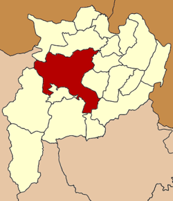
Coordinates: 19°54′31″N 99°49′57″E / 19.90861°N 99.8325°ECoordinates: 19°54′31″N 99°49′57″E / 19.90861°N 99.8325°E Country  Thailand
Province Chiang Rai Seat Tambon Muban Amphoe established Area – Total 1,216.1 km2 (469.5 sq mi) Population (2005) – Total 227,142 – Density 186.8/km2 (483.8/sq mi) Time zone THA (UTC+7) Postal code 57000 Geocode 5701 Mueang Chiang Rai (Thai: เมืองเชียงราย; IPA: [mɯ̄aŋ tɕʰīaŋ rāːj]) is the capital district (amphoe mueang) of Chiang Rai Province, northern Thailand.
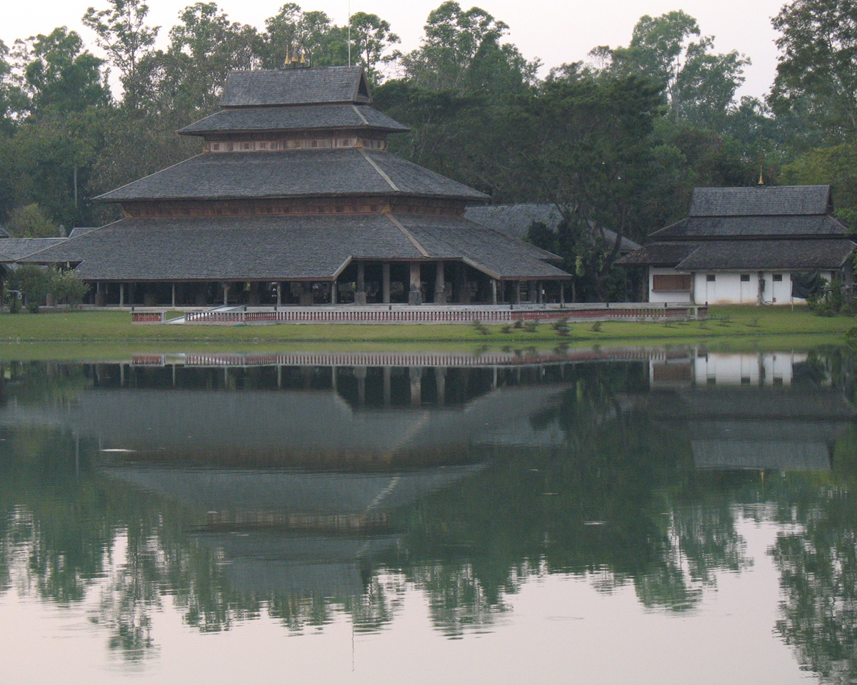
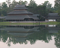 Rai Mae Fah Luang Art and Cultural Park, Tambon Rop Wiang, Amphoe Mueang Chiang Rai
Geography
Neighboring districts are (from the northwest clockwise) Mae Fa Luang, Mae Chan, Wiang Chiang Rung, Wiang Chai, Thoeng, Pa Daet, Phan, Mae Lao, Mae Suai of Chiang Rai Province and Mae Ai of Chiang Mai Province.
The important water resource is the Kok River.
Administration
The district is subdivided into 16 subdistricts (tambon), which are further subdivided into 256 villages (muban). The city (thesaban nakhon) Chiang Rai covers the whole tambon Wiang and parts of Rop Wiang, San Sai and Rum Kok. The township (thesaban tambon) San Sai covers parts of tambon San Sai, and Ban Du the whole tambon Ban Du. There are further 14 Tambon administrative organizations (TAO).
No. Name Thai name Villages Inh. 1. Wiang เวียง 5 12,430 2. Rop Wiang รอบเวียง 7 47,992 3. Ban Du บ้านดู่ 19 14,542 4. Nang Lae นางแล 14 10,312 5. Mae Khao Tom แม่ข้าวต้ม 23 12,500 6. Mae Yao แม่ยาว 18 19,958 7. San Sai สันทราย 11 11,621 11. Mae Kon แม่กรณ์ 13 6,439 12. Huai Chomphu ห้วยชมภู 11 13,494 13. Huai Sak ห้วยสัก 29 17,789 14. Rim Kok ริมกก 11 16,239 15. Doi Lan ดอยลาน 20 10,854 16. Pa O Don Chai ป่าอ้อดอนชัย 21 9,849 18. Tha Sai ท่าสาย 13 8,412 20. Doi Hang ดอยฮาง 8 4,444 21. Tha Sut ท่าสุด 11 10,267 Missing numbers are tambon which now form Mae Lao district.
External links
- amphoe.com (Thai)
Chiang Rai Main article 
Capital city Districts (amphoe) Mueang Chiang Rai · Chiang Khong · Chiang Saen · Doi Luang · Khun Tan · Mae Chan · Mae Fa Luang · Mae Lao · Mae Sai · Mae Suai · Pa Daet · Phan · Phaya Mengrai · Thoeng · Wiang Chai · Wiang Chiang Rung · Wiang Kaen · Wiang Pa Pao ·
Related topics Categories:- Amphoe of Chiang Rai
- Chiang Rai Province geography stubs

Wikimedia Foundation. 2010.