- Chiang Klang District
-
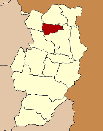
Chiang Klang
เชียงกลาง— Amphoe — Amphoe location in Nan Province
Coordinates: 19°17′30″N 100°51′42″E / 19.29167°N 100.86167°ECoordinates: 19°17′30″N 100°51′42″E / 19.29167°N 100.86167°E Country  Thailand
Province Nan Amphoe established Government – Marshal Prasat Parkthup Area – Total 277.115 km2 (107 sq mi) Population (2009) – Total 28,234 – Density 101.9/km2 (263.9/sq mi) Time zone THA (UTC+7) Postal code 55160 Geocode 5509 Chiang Klang (Thai: เชียงกลาง) is a district (Amphoe) in the northern part of Nan Province, northern Thailand.
Contents
Geography
Neighboring are from the north clockwise Thung Chang, Pua, Tha Wang Pha and Song Khwae.
History
The minor district (King Amphoe) was created on June 20 1968, when the four tambon Puea, Chiang Klang, Chiang Khan and Na Rai Luang were split off from Thung Chang district.[1] It was upgraded to a full district on November 16 1971.[2]
Administration
The district is subdivided into 6 subdistricts (tambon), which are further subdivided into 59 villages (muban). Sop Kon is a township (thesaban tambon) and covers parts of tambon Chiang Klang, Puea and Phaya Kaeo. There are further 4 Tambon administrative organizations (TAO).
No. Name Thai name Villages Inh. 1. Chiang Klang เชียงกลาง 12 7,643 2. Puea เปือ 15 6,970 3. Chiang Khan เชียงคาน 5 1,699 4. Phra That พระธาตุ 10 3,860 8. Phaya Kaeo พญาแก้ว 7 3,412 9. Phra Phutthabat พระพุทธบาท 10 5,289 The missing numbers are the tambon which now form Song Khwae district.
References
- ^ "ประกาศกระทรวงมหาดไทย เรื่อง แบ่งท้องที่ตั้งเป็นกิ่งอำเภอ" (in Thai). Royal Gazette 85 (54 ง): 1755. June 18 1968. http://www.ratchakitcha.soc.go.th/DATA/PDF/2511/D/054/1755.PDF.
- ^ "พระราชกฤษฎีกาตั้งอำเภอปลาปาก อำเภอเชียงกลาง อำเภอปากชม อำเภอบ้านม่วง อำเภอพังโคน อำเภอดอนสัก อำเภอพนม อำเภอเวียงสระ อำเภอสังคม และอำเภอหัวตะพาน พ.ศ. ๒๕๑๔" (in Thai). Royal Gazette 88 (123 ก): 745–748. November 16 1971. http://www.ratchakitcha.soc.go.th/DATA/PDF/2514/A/123/745.PDF.
External links
Mueang Nan · Mae Charim · Ban Luang · Na Noi · Pua · Tha Wang Pha · Wiang Sa · Thung Chang · Chiang Klang · Na Muen · Santi Suk · Bo Kluea · Song Khwae · Phu Phiang · Chaloem Phra Kiat
Categories:- Amphoe of Nan
- Northern Thailand geography stubs
Wikimedia Foundation. 2010.