- Chiang Khong District
-
Chiang Khong
เชียงของ— Amphoe — Amphoe location in Chiang Rai Province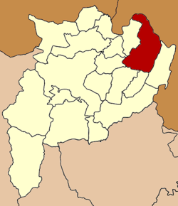
Coordinates: 20°15′36″N 100°24′24″E / 20.26°N 100.40667°ECoordinates: 20°15′36″N 100°24′24″E / 20.26°N 100.40667°E Country  Thailand
Province Chiang Rai Seat Wiang Tambon Muban Amphoe established Area - Total 836.9 km2 (323.1 sq mi) Population (2005) - Total 63,709 - Density 76.1/km2 (197.1/sq mi) Time zone THA (UTC+7) Postal code 57140 Geocode 5703 Chiang Khong (Thai: เชียงของ; IPA: [tɕʰīaŋ kʰɔ̌ːŋ]) is a district (Amphoe) in the northeastern part of Chiang Rai Province, northern Thailand.
Geography
Neighboring districts are (from the southeast clockwise) Wiang Kaen, Khun Tan, Phaya Meng Rai, Wiang Chiang Rung, Doi Luang, Chiang Saen of Chiang Rai Province. To the east is Bokeo province of Laos. The main river is the Mekong, which partially forms the boundary to Laos.
Due to its location, the district forms a gateway to neighboring country, mostly by boats traveling to Luang Prabang. Also bus travel on Asian Highway 3 from Ban Houayxay across the river to Boten at the Chinese-Laotian boundary is available. A bridge crossing the river is currently planned.
Administration
The district is subdivided into 7 subdistricts (tambon), which are further subdivided into 117 villages (muban). There are two townships (thesaban tambon) - Wiang Chiang Khong covers parts of tambon Wiang, and Bun Rueang covers the whole same-named tambon. There are further 6 Tambon administrative organizations (TAO).
No. Name Thai name Villages Inh. 1. Wiang เวียง 14 12,311 2. Sathan สถาน 16 9,453 3. Khrueng ครึ่ง 11 7,024 4. Bun Rueang บุญเรือง 10 7,054 5. Huai So ห้วยซ้อ 23 12,562 8. Si Don Chai ศรีดอนชัย 18 8,919 10. Rim Khong ริมโขง 11 6,386 Missing numbers belonged to the tambon which now form Wiang Kaen district.
External links
Mueang Chiang Rai · Wiang Chai · Chiang Khong · Thoeng · Phan · Pa Daet · Mae Chan · Chiang Saen · Mae Sai · Mae Suai · Wiang Pa Pao · Phaya Mengrai · Wiang Kaen · Khun Tan · Mae Fa Luang · Mae Lao · Wiang Chiang Rung · Doi LuangCategories:- Amphoe of Chiang Rai
- Laos–Thailand border crossings
- Populated places on the Mekong River
- Chiang Rai Province geography stubs

Wikimedia Foundation. 2010.