- Doi Luang District
-
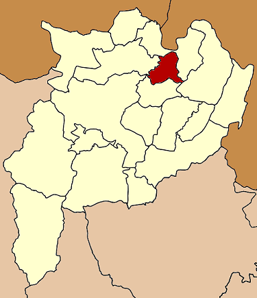
Doi Luang
ดอยหลวง— Amphoe — Amphoe location in Chiang Rai Province
Coordinates: 20°7′6″N 100°6′0″E / 20.11833°N 100.1°ECoordinates: 20°7′6″N 100°6′0″E / 20.11833°N 100.1°E Country  Thailand
Province Chiang Rai Seat Pong Noi Tambon Muban Amphoe established Area - Total 223.0 km2 (86.1 sq mi) Population (2005) - Total 19,356 - Density 86.8/km2 (224.8/sq mi) Time zone THA (UTC+7) Postal code 57110 Geocode 5718 Doi Luang (Thai: ดอยหลวง; IPA: [dɔ̄ːj lǔaŋ]) is a district (amphoe) in the northern part of Chiang Rai Province, northern Thailand.
Contents
History
The area of Doi Luang was separated from Mae Chan district and established as a minor district (King Amphoe) on July 15, 1996.[1]
Following a decision of the Thai government on May 15 2007, all of the 81 minor districts were to be upgraded to full districts.[2] With the publishing in the Royal Gazette on August 24 the upgrade became official.[3]
Geography
Neighboring districts are (from the north clockwise) Chiang Saen, Chiang Khong, Wiang Chiang Rung and Mae Chan.
Administration
The district is subdivided into 3 subdistricts (tambon), which are further subdivided into 31 villages (muban). There are no municipal (thesaban) areas, and 3 Tambon administrative organizations (TAO).
No. Name Thai name Villages Inh. 1. Pong Noi ปงน้อย 10 5,928 2. Chok Chai โชคชัย 11 8,793 3. Nong Pa Ko หนองป่าก่อ 10 4,635 References
- ^ "ประกาศกระทรวงมหาดไทย เรื่อง แบ่งเขตท้องที่อำเภอแม่จัน จังหวัดเชียงราย ตั้งเป็นกิ่งอำเภอดอยหลวง" (in Thai). Royal Gazette 113 (Special 18 ง): 26. June 26 1996. http://www.ratchakitcha.soc.go.th/DATA/PDF/2539/E/018/26.PDF.
- ^ "แถลงผลการประชุม ครม. ประจำวันที่ 15 พ.ค. 2550" (in Thai). Manager Online. http://www.manager.co.th/Politics/ViewNews.aspx?NewsID=9500000055625.
- ^ "พระราชกฤษฎีกาตั้งอำเภอฆ้องชัย...และอำเภอเหล่าเสือโก้ก พ.ศ. ๒๕๕๐" (in Thai). Royal Gazette 124 (46 ก): 14–21. August 24 2007. http://www.ratchakitcha.soc.go.th/DATA/PDF/2550/A/046/14.PDF.
External links
Mueang Chiang Rai · Wiang Chai · Chiang Khong · Thoeng · Phan · Pa Daet · Mae Chan · Chiang Saen · Mae Sai · Mae Suai · Wiang Pa Pao · Phaya Mengrai · Wiang Kaen · Khun Tan · Mae Fa Luang · Mae Lao · Wiang Chiang Rung · Doi LuangCategories:- Amphoe of Chiang Rai
- Chiang Rai Province geography stubs
Wikimedia Foundation. 2010.