- Mae Fa Luang District
-
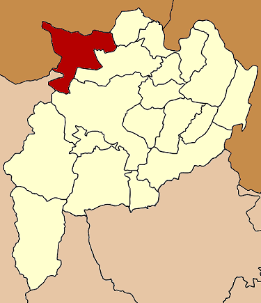
Mae Fa Luang
แม่ฟ้าหลวง— Amphoe — Amphoe location in Chiang Rai Province
Coordinates: 20°16′2″N 99°48′5″E / 20.26722°N 99.80139°ECoordinates: 20°16′2″N 99°48′5″E / 20.26722°N 99.80139°E Country  Thailand
Province Chiang Rai Seat Mae Fa Luang Tambon Muban Amphoe established Area - Total 641.404 km2 (247.6 sq mi) Population (2005) - Total 76,613 - Density 119.4/km2 (309.2/sq mi) Time zone THA (UTC+7) Postal code 57110 Geocode 5715 Mae Fa Luang (Thai: แม่ฟ้าหลวง; IPA: [mɛ̂ː fáː lǔaŋ]) is a district (amphoe) in the northern part of Chiang Rai Province, northern Thailand.
Contents
History
The area of Mae Fa Luang was separated from Mae Chan district and created as a minor district (King Amphoe) on April 1, 1992.[1] Originally it comprised the three tambon Thoet Thai, Mae Salong Nai and Mae Salong Nok. The fourth subdistrict Mae Fa Luang was created in 1996. The minor district was official upgraded to a full district on December 5, 1996.[2]
Etymology
The name Mae Fa Luang was given by Princess Mother Srinagarindra, who was commonly known as "Mae Fa Luang" (lit. Royal Mother from the sky) by the hill tribe people of the area.
Geography
Neighboring districts are (from the east clockwise) Mae Sai, Mae Chan, Mueang Chiang Rai of Chiang Rai Province and Mae Ai of Chiang Mai Province. To the northwest is Shan State of Myanmar.
Administration
The district is subdivided into 4 subdistricts (tambon), which are further subdivided into 87 villages (muban). There are no municipal (thesaban) areas, and 4 Tambon administrative organizations (TAO).
No. Name Thai name Villages Inh. 1. Thoet Thai เทอดไทย 24 22,526 2. Mae Salong Nai แม่สลองใน 29 25,428 3. Mae Salong Nok แม่สลองนอก 13 15,028 4. Mae Fa Luang แม่ฟ้าหลวง 21 13,631 References
- ^ "ประกาศกระทรวงมหาดไทย เรื่อง แบ่งเขตท้องที่อำเภอแม่จัน จังหวัดเชียงราย ตั้งเป็นกิ่งอำเภอแม่ฟ้าหลวง" (in Thai). Royal Gazette 109 (53 ง special): 5. April 22 1992. http://www.ratchakitcha.soc.go.th/DATA/PDF/2535/D/053/5.PDF.
- ^ "พระราชกฤษฎีกาตั้งอำเภอเหนือคลอง อำเภอนายายอาม อำเภอท่าตะเกียบ อำเภอขุนตาล อำเภอแม่ฟ้าหลวง อำเภอแม่ลาว อำเภอรัษฎา อำเภอพุทธมณฑล อำเภอวังน้ำเขียว อำเภอเจาะไอร้อง อำเภอชำนิ อำเภอโนนดินแดง อำเภอปางมะผ้า อำเภอสนธิ อำเภอหนองม่วง อำเภอเบญจลักษ์ อำเภอโพนนาแก้ว อำเภอบุ่งคล้า อำเภอดอนมดแดง และอำเภอลืออำนาจ พ.ศ. ๒๕๓๙" (in Thai). Royal Gazette 113 (62 ก): 5–8. November 20 1996. http://www.ratchakitcha.soc.go.th/DATA/PDF/2539/A/062/5.PDF.
External links
Mueang Chiang Rai · Wiang Chai · Chiang Khong · Thoeng · Phan · Pa Daet · Mae Chan · Chiang Saen · Mae Sai · Mae Suai · Wiang Pa Pao · Phaya Mengrai · Wiang Kaen · Khun Tan · Mae Fa Luang · Mae Lao · Wiang Chiang Rung · Doi LuangCategories:- Amphoe of Chiang Rai
- Chiang Rai Province geography stubs
Wikimedia Foundation. 2010.