- Mae La Noi District
-
Mae La Noi
แม่ลาน้อย— Amphoe — Amphoe location in Mae Hong Son Province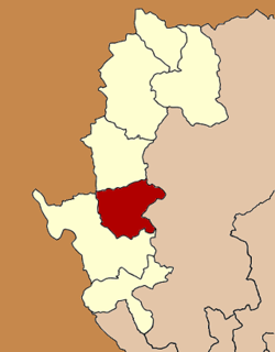
Coordinates: 18°23′4″N 97°56′13″E / 18.38444°N 97.93694°ECoordinates: 18°23′4″N 97°56′13″E / 18.38444°N 97.93694°E Country  Thailand
Province Mae Hong Son Seat Mae La Noi Tambon Muban Amphoe established Area - Total 1,456.6 km2 (562.4 sq mi) Population (2005) - Total 34,126 - Density 23.4/km2 (60.6/sq mi) Time zone THA (UTC+7) Postal code 58120 Geocode 5805 Mae La Noi (Thai: แม่ลาน้อย) is a district (Amphoe) in the southern part of Mae Hong Son Province, northern Thailand.
Contents
History
The minor district (King Amphoe) was created on February 10 1967, consisting of the two tambon Mae La Noi and Mae La Luang.[1] It was made a subordinate of Mae Sariang district, from which the tambon Mae La Noi was split off. Mae La Luang originally belonged to Khun Yuam district.[2] It was official upgraded to a full district on August 21, 1975.[3]
Geography
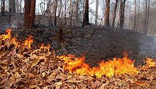 Forest fire during the dry season
Neighboring are (from southwest clockwise) Mae Sariang of Mae Hong Son Province, Kayah State of Myanmar, Khun Yuam of Mae Hong Son Province again and Mae Chaem of Chiang Mai Province.
The important rivers of Mae La Noi are the Yuam, Mae La Luang and Mae La Noi river.
Administration
The district is subdivided into 8 subdistricts (tambon), which are further subdivided into 69 villages (muban). Mae La Noi is also a township (thesaban tambon) which covers parts of the tambon Mae La Noi. There are 8 Tambon administrative organizations (TAO).
No. Name Thai name Villages Inh. 1. Mae La Noi แม่ลาน้อย 15 8,674 2. Mae La Luang แม่ลาหลวง 9 5,140 3. Tha Pha Pum ท่าผาปุ้ม 8 4,052 4. Mae Tho แม่โถ 8 3,456 5. Huai Hom ห้วยห้อม 9 4,346 6. Mae Na Chang แม่นาจาง 7 3,094 7. Santi Khiri สันติคีรี 8 2,669 8. Khun Mae La Noi ขุนแม่ลาน้อย 5 2,695 References
- ^ "ประกาศกระทรวงมหาดไทย เรื่อง แบ่งท้องที่ตั้งเป็นกิ่งอำเภอ" (in Thai). Royal Gazette 84 (16 ง special issue): 4. February 15 1967. http://www.ratchakitcha.soc.go.th/DATA/PDF/2510/D/016/4.PDF.
- ^ "พระราชกฤษฎีกาเปลี่ยนแปลงเขตอำเภอขุนยวมและกิ่งอำเภอแม่ลาน้อย อำเภอแม่สะเรียง จังหวัดแม่ฮ่องสอน พ.ศ. ๒๕๑๐" (in Thai). Royal Gazette 84 (114 ก special issue): 29–30. February 23 1967. http://www.ratchakitcha.soc.go.th/DATA/PDF/2510/A/114/29.PDF.
- ^ "พระราชกฤษฎีกาตั้งอำเภอแวงน้อย อำเภอป่าแดด อำเภอเรณูนคร อำเภอคูเมือง อำเภอคุระบุรี อำเภอแม่ลาน้อย อำเภอเสริมงาม อำเภอไพรบึง และอำเภอหนองโดน พ.ศ. ๒๕๑๘" (in Thai). Royal Gazette 92 (166 ก special issue): 1–4. August 21 1975. http://www.ratchakitcha.soc.go.th/DATA/PDF/2518/A/166/1.PDF.
External links
Mueang Mae Hong Son · Khun Yuam · Pai · Mae Sariang · Mae La Noi · Sop Moei · Pang Mapha
Categories:- Amphoe of Mae Hong Son
- Northern Thailand geography stubs


Wikimedia Foundation. 2010.