- Mae Chaem District
-
Mae Chaem
แม่แจ่ม— Amphoe — Amphoe location in Chiang Mai Province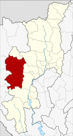
Coordinates: 18°29′56″N 98°21′43″E / 18.49889°N 98.36194°ECoordinates: 18°29′56″N 98°21′43″E / 18.49889°N 98.36194°E Country  Thailand
Province Chiang Mai Seat Chang Khoeng Amphoe established 1908 Area - Total 2,713.57 km2 (1,047.7 sq mi) Population (2008) - Total 57,214 - Density 21.1/km2 (54.6/sq mi) Time zone THA (UTC+7) Postal code 50270 Geocode 5003 Mae Chaem (Thai: แม่แจ่ม) is a district (amphoe) of Chiang Mai Province in northern Thailand.
Contents
History
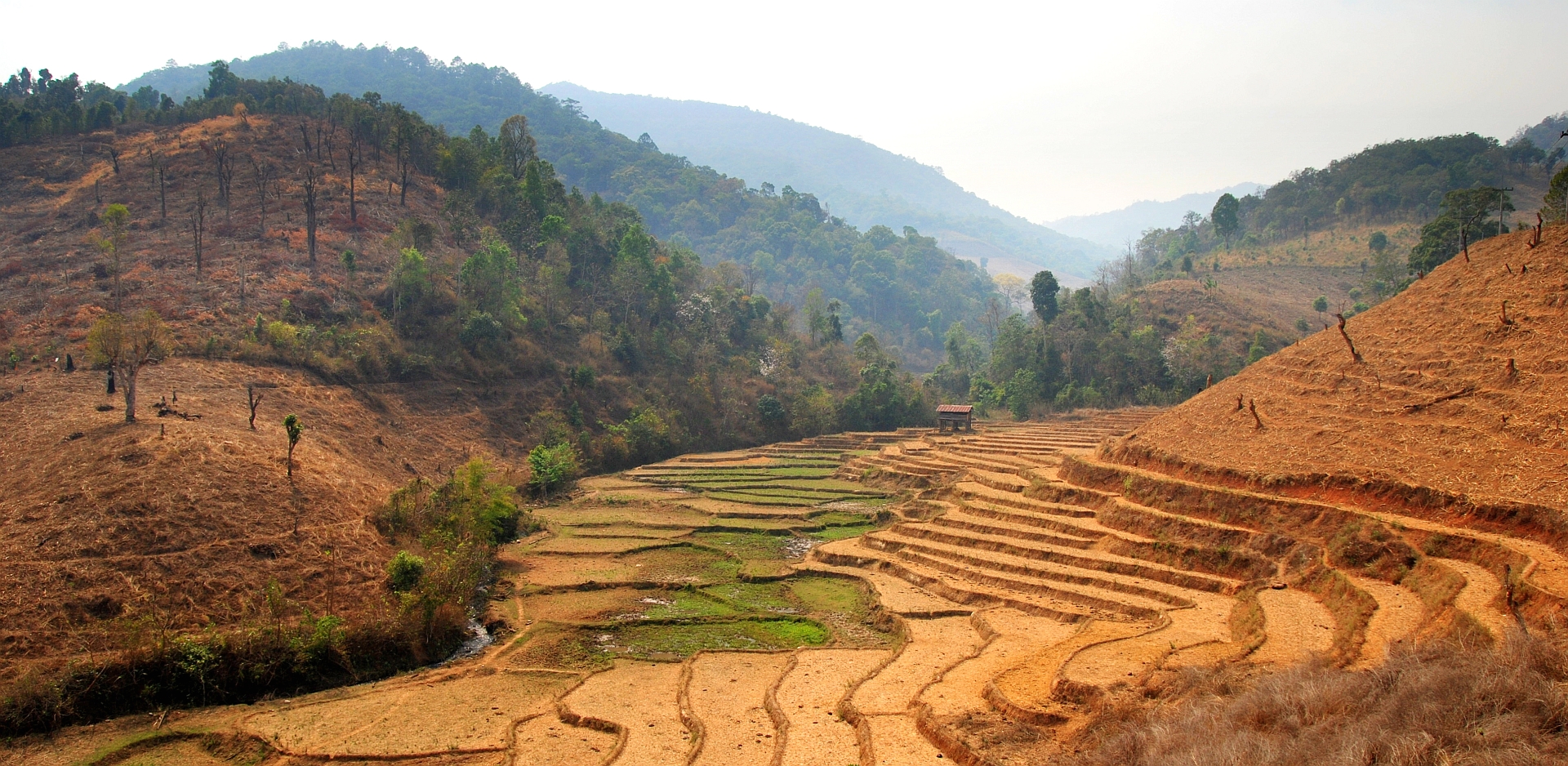
 Rice paddies and recently cleared forest land along road 1263 in Mae Chaem district during the 2010 dry season
The district Mueang Chaem was created in 1908,[1] consisting of the tambon Mae Thap,Tha Pha, Chang Khoeng and Mae Suek split off from Chom Thong. In 1917 it was renamed to Chang Khoeng, as the district office was located in that tambon.[2] In 1938 it was reduced to a minor district (King Amphoe) and was a subordinate of Chom Thong district.[3] 1939 it was renamed to Mae Chaem.[4] In 1956 it was upgraded to a full district.[5]
In 2009 the northern part of the district was split off to form the new district Galyani Vadhana.[6]
Geography
Neighboring districts are (from the north clockwise) Galyani Vadhana, Samoeng, Mae Wang, Chom Thong and Hot of Chiang Mai Province, and Mae Sariang, Mae La Noi, Khun Yuam, Mueang Mae Hong Son and Pai of Mae Hong Son Province.
Thailand's highest mountain, 2.565 meter (8,415 ft) high Doi Inthanon, is located in Mae Chaem district.
Administration
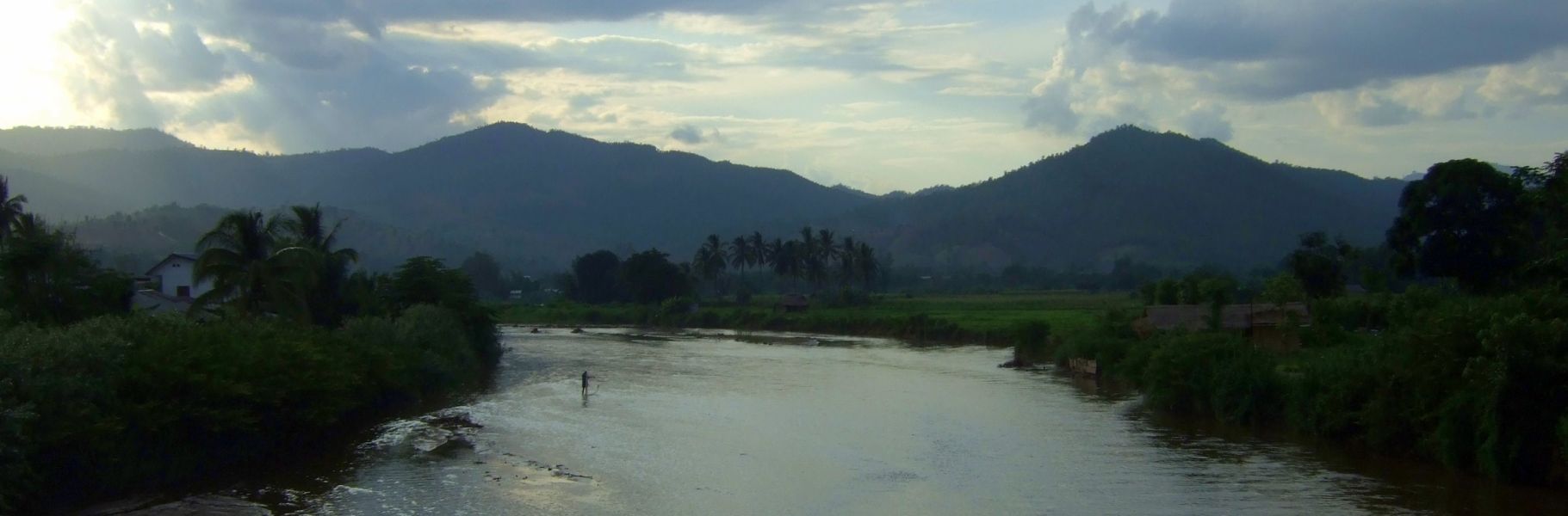
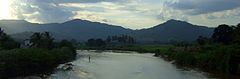 The river going through the town of Mae Chaem
The district is subdivided into 7 subdistricts (tambon), which are further subdivided into 85 villages (muban). Mae Chaem also has subdistrict municipality (thesaban tambon) status and covers parts of tambon Chang Khoeng. There are further 7 Tambon administrative organizations (TAO).
No. Name Thai Villages Inh.[7] 1. Chang Khoeng ช่างเคิ่ง 19 11,206 2. Tha Pha ท่าผา 14 4,952 3. Ban Thap บ้านทับ 13 6,234 4. Mae Suek แม่ศึก 17 11,577 5. Mae Na Chon แม่นาจร 19 10,184 7. Pang Hin Fon ปางหินฝน 14 6,856 8. Kong Khaek กองแขก 12 6,205 Missing numbers belong to the subdistricts which formed Galyani Vadhana district in 2009.
References
- ^ "แจ้งความกระทรวงมหาดไทย" (in Thai). Royal Gazette 25 (15): 447–448. July 4 1908. http://www.ratchakitcha.soc.go.th/DATA/PDF/2451/015/447_1.PDF.
- ^ "ประกาศกระทรวงมหาดไทย เรื่อง เปลี่ยนชื่ออำเภอ" (in Thai). Royal Gazette 34 (0 ก): 40–68. April 29 1917. http://www.ratchakitcha.soc.go.th/DATA/PDF/2460/A/40.PDF.
- ^ "ประกาศสำนักนายกรัฐมนตรี เรื่อง ยุบอำเภอลงเป็นกิ่งอำเภอ" (in Thai). Royal Gazette 55 (0 ง): 2067. September 12 1938. http://www.ratchakitcha.soc.go.th/DATA/PDF/2481/D/2067.PDF.
- ^ "พระราชกฤษฎีกาเปลี่ยนนามอำเภอ กิ่งอำเภอ และตำบลบางแห่ง พุทธศักราช ๒๔๘๒" (in Thai). Royal Gazette 56 (0 ก): 354–364. April 17 1939. http://www.ratchakitcha.soc.go.th/DATA/PDF/2482/A/354.PDF.
- ^ "พระราชกฤษฎีกาจัดตั้งอำเภอนาทวี อำเภอสะบ้าย้อย อำเภอคำชะอี อำเภอย่านตาขาว อำเภอวัดโบสถ์ อำเภอหนองบัว อำเภอวัฒนานคร อำเภอแสวงหา อำเภอท่าชนะ อำเภอพระพุทธบาท อำเภอโนนสัง อำเภอบำเหน็จณรงค์ อำเภอคอนสวรรค์ อำเภอบ้านโฮ่ง อำเภอคีรีมาศ อำเภอชนแดน อำเภอแม่แจ่ม อำเภอไทรน้อย และอำเภอบ้านแพง พ.ศ. ๒๔๙๙" (in Thai). Royal Gazette 73 (46 ก): 657–661. June 5 1956. http://www.ratchakitcha.soc.go.th/DATA/PDF/2499/A/046/657.PDF.
- ^ "พระราชกฤษฎีกาตั้งอำเภอกัลยาณิวัฒนา จังหวัดเชียงใหม่ พ.ศ. ๒๕๕๒" (in Thai). Royal Gazette 126 (97 ก): 7–9. 2009-12-25. http://www.ratchakitcha.soc.go.th/DATA/PDF/2552/A/097/7.PDF.
- ^ "Population statistics 2008". Department of Provincial Administration. http://www.dopa.go.th/xstat/p5150_01.html.
External links
Mueang Chiang Mai · Chom Thong · Mae Chaem · Chiang Dao · Doi Saket · Mae Taeng · Mae Rim · Samoeng · Fang · Mae Ai · Phrao · San Pa Tong · San Kamphaeng · San Sai · Hang Dong · Hot · Doi Tao · Omkoi · Saraphi · Wiang Haeng · Chai Prakan · Mae Wang · Mae On · Doi Lo · Galyani Vadhana
Categories:- Amphoe of Chiang Mai
- Chiang Mai geography stubs

Wikimedia Foundation. 2010.