- Mae Taeng District
-
Mae Taeng
แม่แตง— Amphoe — Amphoe location in Chiang Mai Province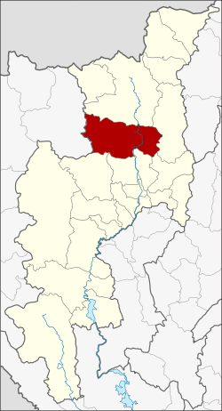
Coordinates: 19°7′19″N 98°56′37″E / 19.12194°N 98.94361°ECoordinates: 19°7′19″N 98°56′37″E / 19.12194°N 98.94361°E Country  Thailand
Province Chiang Mai Seat San Maha Phon Tambon Muban Amphoe established Area - Total 1,362.784 km2 (526.2 sq mi) Population (2005) - Total 82,094 - Density 60.2/km2 (155.9/sq mi) Time zone THA (UTC+7) Postal code 50150 Geocode 5006 Mae Taeng (Thai: แม่แตง) is a district (amphoe) in the northern part of Chiang Mai Province in northern Thailand.
Contents
Geography
Neighboring districts are (from the north clockwise) Chiang Dao, Phrao, Doi Saket, San Sai, Mae Rim, Samoeng of Chiang Mai Province and Pai of Mae Hong Son Province.
History
In 1892, Khwaeng Mueang Kuet (เมืองกื้ด) was created, and renamed in 1894 to Khwaeng Mueang Kaen (เมืองแกน). In 1907 it was upgraded to a district (amphoe) named San Maha Phon (สันมหาพน), and renamed Mae Tang in 1939.[1]
Administration
The district is subdivided into 13 subdistricts (tambon), which are further subdivided into 128 villages (muban). There are two townships (thesaban tambon) - San Maha Phon covers parts of tambon San Maha Phon and Khilek; Mueang Kaen Phatthana covers the whole tambon Cho Lae and parts of Intha Khin. There are further 11 Tambon administrative organizations (TAO).
No. Name Thai name Villages Inh. 1. San Maha Phon สันมหาพน 10 6,660 2. Mae Taeng แม่แตง 8 4,548 3. Khilek ขี้เหล็ก 10 9,609 4. Cho Lae ช่อแล 16 4,787 5. Mae Ho Phra แม่หอพระ 9 5,643 6. Sop Poeng สบเปิง 13 7,977 7. Ban Pao บ้านเป้า 7 4,029 8. San Pa Yang สันป่ายาง 5 4,637 9. Pa Pae ป่าแป๋ 14 6,847 10. Mueang Kai เมืองก๋าย 5 1,938 11. Ban Chang บ้านช้าง 5 5,488 12. Kuet Chang กื้ดช้าง 8 5,834 13. Inthakhin อินทขิล 18 14,097 See also
References
- ^ "พระราชกฤษฎีกาเปลี่ยนนามอำเภอ กิ่งอำเภอ และตำบลบางแห่ง พุทธศักราช ๒๔๘๒". Royal Gazette 56 (0 ก): 354–364. April 17, 1939. http://www.ratchakitcha.soc.go.th/DATA/PDF/2482/A/354.PDF.
External links
Mueang Chiang Mai · Chom Thong · Mae Chaem · Chiang Dao · Doi Saket · Mae Taeng · Mae Rim · Samoeng · Fang · Mae Ai · Phrao · San Pa Tong · San Kamphaeng · San Sai · Hang Dong · Hot · Doi Tao · Omkoi · Saraphi · Wiang Haeng · Chai Prakan · Mae Wang · Mae On · Doi Lo · Galyani Vadhana
Categories:- Amphoe of Chiang Mai
- Chiang Mai geography stubs

Wikimedia Foundation. 2010.