- Chai Prakan District
-
Chai Prakan
ไชยปราการ— Amphoe — Amphoe location in Chiang Mai Province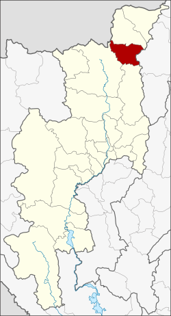
Coordinates: 19°43′56″N 99°8′25″E / 19.73222°N 99.14028°ECoordinates: 19°43′56″N 99°8′25″E / 19.73222°N 99.14028°E Country  Thailand
Province Chiang Mai Seat Pong Tam Tambon Muban Amphoe established Area – Total 510.9 km2 (197.3 sq mi) Population (2005) – Total 47,898 – Density 93.8/km2 (242.9/sq mi) Time zone THA (UTC+7) Postal code 50320 Geocode 5021 Chai Prakan (Thai: ไชยปราการ) is a district (amphoe) in the northern part of Chiang Mai Province in northern Thailand.
Contents
Geography
Neighboring districts are (from the south clockwise) Phrao, Chiang Dao, Fang of Chiang Mai Province and Mae Suai of Chiang Rai Province.
History
The minor district (King Amphoe) Chai Prakan was created on January 1, 1988, when four tambon were split off from Fang district.[1] It was upgraded to a full district on July 4, 1994.[2]
Administration
The district is subdivided into 4 subdistricts (tambon), which are further subdivided into 43 villages (muban). Chai Prakan itself is a township (thesaban tambon) which covers parts of the tambon Pong Tam, Si Dong Yen and Nong Bua. There are further 3 Tambon administrative organizations (TAO).
No. Name Thai name Villages Inh. 1. Pong Tam ปงตำ 8 8,267 2. Si Dong Yen ศรีดงเย็น 18 15,842 3. Mae Thalop แม่ทะลบ 6 7,415 4. Nong Bua หนองบัว 11 16,374 References
- ^ "ประกาศกระทรวงมหาดไทย เรื่อง แบ่งเขตท้องที่อำเภอฝาง จังหวัดเชียงใหม่ ตั้งเป็นกิ่งอำเภอไชยปราการ" (in Thai). Royal Gazette 105 (5 ง): 107. January 7, 1988. http://www.ratchakitcha.soc.go.th/DATA/PDF/2531/D/005/107.PDF.
- ^ "พระราชกฤษฎีกาตั้งอำเภอเปือยน้อย ... และอำเภอศรีวิไล พ.ศ. ๒๕๓๗" (in Thai). Royal Gazette 111 (21 ก): 32–35. June 3, 1994. http://www.ratchakitcha.soc.go.th/DATA/PDF/2537/A/021/32.PDF.
External links
Mueang Chiang Mai · Chom Thong · Mae Chaem · Chiang Dao · Doi Saket · Mae Taeng · Mae Rim · Samoeng · Fang · Mae Ai · Phrao · San Pa Tong · San Kamphaeng · San Sai · Hang Dong · Hot · Doi Tao · Omkoi · Saraphi · Wiang Haeng · Chai Prakan · Mae Wang · Mae On · Doi Lo · Galyani Vadhana
Categories:- Amphoe of Chiang Mai
- Chiang Mai geography stubs

Wikimedia Foundation. 2010.