- Mae Sariang District
-
Mae Sariang
แม่สะเรียง— Amphoe — Amphoe location in Mae Hong Son Province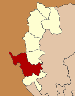
Coordinates: 18°9′34″N 97°56′1″E / 18.15944°N 97.93361°ECoordinates: 18°9′34″N 97°56′1″E / 18.15944°N 97.93361°E Country  Thailand
Province Mae Hong Son Seat Mae Sariang Tambon 7 Muban 77 Area - Total 2,587.4 km2 (999 sq mi) Population (2010) - Total 50,937 - Density 20.1/km2 (52.1/sq mi) Time zone THA (UTC+7) Postal code 58110 Geocode 5804 Mae Sariang is a small town and district (Amphoe) alongside the Yuam River in Mae Hong Son Province, northern Thailand, along the Myanmar border. The areas around Mae Sariang are mountainous and forested. The area has many links to Burma, such as its architecture and a large population of Burmese Muslims.
Contents
Geography
Neighboring are (from north clockwise) Mae La Noi of Mae Hong Son Province, Mae Chaem, Hot of Chiang Mai Province, Sop Moei of Mae Hong Son Province again Kayin State and Kayah State of Myanmar.
The Salawin National Park is located in the district.
The important river of Mae Sariang is the Yuam River.
History
1900 the administration in the area was formalized as a district under Mae Hong Song. Originally the district was named Mueang Yuam (เมืองยวม), which was changed in 1917 to Mae Sariang.[1]
Administration
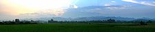 Panorama of the mountains south west of the town of Mae Sariang
The district is subdivided into 7 subdistricts (tambon), which are further subdivided into 77 villages (muban). Mae Sariang is also a subdistrict municipality (thesaban tambon) which covers parts of the tambon Ban Kat and Mae Sariang. There are further 7 Tambon administrative organizations (TAO).
No. Name Thai Villages Inh.[2] 1. Ban Kat บ้านกาศ 13 11,283 2. Mae Sariang แม่สะเรียง 9 9,968 3. Mae Khong แม่คง 11 4,154 4. Mae Ho แม่เหาะ 13 7,813 5. Mae Yuam แม่ยวม 13 9,273 6. Sao Hin เสาหิน 6 2,691 8. Pa Pae ป่าแป๋ 12 5,755 Number 7 is not used.
References
- ^ "ประกาศกระทรวงมหาดไทย เรื่อง เปลี่ยนชื่ออำเภอ" (in Thai). Royal Gazette 34 (0 ก): 40–68. 1917-04-29. http://www.ratchakitcha.soc.go.th/DATA/PDF/2460/A/40.PDF.
- ^ "Population statistics 2010". Department of Provincial Administration. http://203.113.86.149/xstat/p5358_01.html.
External links
- amphoe.com (Thai)
- http://www.maesariang.go.th/ Website of Mae Sariang municipality
- Salawin National Park
Mueang Mae Hong Son · Khun Yuam · Pai · Mae Sariang · Mae La Noi · Sop Moei · Pang Mapha
Categories:- Amphoe of Mae Hong Son
- Northern Thailand geography stubs

Wikimedia Foundation. 2010.