- Mae Sot District
-
Mae Sot or Mae Sod
แม่สอด— Amphoe — Amphoe location in Tak Province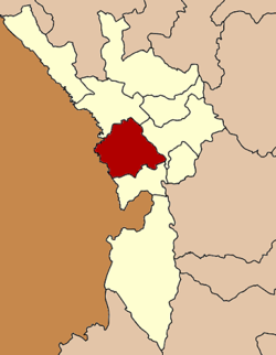
Coordinates: 16°42′47″N 98°34′29″E / 16.71306°N 98.57472°ECoordinates: 16°42′47″N 98°34′29″E / 16.71306°N 98.57472°E Country  Thailand
Province Tak Seat Tambon Muban Amphoe established Area - Total 1,986.1 km2 (766.8 sq mi) Population (2008) - Total 120,569 - Density 60.71/km2 (157.2/sq mi) Time zone THA (UTC+7) Postal code 63110 Geocode 6306 

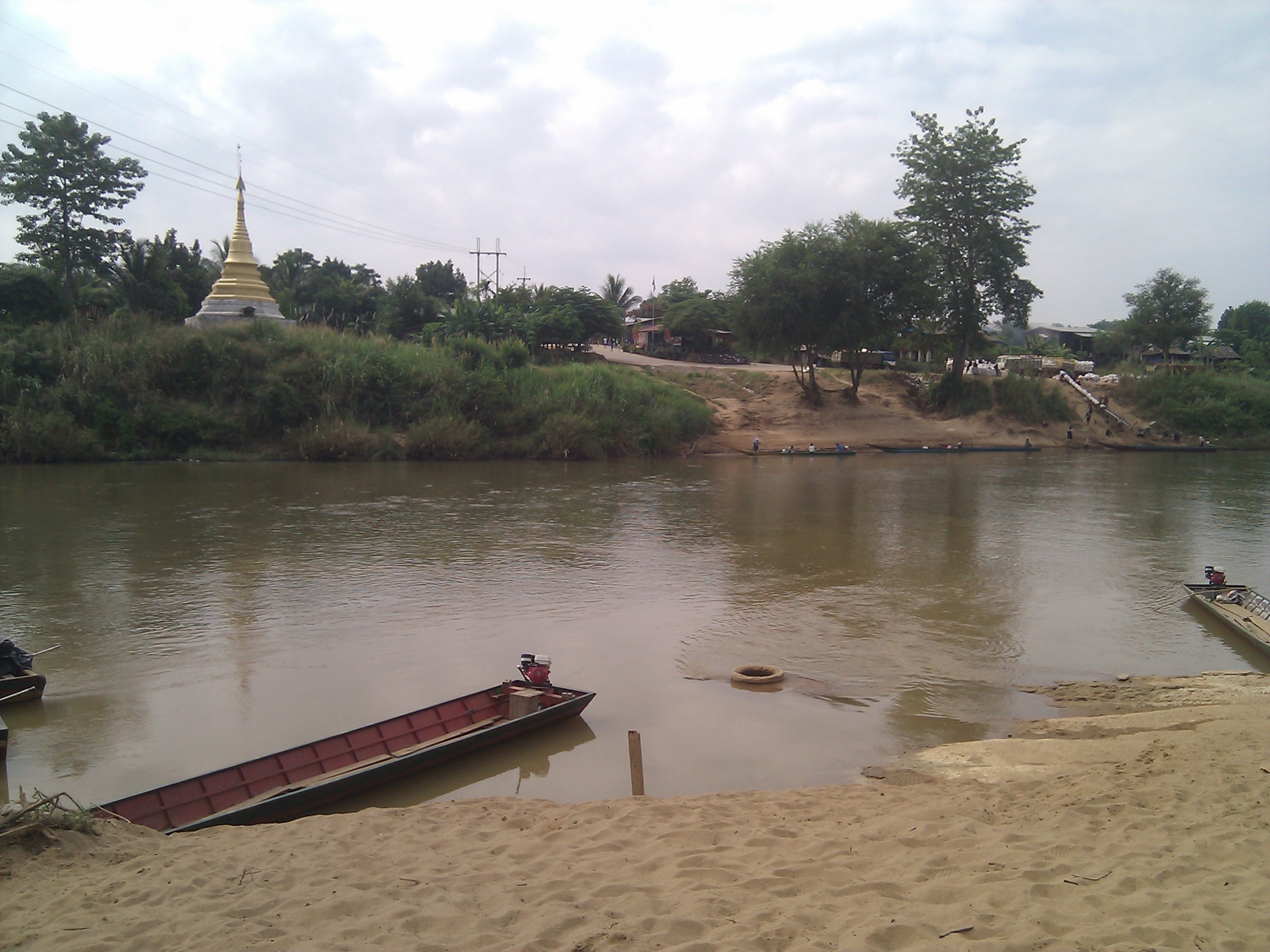
Mae Sot (Thai: แม่สอด, pronounced [mɛ̂ː sɔ̀ːt]; Burmese: မဲဆောက်, [mɛ́ sʰauʔ]; Shan: ႄႈသၢႆ, [ɛ sʰaaj]) is a town in western Thailand that shares a border with Burma to the west. It is notable as a trade hub and for its substantial population of Burmese migrants and refugees. The town is part of the larger Tak Province and is the main land gateway between Thailand and Burma. As a result it has also gained notoriety for its trade in gems and teak, as well as black market services such as people trafficking and drugs. Neighboring districts are (North from clockwise): Mae Ramat, Mueang Tak and Phop Phra. The Moei River serves as a natural border between Mae Sot and the Burmese town of Myawaddy.
Contents
Gateway to Burma
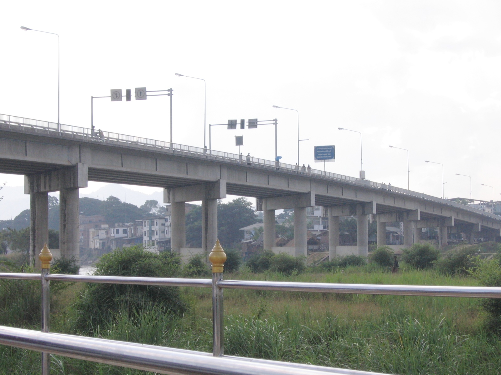
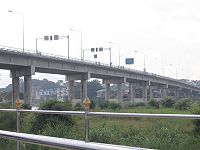 Thai-Burmese Friendship Bridge
Mae Sot is the location where Asian Highway AH1 links between Thailand and Burma. It is one of the only two transnational roads and cross-border points across the Tenasserim Hills to Burma, along with Three Pagodas Pass. The Thai-Myanmar Friendship Bridge crossing the Moei River was constructed in 1997 completing the link between the two countries.[1] At the entrance of the bridge is the immigration office which is open from 6 a.m. to 6 p.m. The bridge and the fontier have been closed by Burmese government in July 2010.
As a gateway city, Mae Sot has its own domestic airport. But due to high fuel costs, some airlines such as Phuket Air have cancelled their flights between Bangkok and Mae Sot. The bridge over the river has been closed for almost one year (as 22nd July 2011) and there are no signs of it re opening soon.
Every year, Tak Chamber of Commerce organizes a friendship bicycle rally to Myawaddy.
Economy
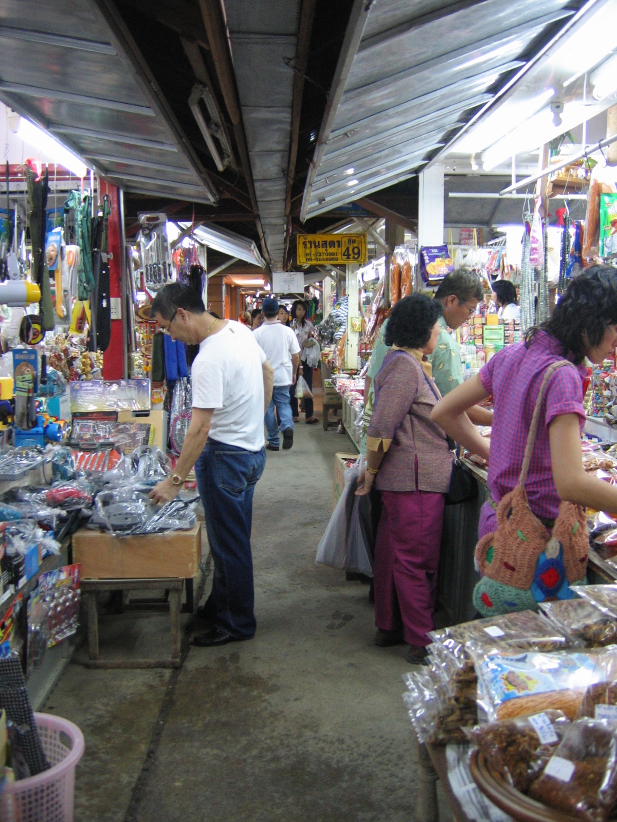
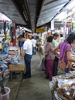 Rim Moei Market
Trade with Burma constitutes the largest portion of Mae Sot's economy. It has an established market for commodities such as wholesale gems and teak. Most of the towns service industries are supported by Burmese migrants who fill positions within sweat-shops and factories throughout the region. The town also suffers from a black market in illegal smuggling, people trafficking and narcotics. The Thai-Myanmar friendship bridge, is the primary gateway for trade with Burma. The border region, located several kilometres from central Mae Sot includes the Rim Moei Market that deals in imported goods and woodwork.
Mae Sot also serves as a minor tourist destination, primarily used for those wishing to visit Myawaddy in Burma or as a stopover on the way to Amphoe Umphang, popular for trekking.
Burmese refugees
The town has a substantial population of Burmese refugees and economic migrants. The exact number of Burmese in Mae Sot is unclear but estimates say that over 100,000 exist in addition to the 106,000 already recorded in the official census. In recent years the ongoing refugee situation has attracted NGO's and International aid agencies to set programs in the town and surrounding areas.
One of the most notable organizations is Mae Tao Clinic located just outside the west of the town. It was established by the Burmese/Karen Dr. Cynthia Maung to offer free medical services to Burmese who do not qualify for treatment at the local Mae Sot Hospital. The center is funded independently and is supported by teams of volunteers on an ongoing basis.[2]
The Mae Sot region has around 70 migrant schools that have started spontaneously to meet the needs of the 30,000 children who have crossed the border with their parents from Burma. The students are a mix of refugees and economic migrants. Of this number only 7000 currently are attending these schools. The schools range in size from 20 to over 650 students (Hsa Thoo Lei School). These schools receive no support from the Thai government and rely solely on resourcefulness and international support.
Administration
The district (Amphoe) Mae Sot is subdivided into 10 subdistricts (Tambon), which are further subdivided into 86 villages (muban). The city (thesaban nakhon) Mae Sot covers the whole tambon Mae Sot. Tha Sai Luat and Mae Ku are subdistrict municipalities (thesaban tambon), each covering parts of the same-named tambon. There are further 9 Tambon administrative organizations (TAO).
No. Name Thai name 1. Mae Sot แม่สอด 6. Tha Sai Luat ท่าสายลวด 2. Mae Ku แม่กุ 7. Mae Pa แม่ปะ 3. Phawo พะวอ 8. Mahawan มหาวัน 4. Mae Tao แม่ตาว 9. Dan Mae La Mao ด่านแม่ละเมา 5. Mae Kasa แม่กาษา 10. Phra That Pha Daeng พระธาตุผาแดง There are plans to create a new province centered in Mae Sot, covering the 5 border districts of Tak province. [3] [4] Additionally the town is planned to be converted into a metropolis, covering the tambon Mae Sot, Mae Pa and Tha Sai Luat. [5]
Climate
Climate data for {{{location}}} Month Jan Feb Mar Apr May Jun Jul Aug Sep Oct Nov Dec Year Average high °C (°F) 30.8
(87.4)33.5
(92.3)35.6
(96.1)36.6
(97.9)33.8
(92.8)30.6
(87.1)29.8
(85.6)29.7
(85.5)30.8
(87.4)31.6
(88.9)30.9
(87.6)30.0
(86.0)31.98
(89.56)Average low °C (°F) 14.4
(57.9)16.4
(61.5)19.6
(67.3)22.8
(73.0)23.9
(75.0)23.4
(74.1)23.1
(73.6)23.0
(73.4)23.0
(73.4)22.2
(72.0)19.1
(66.4)15.2
(59.4)20.51
(68.91)Precipitation mm (inches) 3.5
(0.138)5.3
(0.209)6
(0.24)35
(1.38)179
(7.05)257
(10.12)305
(12.01)354
(13.94)174
(6.85)108
(4.25)21
(0.83)3
(0.12)1,450.8
(57.118)[citation needed] References
- ^ "Asian Highway". Development of the Asian Highway. Asian Highway. http://www.unescap.org/jecf/p06highway.htm. Retrieved 2008-08-26.
- ^ "Mae Tao Clinic". Mae Tao Clinic. 2007. http://www.maetaoclinic.org/. Retrieved 2008-09-07.
- ^ "MaeSot in Thailand". MaeSot in Thailand. http://www.maesod.in.th/. Retrieved 2011-07-27.
- ^ "อปท.5 อ.ชายแดนตาก ดันตั้ง "จว.77-มหานคร" เสนอ "3 พล.อ.-สนช." หลังดันมา 5 ปีแต่ไม่คืบ" (in Thai). Manager Online. http://www.manager.co.th/Local/ViewNews.aspx?NewsID=9500000058846. Retrieved 2009-04-26.
- ^ "Mae Sot Metropolis Plan". The Irrawaddy. http://www.irrawaddy.org/article.php?art_id=7379. Retrieved 2009-04-26.
External links
- Mae Sot District travel guide from Wikitravel
- MaeSot in Thailand
- Hoping for freedom in Mae Sot: an audio documentary.
- Asian Highway
- Tak Chamber
Mueang Tak · Ban Tak · Sam Ngao · Mae Ramat · Tha Song Yang · Mae Sot · Phop Phra · Umphang · Wang ChaoCategories:- Amphoe of Tak
- Burma–Thailand border crossings

Wikimedia Foundation. 2010.