Three Pagodas Pass

Three Pagodas Pass
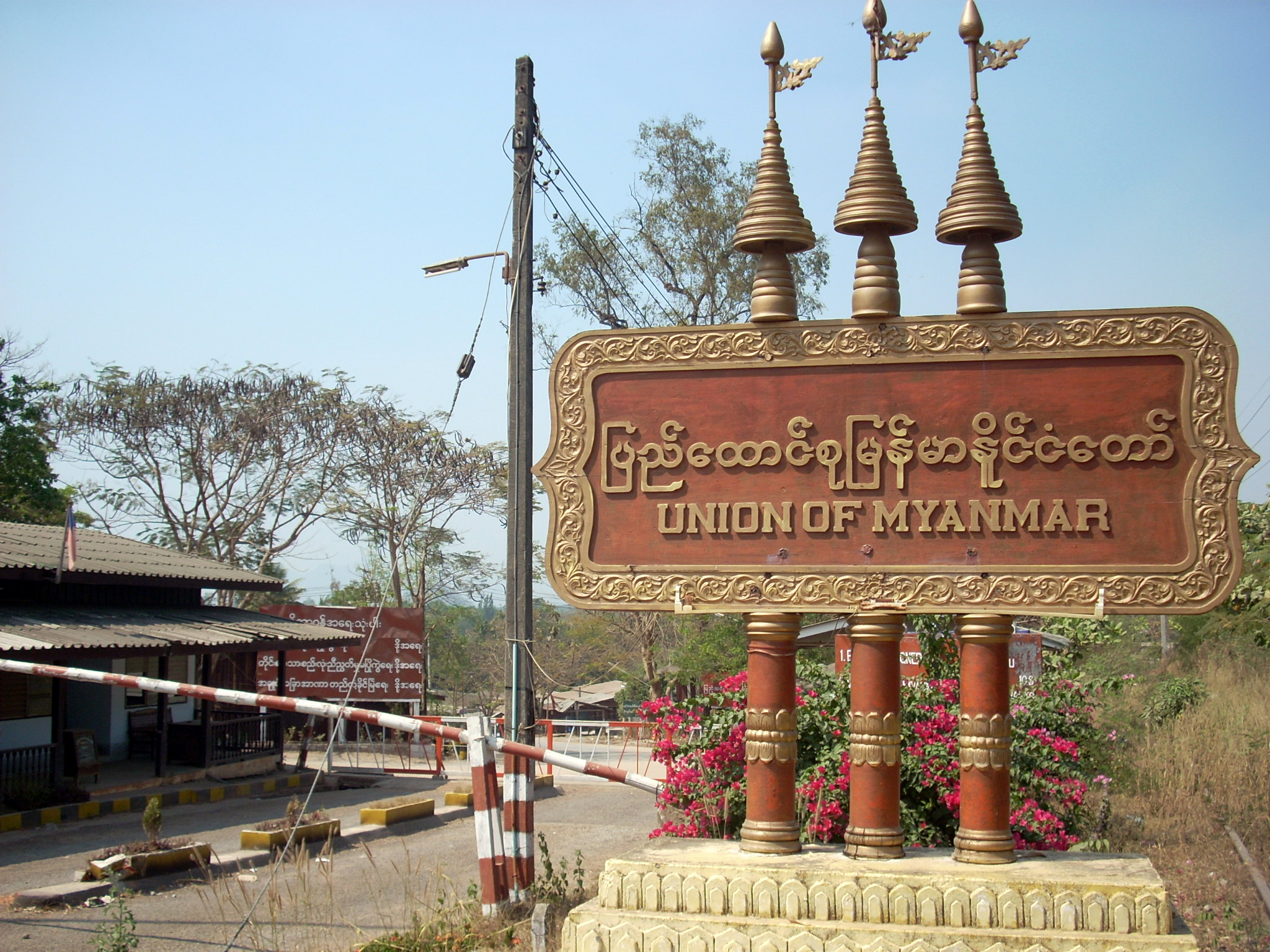
The Burmese-Thai border checkpoint at the Three Pagodas Pass.

The Three Pagodas Pass (Burmese: ဘုရားသုံးဆူ တောင်ကြားလမ်း, Burmese pronunciation: [pʰajá θóuɴ zù tàuɴ dʑá láɴ]; Thai: ด่านเจดีย์สามองค์, RTGS: Dan Chedi Sam Ong, Thai pronunciation: [dàːn tɕeːdiː sǎːm ʔoŋ]) is a pass in the Tenasserim Hills on the border between Thailand and Burma (Myanmar), at an altitude of 282 metres (925 ft) above sea level.

The pass links the town of Sangkhla Buri in the north of Kanchanaburi Province, Thailand, to the town of Payathonsu in the south of Kayin State, Myanmar.

The pass is popular with tourists, who are allowed to obtain a one-day visa from the Thai side to visit Payathonsu. Attractions on the Burmese side include wooden furniture, jade carvings, and textiles. Thai tourists are allowed in as of 2011, while other tourists are not.[citation needed]

History

This pass has been the main land route into western Thailand since ancient times, and is believed be the point at which Buddhist teachings reached the country from India in the 3rd century. During the Ayutthaya period in Thai history (14th-18th centuries), the pass was the main invasion route for the Burmese, but at times was also used against them by Siamese armies. The first of such was the Burmese invasion in 1548, which was part of the Burmese–Siamese War of 1548. The pass is named for three small, crumbling pagodas (chedis) which were probably built at the end of this period as a symbol of peace. They are now on the Thai side of the border. Parts of the border are still disputed.

During World War II, Japan built the infamous Death Railway (officially Taimen - Rensetsu Tetsudo) through the pass. There is a memorial to commemorate the thousands of Australian prisoners of war who (with other Allied prisoners and Asian civilians) died as forced labourers in the construction of the railway.

The region is home to several hill tribes, including Karens and Mons, who are unable or unwilling to obtain citizenship from either countries. Separatist armies have repeatedly tried to take seize of the pass from Burma, with the Mons in effective control until 1990, when Burmese troops regained it.

External links

Coordinates: 15°18′6″N 98°24′7″E / 15.30167°N 98.40194°E / 15.30167; 98.40194


Wikimedia Foundation. 2010.

Игры ⚽ Нужна курсовая?

Look at other dictionaries:

  • Three Pagodas Pass —    Known as Payathonzu in the Burmese (Myanmar) language, Three Pagodas Pass is a historically important trade and invasion route that links Burma s Karen (Kayin) State and Thailand s border town of Sangklaburi. Before 1988 the settlement at… …   Historical Dictionary of Burma (Myanmar)

  • Three Pagodas Pass — ▪ mountain pass, Myanmar Thailand Thai  Phra Chedi Sam Ong        mountain pass in the Tenasserim Mountain Range on the Myanmar (Burma) Thailand border, 100 miles (160 km) southeast of Moulmein, Myanmar. The pass, at an elevation of 925 feet (282 …   Universalium

  • Kanchanaburi Province — Infobox Thai Province name = Kanchanaburi thai = กาญจนบุรี capital = Kanchanaburi area = 19,483.2 arearank = 3rd population = 734,394 population as of = 2000 populationrank = 31st density = 38 densityrank = 74th isocode = TH 71 governor = Amnat… …   Wikipedia

  • Burmese general election, 2010 — Burmese (Myanma) general election, 2010 1990 ← 7 November 2010 → 2015 …   Wikipedia

  • Burma Railway — This article is about the railway constructed by Japan during World War II. For articles relating to the railways of the country Burma, see Rail transport in Burma. The Bridge over the Mae Klong River; the railway is along the northeastern side… …   Wikipedia

  • Bo Nat Khann Mway — In this Burmese name, Bo is an honorific. Bo Nat Khann Mway;[1] Na Kham Mwe ;[2][3][4][5] Na Kam Mui ; …   Wikipedia

  • Introduction —    When Burma (Myanmar) achieved independence from British colonial rule in 1948, many observers viewed it with its high standards of education and abundant natural resources as one of the Asian countries most likely to achieve economic… …   Historical Dictionary of Burma (Myanmar)

  • Khwae Noi River — ▪ river, Thailand also called  Kwai River , Thai  Mae Nam Khwae Noi   tributary of the Mae Klong River, flowing wholly in western Thailand. It rises near Three Pagodas Pass (Phra Chedi Sam Ong) on the mountainous Myanmar Thailand border and runs… …   Universalium

  • Thailand, Relations with —    Sharing both a common IndoBuddhist civilization and many centuries of antagonism, the governments of Burma and Thailand followed fundamentally different courses after World War II. Under both U Nu and Ne Win, Burmese policies emphasized… …   Historical Dictionary of Burma (Myanmar)

  • List of Burma-related articles — Articles (arranged alphabetically) related to Burma include: compactTOC20 9.bu .mm 13 Carat Diamond and Other Stories (.) 1991 Bangladesh cyclone (.) 2007 Burmese anti government protests 8888 Uprising (. .)AAchang (. . . . . . . . . . .)… …   Wikipedia

Share the article and excerpts

Direct link
Do a right-click on the link above
and select “Copy Link”