- Mountains To Sound Greenway
-
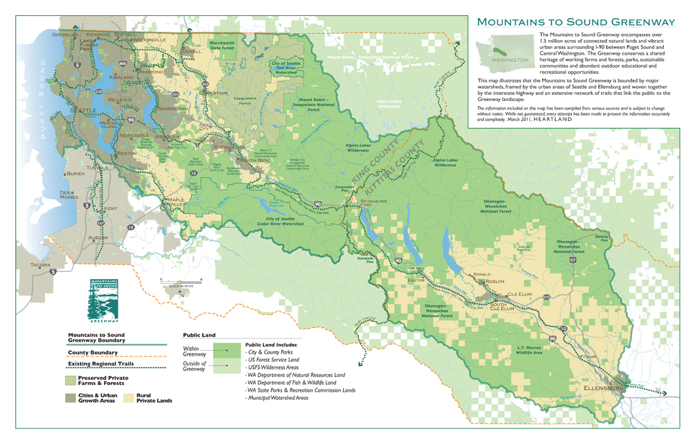
The Mountains to Sound Greenway is a magnificent 1.5 million-acre landscape providing bountiful opportunities for people to connect with nature, enjoy stellar outdoor recreation and scenic views as well as a quality of life that is deeply connected to our surroundings. The Greenway is key to the heritage and culture of the Pacific Northwest.
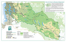

Framed by the urban areas of Seattle and Ellensburg, the Mountains to Sound Greenway is woven together by the historic transportation corridors and an extensive network of trails that link the public to the landscape. The Greenway is shaped by watershed boundaries: the Yakima to the east, the Cedar to the south, Snoqualmie and Lake Washington to the north, and Puget Sound to the west.
The Greenway as it is today was first envisioned in 1990, when a group of citizens hiked from the Cascade Crest alongside Interstate 90, through the forest all the way. They appreciated the priceless asset of natural lands and green spaces near a major metropolitan area, which could easily be lost without thoughtful planning. The Seattle region was on the verge of a significant economic boom, and unchecked sprawl threatened much of the region. In 1991, the Mountains to Sound Greenway Trust was founded to work toward a shared vision of keeping some of these natural lands within a connected, multi-purpose Greenway between Seattle and Central Washington.
Twenty years later in the Mountains to Sound Greenway, vibrant urban, suburban and rural communities flourish alongside working forests and farms, spectacular natural beauty, abundant wildlife, clean rivers and lakes, world-class recreation and quiet places where one can simply get away from it all. It's a remarkable conservation success built through a local cultural commitment to healthy people and place. By gathering a broad range of public and private stakeholders around a shared vision and daily work, the Mountains to Sound Greenway Trust serves as a catalyst for action to ensure retention of a thriving natural world and a growing and globally competitive economy.
The Greenway is a living, dynamic place requiring continuous attention and care, or its unique balance between built and natural environments could be lost. The Greenway coalition works to:• Promote voluntary public land acquisitions for wildlife habitat and recreational access
• Build and maintain trails and facilities to enhance recreational opportunities
• Create a connected regional Greenway trail system
• Conduct on-the-ground habitat restoration
• Mobilize thousands of volunteers
• Support working farms and forests
• Promote tourism within the Greenway
• Provide environmental education
• Support historic preservation and interpretation
• Promote a balance between built and natural environments
• Provide a forum for diverse interests to integrate conservation and economic prosperity.
Learn more about the Mountains to Sound Greenway at http://mtsgreenway.orgCategories:
Wikimedia Foundation. 2010.