- Neighborhoods of Miami
-
- This article is a list of neighborhoods inside the city limits of the City of Miami, for neighborhoods in all of Miami-Dade County, see Neighborhoods of Miami-Dade County.
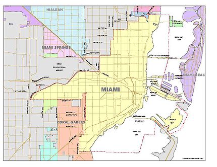
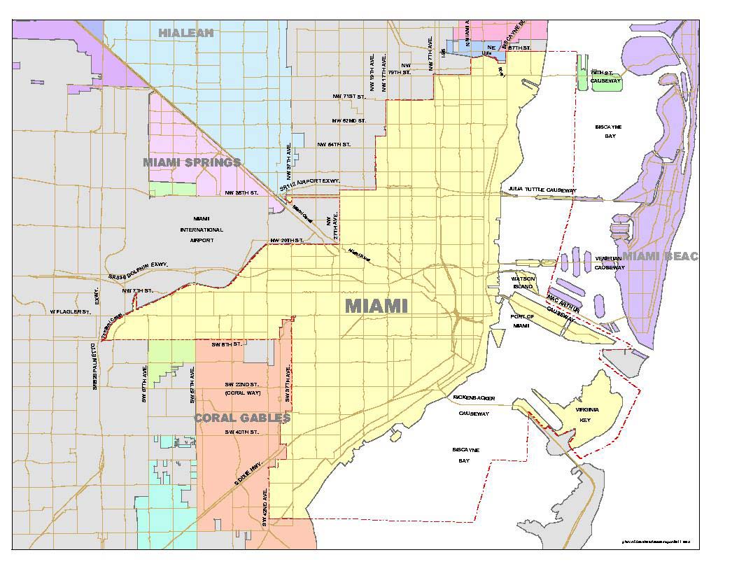
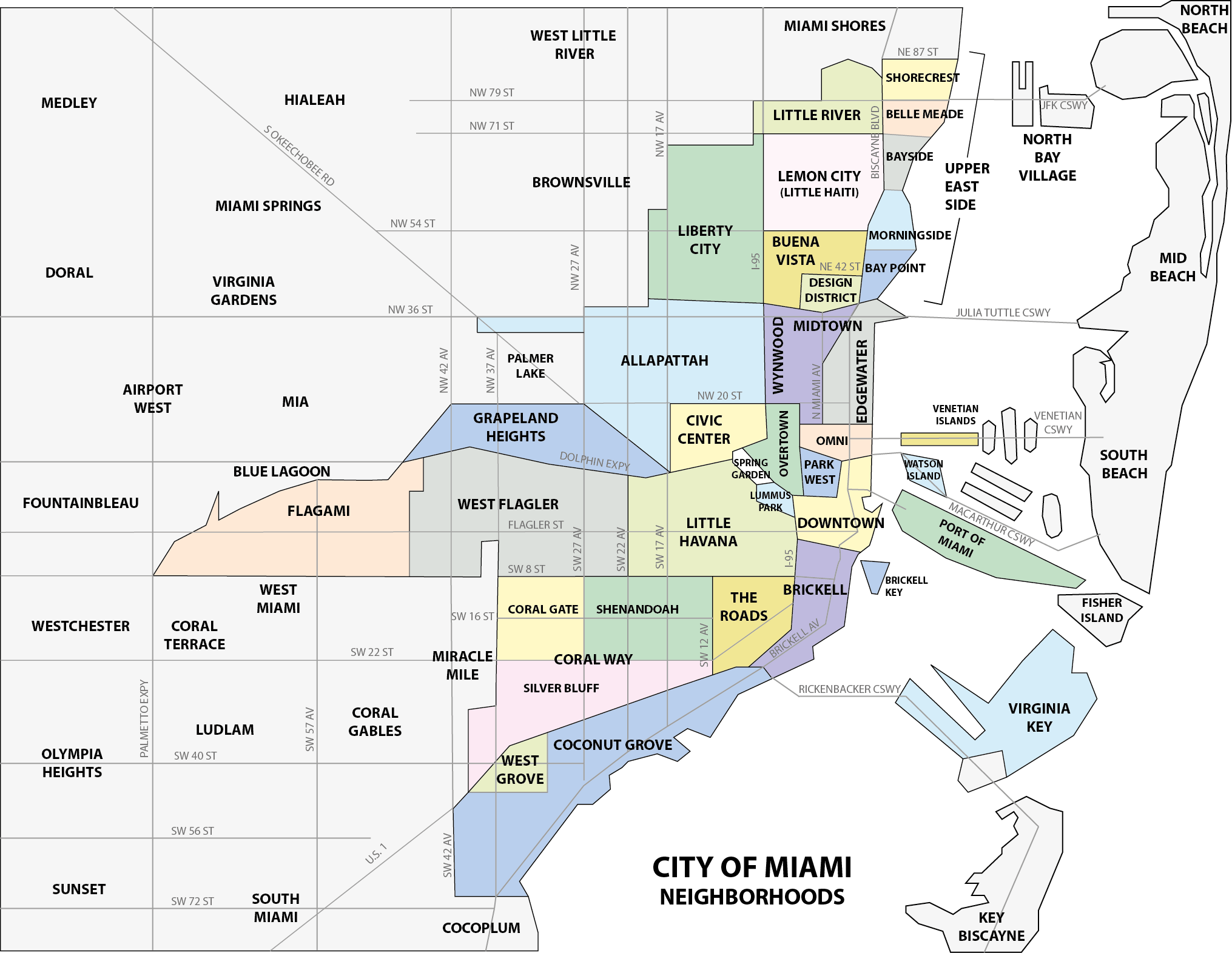
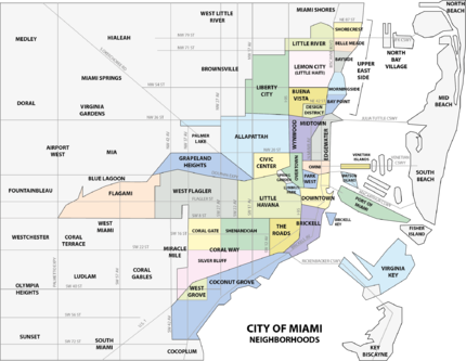 Map of Miami neighborhoods
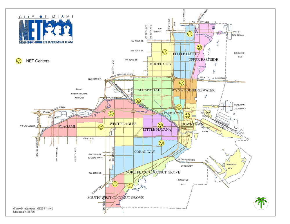
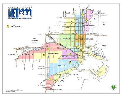 Neighborhood Enhancement Team map of the neighborhoods of the City of Miami.
This is a list of neighboorhoods in the City of Miami in Miami-Dade County, Florida, United States. Many of the city's neighborhoods have been renamed, redefined and changed since the city's founding in 1896. As such, the exact extents of some neighborhoods can differ from person to person. The following is the list of all the city's major neighborhoods, including any corresponding sub-neighborhoods within them.
The Coconut Grove neighborhood is an example of a neighborhood whose size and name has stayed relatively the same since its settlement in 1825. Having been settled originally as "Cocoanut Grove", its character has stayed almost intact from its early days.[1] In contrast, other neighborhoods have undergone many name and size changes. Buena Vista was once a much larger neighborhood in the 1920s, than it is today. Buena Vista once consumed all of the Design District as well as a large part of Little Haiti, Wynwood and Edgewater. Other neighborhoods, such as Omni have only recently been rebranded as "Omni", after the Omni Mall that was located there in the 1980s and 1990s. Midtown emerged as a new neighborhood in the mid-2000s after developers created the large scale Midtown Miami development in an area traditionally known as Edgewater.
Neighborhoods of Miami[2] Neighborhood Demonym Population
2010Population/
km²Sub-neighborhoods Allapattah 54,289 4,401 Brickell Brickellite 31,759 14,541 West Brickell Buena Vista 9,058 3,540 Buena Vista East Historic District Civic Center 2,705 2,148 Coconut Grove Grovite 20,076 3,091 Center Grove, Northeast Coconut Grove, Southwest Coconut Grove, and the West Grove (Black Grove) Coral Way 35,062 4,496 Coral Gate, Shenandoah, and Silver Bluff Design District 3,573 3,623 Downtown Downtowner 71,000
(13,635 CBD only)10,613 Brickell, Central Business District (CBD), Downtown Miami Historic District, Jewelry District, Omni, and Park West Edgewater 15,005 6,675 Flagami 50,834 5,665 Alameda, and Fairlawn Grapeland Heights 14,004 4,130 Liberty City 19,725 3,733 Little Haiti 29,760 3,840 Lemon City, and Little River Little Havana 76,163 8,423 South River Drive Historic District Lummus Park 3,027 3,680 Midtown Midtowner - - Omni 11,033 7,948 Overtown Towner 6,736 3,405 Park West 4,655 3,635 The Roads 7,327 4,899 Upper East Side Upper East Sider 12,525 2,513 Bay Point Estates, Bayside District, Belle Meade, El Portal, Magnolia Park, MiMo Historic District, Morningside, Palm Grove, and Shorecrest Venetian Islands N/A N/A Biscayne Island and San Marco Island Virginia Key 14 - West Flagler 31,407 4,428 Wynwood 7,277 2,983 Wynwood Art District, and Wynwood Fashion District Miami Miamian 399,457 4,687 See also
References
- ^ Planning Your Vacation in Florida, Miami and Dade County [WPA Guide to Miami], Northport, NY: Bacon, Percy & Daggett, 1941, page 49.
- ^ http://projects.nytimes.com/census/2010/map
External links
Neighborhoods of Miami Allapattah · Brickell (Key) · Buena Vista · Civic Center · Coconut Grove · Coral Way · Design District · Downtown · Edgewater · Flagami · Grapeland Heights · Liberty City · Little Haiti · Little Havana · Lummus Park · Midtown · Omni · Overtown · Park West · The Roads · Upper Eastside · Venetian Islands · Virginia Key · Watson Island · West Flagler · Wynwood

City of Miami Accent • Arts • Climate • Companies • Downtown • Education • Fire • Government • Historic Landmarks • History • Library • Mayors • Miamians • Music • Neighborhoods • Police • Skyscrapers • Sports • Television • Transportation Categories:
- Neighborhoods in Miami, Florida
- Lists of neighborhoods in U.S. cities


Wikimedia Foundation. 2010.