- McPherson Square (WMATA station)
-
McPherson Square 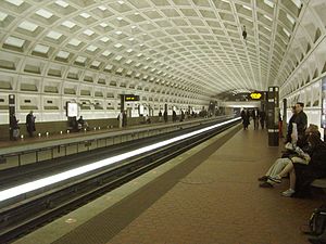
Station statistics Address 1400 I Street, Northwest
Washington, D.C. 20005Lines Connections Metrobus
DC Circulator
Loudoun County Commuter Bus
MTA Maryland Commuter Bus
OmniRide CommuterStructure Underground Platforms 2 side platforms Tracks 2 Bicycle facilities 1 rack Other information Opened July 1, 1977 Accessible 
Code C02 Owned by Washington Metropolitan Area Transit Authority Traffic Passengers (2001) 5.990 million  0%
0%Services Preceding station Washington Metro Following station Farragut Westtoward Franconia–SpringfieldBlue Line toward Largo Town CenterFarragut Westtoward ViennaOrange Line toward New CarrolltonFarragut Westtoward Route 772Silver Line (planned) toward Stadium–Armory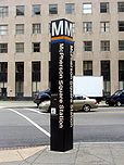
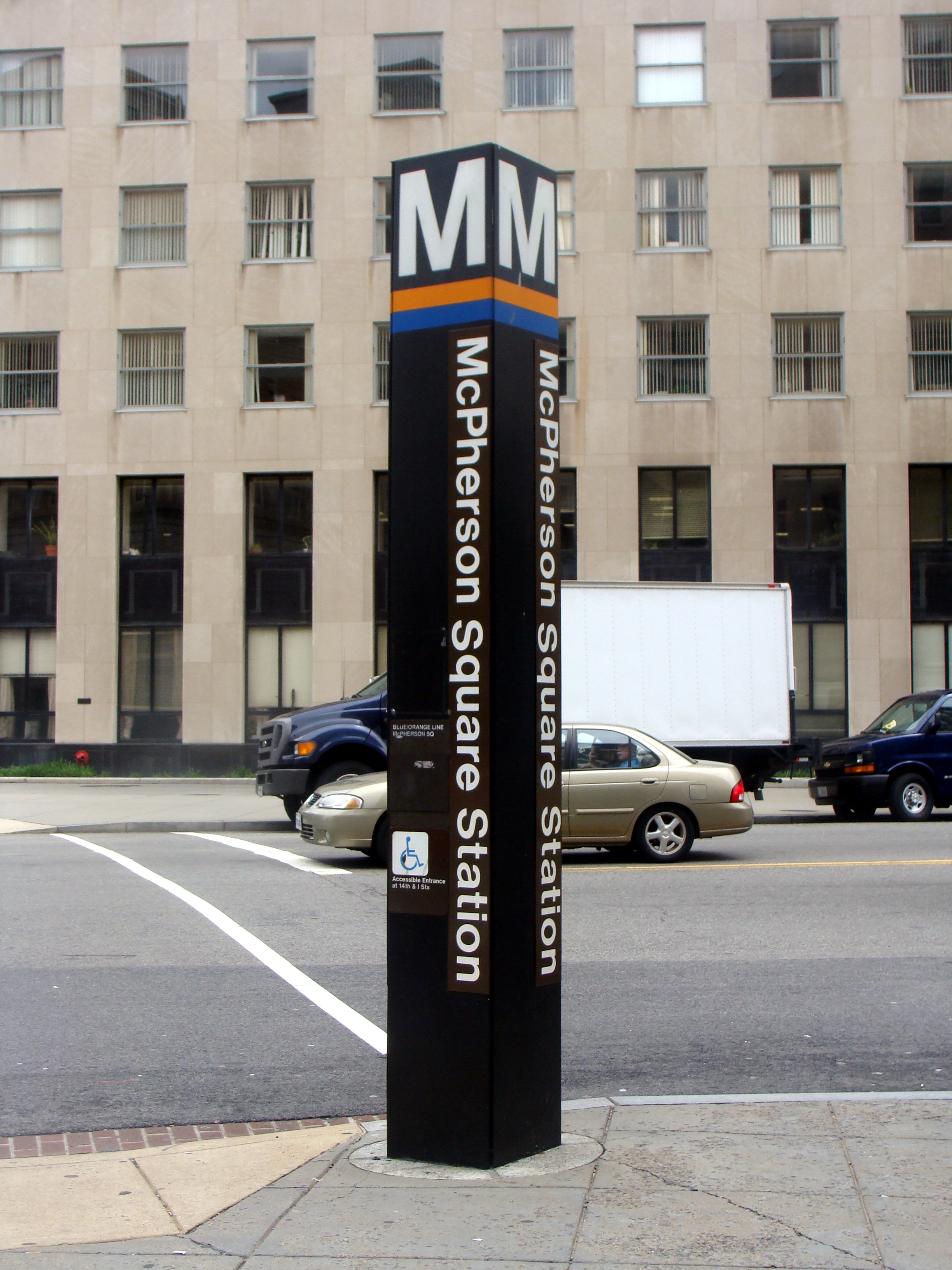
McPherson Square is a side platformed Washington Metro station in Downtown Washington, D.C., United States. The station was opened on July 1, 1977, and is operated by the Washington Metropolitan Area Transit Authority (WMATA). Providing service for both the Blue and Orange Lines, the station is located between McPherson Square and Franklin Square, with two entrances on I Street at Vermont Avenue and 14th Street NW. It is also scheduled to be on the Silver Line route, which is expected to start operations in 2013.[1] This is the main station to access the White House, and the Vermont Avenue exit is directly underneath the Department of Veterans Affairs building.
The station opened on July 1, 1977.[2] Its opening coincided with the completion of 11.8 miles (19.0 km)[3] of rail between National Airport and RFK Stadium and the opening of the Arlington Cemetery, Capitol South, Crystal City, Eastern Market, Farragut West, Federal Center SW, Federal Triangle, Foggy Bottom–GWU, L'Enfant Plaza, National Airport, Pentagon, Pentagon City, Potomac Avenue, Rosslyn, Smithsonian and Stadium–Armory stations.[4] Orange Line service to the station began upon the line's opening on November 20, 1978.[5]
Notable places nearby
- Blair House
- Department of the Treasury
- The Center for American Progress
- The American Constitution Society
- Hudson Institute
- Lafayette Square
- St. John's Episcopal Church
- Strayer University
- The Washington Post Headquarters
- The White House
References
- ^ Metropolitan Washington Airports Authority (2010). "Dulles Metrorail Project Overview". http://www.dullesmetro.com/about/overview.cfm. Retrieved July 25, 2010.
- ^ Feaver, Douglas B. (July 1, 1977), "Today, Metro could be U.S. model", The Washington Post: A1
- ^ Washington Metropolitan Area Transit Authority (July 2009). "Sequence of Metrorail openings". http://www.wmata.com/about_metro/docs/metrofacts.pdf. Retrieved July 25, 2010.
- ^ Staff Reporters (June 24, 1977), "Metro's newest stations: Where they are, what's nearby", The Washington Post
- ^ Eisen, Jack; John Feinstein (November 18, 1978), "City-County fanfare opens Orange Line; Ceremonies open new Orange Line", The Washington Post: D1
External links
 Media related to McPherson Square (Washington Metro) at Wikimedia Commons
- WMATA: McPherson Square Station
- StationMasters Online: McPherson Square Station
- The Schumin Web Transit Center: McPherson Square Station
- McPherson Square (Washington Metro) is at coordinates:
- 38°54′04″N 77°02′05″W / 38.901162°N 77.034853°W Vermont Avenue Entrance
- 38°54′04″N 77°01′56″W / 38.901111°N 77.032206°W 14th Street Entrance
- Vermont Avenue entrance from Google Maps Street View
- 14th Street entrance from Google Maps Street View
Coordinates: 38°54′4.8″N 77°1′59.8″W / 38.901333°N 77.033278°W
Categories:- Blue Line (Washington Metro)
- Orange Line (Washington Metro)
- Silver Line (Washington Metro)
- Washington Metro stations in Washington, D.C.
- Railway stations opened in 1977

Wikimedia Foundation. 2010.