- Crystal City (WMATA station)
-
For the nearby Virginia Railway Express station, see Crystal City (VRE station).
Crystal City 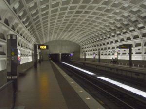
Station statistics Address 1750 South Clark Street (Metro) Lines Metro:
Connections Fredericksburg LineWMATA Metrobus
Arlington Transit
Fairfax Connector
Loundoun County Commuter
OmniRide CommuterStructure Underground Platforms 2 side platforms Tracks 2 Bicycle facilities 10 racks Other information Opened July 1, 1977 Accessible 
Code C09 Owned by Washington Metropolitan Area Transit Authority Traffic Passengers (2007) 7.599 million[1]  3% (Metro)
Services Preceding station Washington Metro Following station toward Franconia–SpringfieldBlue Line Pentagon Citytoward Largo Town Centertoward HuntingtonYellow Line Pentagon Citytoward Fort TottenCrystal City is a side platformed Washington Metro station in the Crystal City neighborhood of Arlington, Virginia, United States. The station was opened on July 1, 1977, and is operated by the Washington Metropolitan Area Transit Authority (WMATA). Providing service for both the Blue and Yellow Lines, the station is located on 18th Street in between the Jefferson Davis Memorial Highway and South Bell Street. The station is also accessible from the underground network of shopping centers and restaurants extending beneath Crystal City.
History
The station opened on July 1, 1977.[2] Its opening coincided with the completion of 11.8 miles (19.0 km)[3] of rail between National Airport and RFK Stadium and the opening of the Arlington Cemetery, Capitol South, Eastern Market, Farragut West, Federal Center SW, Federal Triangle, Foggy Bottom–GWU, L'Enfant Plaza, McPherson Square, National Airport, Pentagon, Pentagon City, Potomac Avenue, Rosslyn, Smithsonian and Stadium–Armory stations.[4]
Since summer 1992, Virginia Railway Express has a nearby station with the same name on Crystal Drive.[5]
References
- ^ FY2006-07 Metrorail ridership summary by station Think Outside the Car Retrieved
- ^ Feaver, Douglas B. (July 1, 1977), "Today, Metro could be U.S. model", The Washington Post: A1
- ^ Washington Metropolitan Area Transit Authority (July 2009). "Sequence of Metrorail openings". http://www.wmata.com/about_metro/docs/metrofacts.pdf. Retrieved July 25, 2010.
- ^ Staff Reporters (June 24, 1977), "Metro's newest stations: Where they are, what's nearby", The Washington Post
- ^ Fehr, Stephen C. (June 18, 1992), "Getting on track; Fairfax ready to roll with its 3 commuter stations", The Washington Post
External links
- WMATA: Crystal City Station
- StationMasters Online: Crystal City Station
- The Schumin Web Transit Center: Crystal City Station
- 18th Street entrance from Google Maps Street View
Coordinates: 38°51′28″N 77°03′03″W / 38.857856°N 77.050874°W
Categories:- Blue Line (Washington Metro)
- Transportation in Arlington County, Virginia
- Washington Metro stations in Virginia
- Yellow Line (Washington Metro)
- Railway stations opened in 1977

Wikimedia Foundation. 2010.