- Mayville, Oregon
-
Mayville, Oregon — Unincorporated community — Mayville from Oregon Route 19
 Mayville, Oregon
Coordinates: 45°04′56″N 120°11′32″W / 45.08222°N 120.19222°WCoordinates: 45°04′56″N 120°11′32″W / 45.08222°N 120.19222°W Country United States State Oregon County Gilliam Elevation 2,963 ft (903 m) Time zone Pacific (PST) (UTC-8) - Summer (DST) PDT (UTC-7) ZIP code 97830 Area code(s) 458 and 541 Coordinates and elevation from United States Geological Survey[1] Mayville is an unincorporated community in Gilliam County, Oregon, United States.[1] It is located on Oregon Route 19. According to 1909 Oregon law, Mayville was the permanent meeting place of the board of commissioners of Gilliam and Wheeler counties. They met in Mayville each year to elect the president of the board.[2] A post office was established in Mayville and "put in operation in October 1884 with Samuel Thornton postmaster."[3] The community's name was originally made by Thornton's wife.[3]
References
- ^ a b "Mayville". Geographic Names Information System, U.S. Geological Survey. November 22, 1980. http://geonames.usgs.gov/pls/gnispublic/f?p=gnispq:3:::NO::P3_FID:1123881. Retrieved June 5, 2011.
- ^ Legislative Assembly, Twenty-Fifth Session. The General Laws and Joint Resolutions and Memorials.
- ^ a b McArthur, Lewis A.; McArthur, Lewis L (2003 [1928]). Oregon geographic names. Portland, Oregon: Oregon Historical Society Press. p. 619. ISBN 0-87595-277-1.
Municipalities and communities of Gilliam County, Oregon County seat: Condon Cities 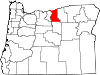
Unincorporated
communitiesCategories:- Unincorporated communities in Gilliam County, Oregon
- Oregon geography stubs


Wikimedia Foundation. 2010.