- Mersa Matruh
-
Marsa Matrouh
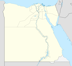
مرسى مطروحLocation in Egypt Coordinates: 31°20′N 27°13′E / 31.333°N 27.217°E Country  Egypt
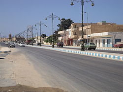
EgyptGovernorate Matrouh Population – Total 68 339 – Ethnicities Egyptians, Amazigh & Arabs. Time zone EST (UTC+2) Marsa Matrouh (Arabic: مرسى مطروح Marsā Maṭroūḥ) is a Mediterranean seaport and the capital of the Matrouh Governorate in Egypt. It is 240 km (150 mi) west of Alexandria and 222 km from Sallum, on the main highway from the Nile Delta to the Libyan border. Another highway leads south from the town, toward the Western Desert and the oases of Siwa and Bahariya. During Ancient Egyptian times and during the reign of Alexander The Great, the city was known as Amunia. In Ptolemaic and Byzantine times it was known as Paraitonion (Παραιτόνιον), and in Roman times, as Paraetonium.
Marsa Matrouh is a main Egyptian tourist city, and serves as a getaway resort for Europeans and Cairenes eager to flee the capital in the sweltering summer months. It is served by Marsa Matrouh Airport. The city is known for its white soft sands and calm transparent waters; the bay is protected from the high seas by a series of rocks forming a natural breakwater, with a small opening to allow light vessels in.
Contents
History
It started as a small fishing town during Ancient Egyptian times and Alexander The Great and was named Amunia. And there are ruins of a temple of Rameses II (1200 B.C.). Then, Marsa Matrouh became known as Paraitonion in Ptolemaic era. Yet, when Roman occupation came to Egypt the town became an important harbor for trade and sending goods and crops to Rome. It was named Paraetonium at that time. During World War II, the British Army's Baggush Box was located to the east. During this period, Marsa Matrouh was the terminus for a single-track railway which passed through El Alamein.
Climate
Marsa Matrouh has a typical dry Mediterranean climate, with cool winters and warm, dry summers. As the city and the region as a whole experience pleasant weather during summer, the city becomes a destination for millions of Egyptians and foreign tourists. Rainfall occurs mainly during winter, but may also appear during the autumn or spring. Sleet and hail can also occur.
Climate data for Marsa Matrouh Month Jan Feb Mar Apr May Jun Jul Aug Sep Oct Nov Dec Year Record high °C (°F) 25.7
(78.3)26.1
(79.0)27.6
(81.7)34.3
(93.7)38.0
(100.4)44.3
(111.7)44.7
(112.5)43.1
(109.6)39.2
(102.6)33.8
(92.8)29.1
(84.4)26.5
(79.7)44.7
(112.5)Average high °C (°F) 15.5
(59.9)16.0
(60.8)18.6
(65.5)22.8
(73.0)27.5
(81.5)33.7
(92.7)34.8
(94.6)34.6
(94.3)27.9
(82.2)22.0
(71.6)18.3
(64.9)16.4
(61.5)24.01
(75.21)Average low °C (°F) 10.0
(50.0)10.6
(51.1)13.6
(56.5)16.2
(61.2)19.7
(67.5)23.5
(74.3)24.8
(76.6)23.4
(74.1)18.4
(65.1)14.2
(57.6)11.0
(51.8)9.8
(49.6)16.27
(61.28)Record low °C (°F) 2.3
(36.1)2.5
(36.5)4.7
(40.5)6.8
(44.2)8.5
(47.3)10.1
(50.2)10.6
(51.1)9.9
(49.8)8.2
(46.8)6.7
(44.1)4.0
(39.2)3.0
(37.4)2.3
(36.1)Precipitation mm (inches) 19.9
(0.783)14.8
(0.583)12.0
(0.472)7.9
(0.311)1.5
(0.059)0.0
(0)0.0
(0)0.0
(0)2.1
(0.083)8.6
(0.339)18.0
(0.709)22.7
(0.894)107.5
(4.232)[citation needed] Monuments and Tourist Sites
- Ruins of the Temple of the King, Pharaoh Rameses II (1200 B.C)
- Drown city of Caesar.
- Drown Palace of Cleopatra.
- Egyptian Fleet Anchorage which was built by the Ptolemies, the remains of the naval installations still stand west of the port.
- Coptic Chapel: built in the early Coptic age, and contains several caves bearing inscriptions.
- Rommel's Hideout: A cave, hewn in the rock, where Rommel drew up plans of his military operations. It has now been turned into a military museum.
- The British Cemetery: Thousands upon thousands of rock-hewn tombstones stand straight rows amidst a fenced garden.
- The German Cemetery: It is a fortress like memorial that was built on a high overlooking the sea.
- The Italian Cemetery: It is a high tower fort standing on a high hill. The walls of the building are covered with marble.
Main Beaches
- Ageebah Beach: About 28 km. west of Marsa Matrouh downtown, it is distinguished by its numerous natural caves and enchanting scenery.
- Al-Obayed Beach: About 20 km. west of Marsa Matrouh downtown, beauty surpasses that of Marsa Matrouh beach.
- Romel Bay.
See also
References
- Falling Rain Genomics, Inc. "Geographical information on Marsa Matruh, Egypt". http://www.fallingrain.com/world/EG/22/Marsa_Matruh.html. Retrieved 2008-03-23.
Coordinates: 31°20′N 27°13′E / 31.333°N 27.217°E
Governorates capitals of Egypt Governorate (capital) Alexandria (Alexandria) · Aswan (Aswan) · Asyut (Asyut) · Beheira (Damanhur) · Beni Suef (Beni Suef) · Cairo (Cairo) · Dakahlia (Mansoura) · Damietta (Damietta) · Faiyum (Faiyum) · Gharbia (Tanta) · Giza (Giza) · Ismailia (Ismailia) · Kafr el-Sheikh (Kafr el-Sheikh) · Luxor (Luxor) · Matrouh (Mersa Matrouh) · Minya (Minya) · New Valley (Kharga) · North Sinai (Arish) · Qalyubia (Benha) · Qena (Qena) · Red Sea (Hurghada) · Sharqia (Zagazig) · Sohag (Sohag) · South Sinai (El-Tor) · Suez (Suez)
Categories:- Mersa Matruh
- Matruh Governorate
- Governorate capitals in Egypt
- Populated places in Egypt
- Populated coastal places in Egypt
- Tourism in Egypt
- Mediterranean port cities and towns in Egypt
Wikimedia Foundation. 2010.


