- Malanggad
-
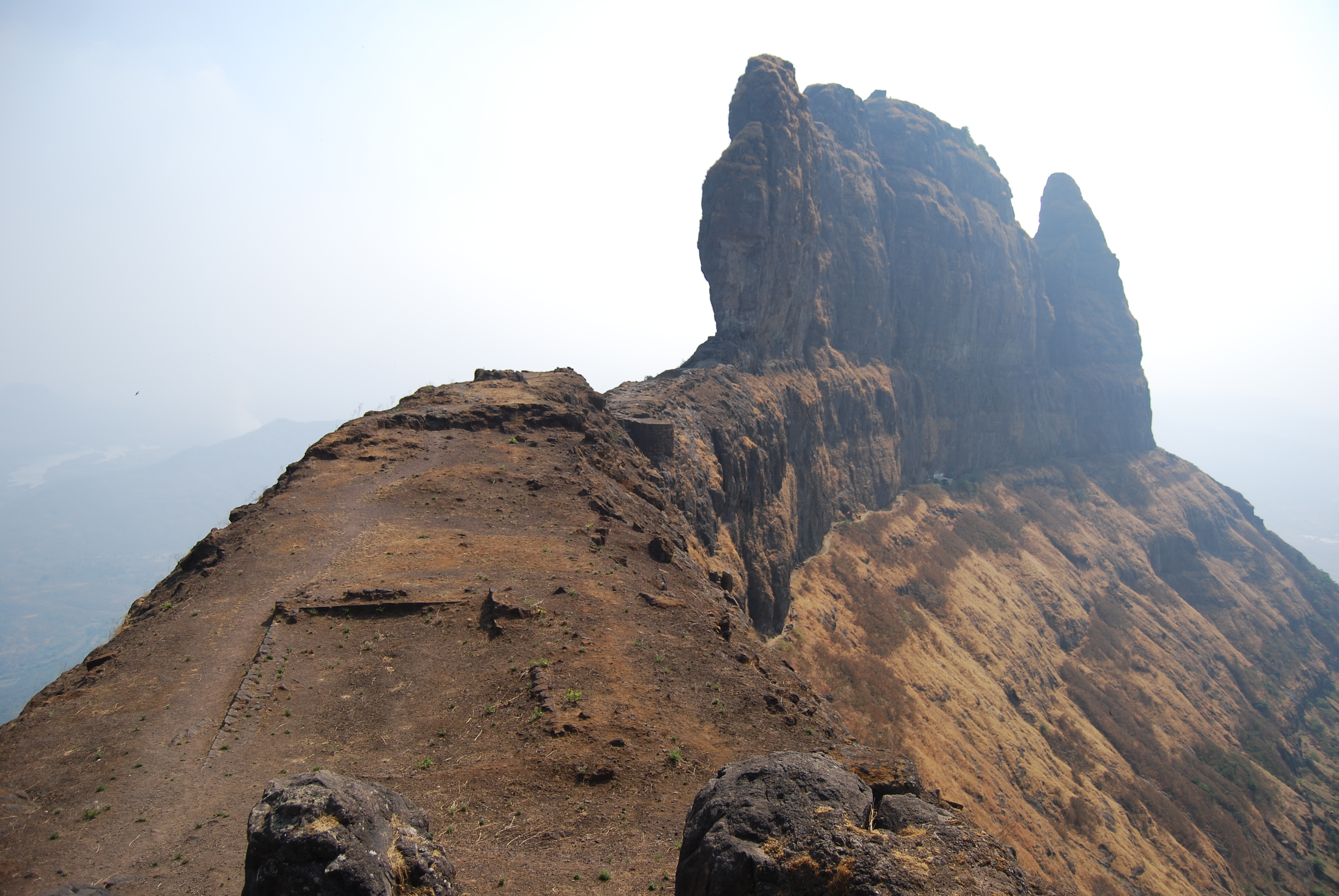
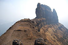 Malanggad summit, the Citadel
Malanggad (also called Bawa Malang) is a hill fort located in Raigad District, Maharashtra. It has an elevation of 789 m above sea level.[1]
Contents
Major features
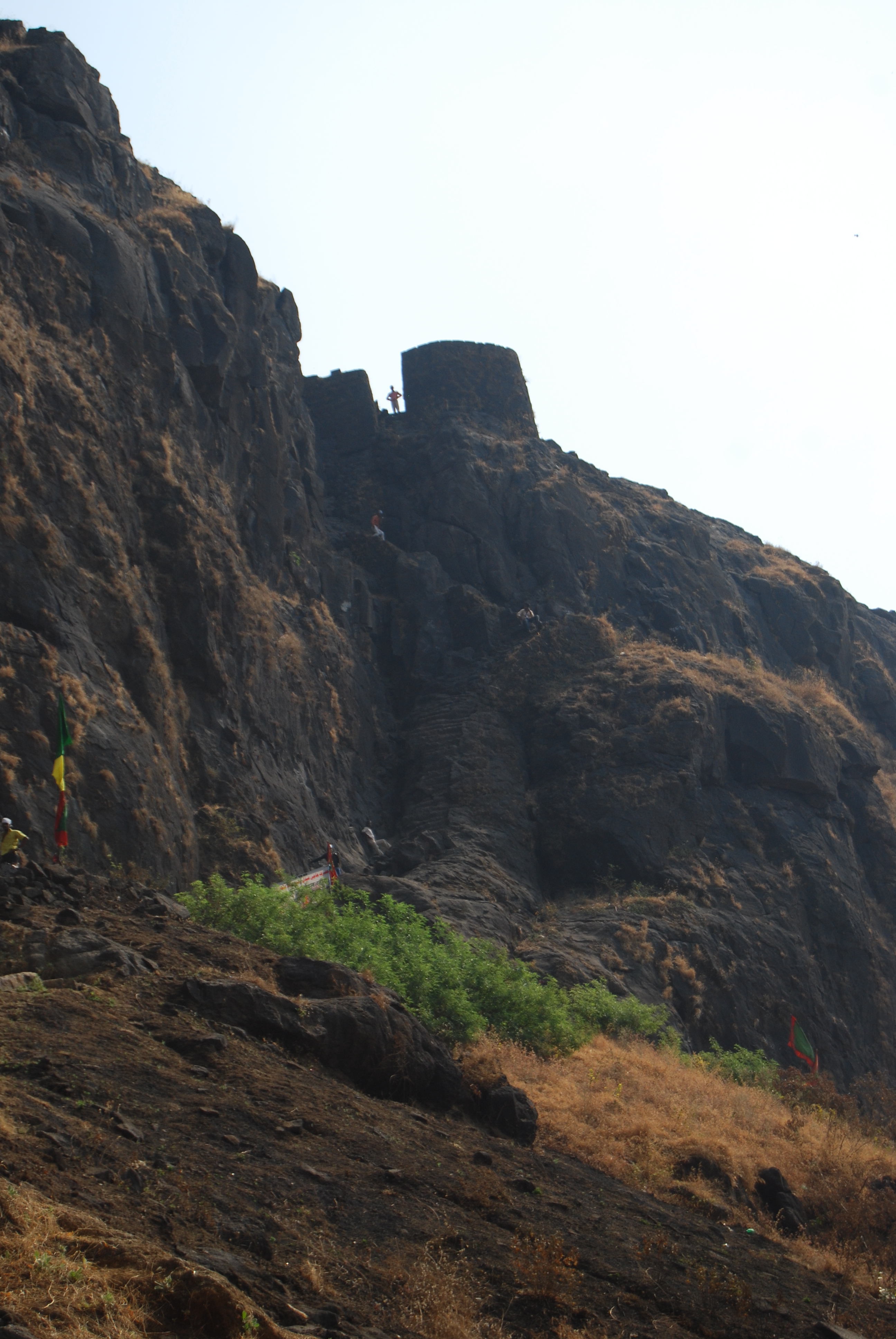
 Malanggad bastion of the middle level
Malangad is built on three levels. The lowest level is a plateau which is 1000 feet broad and 2500 feet long on which stands the Dargah of a Sufi saint - Haji Malang. At the other end of the plateau is the Panchi Pir which lies almost at the edge of the rock and is named after the five pirs who accompanied Haji Malang[2]. This plateaus is called Pir Machi.
The next higher level is called the Sone Machi as it is the lower part of the fort. This is a projection of rock with is 70 feet broad and 100 feet long. It is shaped like an elephant trunk.[2] It has a parapet wall with bastions on two sides but there are no machicolations to fire at the an invading army.
The highest level is the Citadel which is 200 yards long and 70 yards broad. This is the summit of the hill and has no fortifications. The water supply is from five cisterns at the top of the hill with a copper pipe to carry water to the lower levels.
Malanggad is different from other forts in Maharashtra. Whereas other forts have several gates and multiple watchtowers, Malanggad has only one small gate and one watchtower which is not independent but a part of the main gate itself. With a wall with no machicolations to fire at the enemy and no fortifications, Malanggad is one of the few forts to depend completely on natural aspects of the hill to defend itself. [2]
History
Malanggad was built in the 7th century by Raja Nagal probably during the Yadav period.[1][2] His is the oldest name associated with Malanggad and he is said to have improved access to the hill by means of an iron bridge.
On 4 August, 1780, British troops under a Captain Abington, stormed Malanggad and took the Sone Machi(the middle level). The Marathas who held the fort then fled to the Citadel(the highest level) and managed to cut off his communication with Kalyan. Reinforcements arrrived in early October as Coloner Hartley and Captain Jameson and their troops advanced on Malanggad and finally defeated the Marathas.[2][3] Thus in 1780, the English established themselves in Malanggad but they left after two years. The Peshwa attributed this to the "power of the saint" and he sent to the shrine a cloth of gold trimmed with pearls set on silver posts.[3]
After Konkan ceded to the British Raj in 1817, Malanggad fort resisted for several months. However, in January 1818 by a small force under a Colonel Kennedy, scaled the mountain and brought Malanggad under British rule. There is a local legend that in 1834 some Europeans, who went into the shrine with their shoes, were attacked by bees.[3] It is believed that it belongs to the hindu saint Navnath panth and muslims acquired the fort in the name of hazi malang. The presence of the 'fish' symbolism at the tip of the dome is argued as a sign of 'machindranath' of the nath panth tradition.
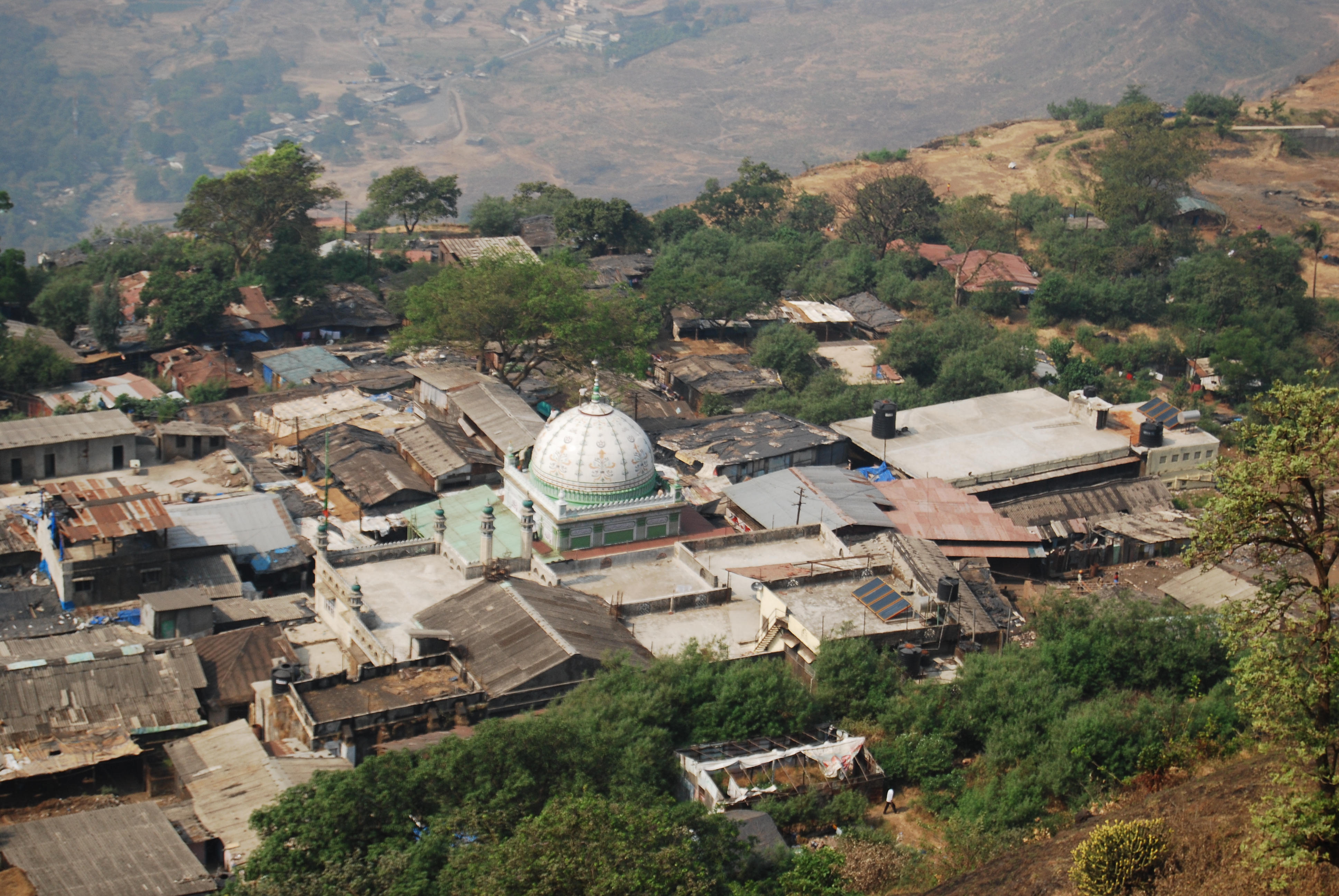
 Haji Malang Dargah from the summit
Current use
On the February full moon (Magh Shuddh' Purnima) a large fair is attended by the people of all faiths from Kalyan, Panvel, Thane, and Mumbai. The annual pilgrimage to the shrine is during May. On reaching the top the pilgrims perform three rituals - washing their hands and feet in the large water cistern, eating wild figs from the trees growing around the shrine and throwing stones at a rock pinnacle on the south west side.[3]
References
- ^ a b "Friends of Forts". http://www.fortsofsahyadri.friendsofforts.com/list_of_maharashtraforts.htm. Retrieved 2009-02-01.
- ^ a b c d e Kantak, M.R. (1993). The First Anglo-Maratha War, 1774-1783. Popular Prakashan. pp. 99. ISBN 817154696X. http://books.google.com/books?id=cdXnVOKKkssC&pg=PA118&lpg=PA99&dq=yeshwant+gad&source=web&ots=8MtDy0OCI0&sig=UZ8NiBKohcw3_fNTrUMGaiY2JUU&hl=en&sa=X&oi=book_result&resnum=6&ct=result#PPA99,M1. Retrieved 2009-03-16.
- ^ a b c d Gazetteers Department. "Places of Interest". Government of India. http://www.maharashtra.gov.in/pdf/gazeetter_reprint/Thane-III/places_Malanggad.html. Retrieved 2009-03-17.
Forts in Maharashtra Akola district Satara district Mumbai suburban district Mumbai city district Bombay Castle · Dongri Fort · Fort George · Mahim Fort · Mazagon Fort · Riwa Fort · Sewri Fort · Sion Hillock Fort · Worli FortRaigad district Karnala · Korlai · Kothaligad · Kolaba Fort · Lingana · Manikgad · Murud-Janjira · Padmadurg · Raigad · Sudhagad · Malanggad · Khanderi · Underi · Prabalgad · IrshalgadAurangabad District Amravati district Ahmednagar district Ratnagiri district Pune district Nashik district Kolhapur district Sindhudurg district Sindhudurg · VijaydurgNagpur district SitabuldiDhule district Laling · ThalnerThane district Bassein Fort · Belapur Fort · Arnala · Ghodbunder Fort · Mahuli
Categories:- Forts in Maharashtra
Wikimedia Foundation. 2010.