- Makalu Barun National Park
-
Makalu Barun National Park and Conservation Area IUCN Category II (National Park)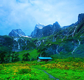
Landscape in Makalu Barun National ParkLocation Nepal Coordinates 27°45′25″N 87°06′49″E / 27.7569°N 87.1136°ECoordinates: 27°45′25″N 87°06′49″E / 27.7569°N 87.1136°E Area 2,330 km2 (900 sq mi) Established 1992 Makalu Barun National Park is the eighth national park in the Himalayas of Nepal and was established in 1992 as eastern extension of the Sagarmatha National Park. Covering an area of 1,500 km2 (580 sq mi) in the districts of Solukhumbu and Sankhuwasabha it is the world's only protected area with an elevation gain of more than 8,000 m (26,000 ft) enclosing tropical forest as well as snow-capped peaks.
The northern border of the national park coincides with the international border to the Tibet Autonomous Region. Adjacent to the southern and southeastern border is the bufferzone Makalu Barun Conservation Area covering an area of 830 km2 (320 sq mi).
The rugged summits of Makalu, with 8,463 m (27,766 ft) the fifth highest mountain of the world, Chamalang (7,319 m (24,012 ft)), Baruntse (7,129 m (23,389 ft)) and Mera (6,654 m (21,831 ft)) are included in the national park. The protected area extends to about 66 km (41 mi) from west to east and to about 44 km (27 mi) from north to south. From the Arun river valley in the southeast, located at 344–377 m (1,129–1,237 ft) above sea level, elevation gains about 8,025 m (26,329 ft) to the peak of Makalu.[1]
Contents
History
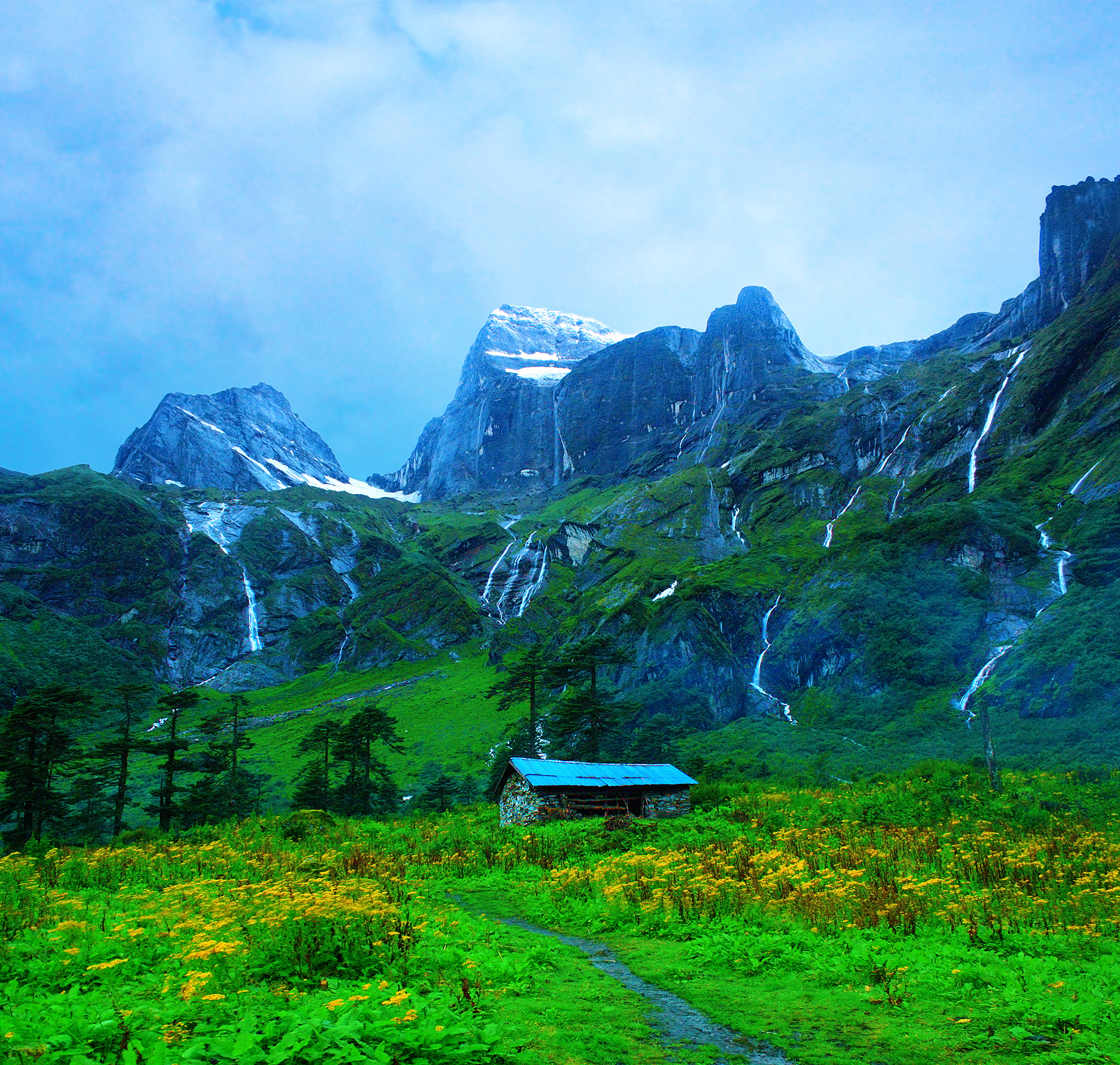
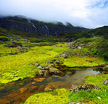 Barun Valley
The idea of preserving the unique biological and cultural features of the Makalu Barun area was already conceived in the mid-1980s. The management plans accomplished in 1990 also addressed the issue of protecting the upper watershed of the Arun River. In 1991 Makalu Barun National Park was gazetted. When in 1999 the bufferzone was declared, the park was the first to include an adjacent inhabited conservation area. About 35,000 people reside in 12 Village Development Committees, who are primarily subsistence farmers of Sherpa, Rai, Gurung, Tamang, Magar, Newar, Brahmin and Chhetri ethnic groups.[2]
Both national park and conservation area are administered by the Department of National Parks and Wildlife Conservation. An innovative park management approach encourages local people to become actively involved in conserving their rich cultural heritage and protecting forests and natural resources, upon which their lives depend.
The inaccessible valleys of the Barun River, glacier-fed tributary to the Arun River, and of its tributary Saldima, treasure some of the last remaining pristine forests and alpine meadows. They have been designated as a Strict Nature Reserve, the first in Nepal, in order to protect natural ecosystems and processes in an undisturbed state for scientific study, environmental monitoring, education and the maintenance of genetic resources.
Climate
The park is located in the eastern climatic zone of the Himalayas, where monsoon already starts in June and eases off in late September. During these months about 70% of the annual precipitation of 4,000 mm (160 in) falls. The first monsoon clouds reach the area already in April. Temperatures vary greatly due to the extreme difference in altitude in the entire area. Lower elevations are temperate throughout winter and hot during April and May.
Vegetation
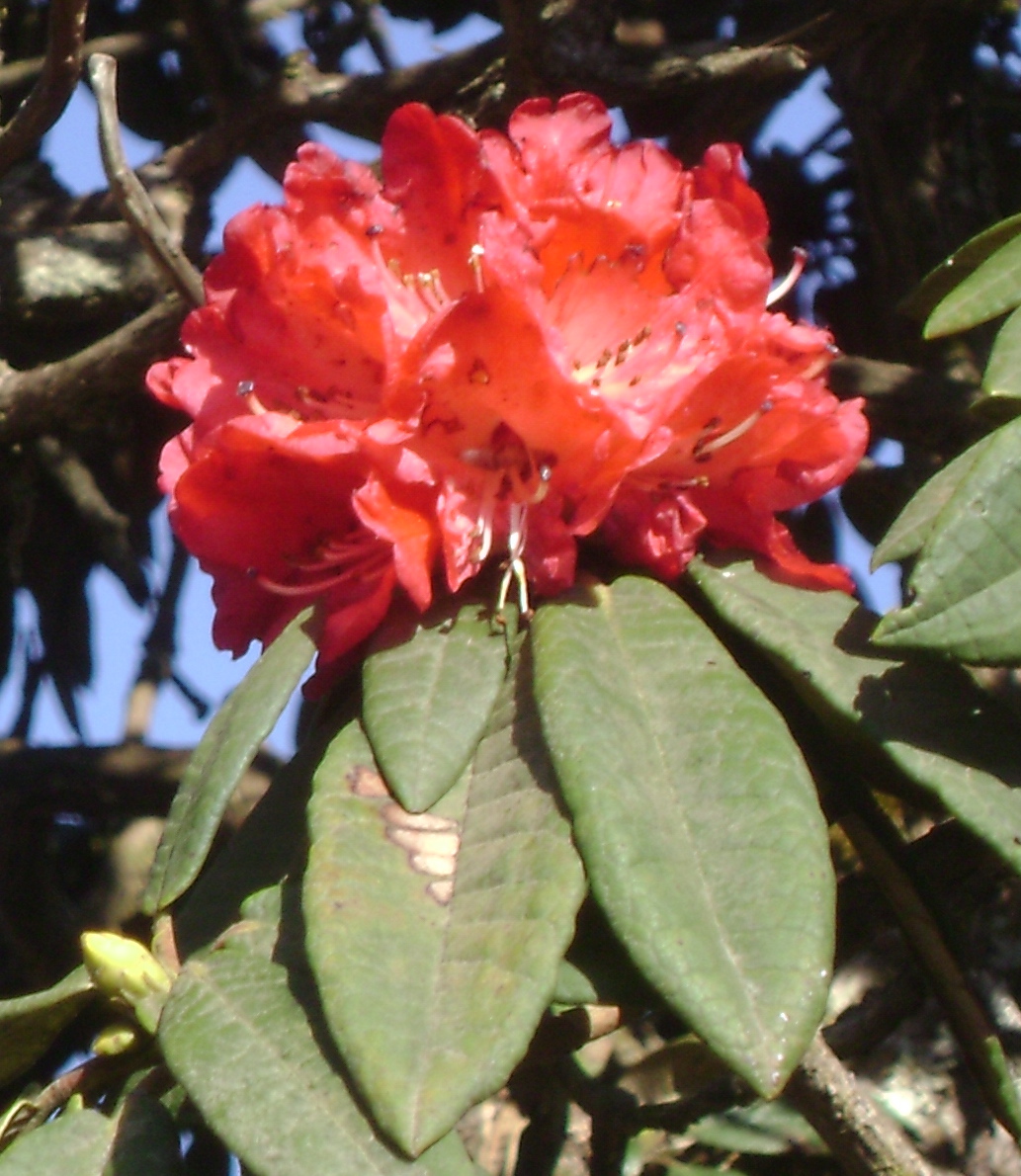
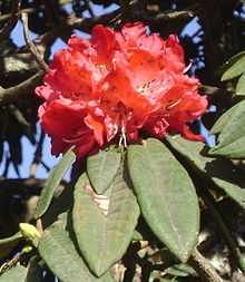 Rhododendron arboreum - the floral emblem of Nepal
The Makalu Barun National Park exhibits a high diversity of forest types that are characteristic for the Eastern Himalayas, ranging from near-tropical dipterocarp monsoon forest on 400 m (1,300 ft) altitude to subalpine conifer stands on 4,000 m (13,000 ft) altitude. Forest aspects vary depending on seasonal moisture availability, temperature and snow cover at different elevations and slopes. Forests below 2,000 m (6,600 ft) are strongly affected by subsistence agriculture, so that only some ecologically significant stands remain there. Above 2,000 m (6,600 ft) forests are usually extensive since the cool, humid climate suppresses agricultural activity.
Forests span five bioclimatic zones:- Tropical – below 1,000 m (3,300 ft) with stands of Sal;
- Subtropical - Himalayan subtropical broadleaf forests from 1,000 to 2,000 m (3,300 to 6,600 ft) with stands of Schima and Castanopsis;
- Lower and upper temperate - Eastern Himalayan broadleaf forests from 2,000 to 3,000 m (6,600 to 9,800 ft) with predominantly broadleaf evergreen species of Oak and Laurel families and broadleaf deciduous stands of Maple and Magnolia;
- Subalpine - Eastern Himalayan subalpine conifer forests from 3,000 to 4,000 m (9,800 to 13,000 ft) with stands of Himalayan Birch and East Himalayan Fir; along a transect from outer, southern slopes to the inner valleys these stands are dominated by conifers such as Juniper and Fir.[1]
On alpine pastures above 4,000 m (13,000 ft) - Eastern Himalayan alpine shrub and meadows - the religiously important dwarf rhododendron and juniper, aromatic herbs and delicate wildflowers prosper.
Botanists recorded 3,128 species of flowering plants, including 25 of Nepal's 30 varieties of rhododendron, 48 primroses, 47 orchids, 19 bamboos, 15 oaks, 86 fodder trees and 67 economically valuable aromatic and medicinal plants.[3]
Fauna
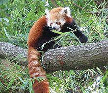 Red Panda
The protected area is habitat for a wide diversity of faunal species. There are 315 species of butterflies, 43 species of reptile and 16 species of amphibians. 78 species of fish inhabit the many ponds, lakes and rivers.[4] Ornithologists have recorded 440 bird species, ranging from eagles and other raptors to white-necked storks and brilliantly colored sunbirds. The 16 rare or protected bird species include the rose-ringed parakeet, Blyth’s kingfisher, deep-blue kingfisher, blue-naped pitta, pale blue flycatcher, Sultan tit, silver-eared mesia and the white-naped yuhina.
The 88 species of mammals include snow leopard, leopard, clouded leopard, jungle cat, leopard cat, jackal, Himalayan Wolf, red fox, red panda, black bear, Hanuman langur, Assam macaque, Himalayan tahr, Himalayan goral, muntjak, musk deer, barking deer, Himalayan serow, wild boar, flying squirrel, otters, spotted linsang, weasel and marmot.[4] In May 2009 zoologists obtained the first image of an Asian golden cat at an altitude of 2517 m.[5]
References
- ^ a b Carpenter, C., Zomer, R. (1996) Forest ecology of the Makalu-Barun National Park and Conservation Area, Nepal. Mountain Research and Development, 16 (2), 1996: 135-148
- ^ Mehta, J., Kellert, S. (1998) Local attitudes toward community-based conservation policy and programmes in Nepal: a case study in the Makalu-Barun Conservation Area. Environmental Conservation 25 (4): 320–333.
- ^ Shrestha, T.B., Sakya R., Nepali, H.S. (1990) Scientific Report on field survey of 1989: General and Phyto-ecology Working paper No. 8, Makalu-Barun Conservation Project, Kathmandu, Nepal.
- ^ a b Jha, S. G. (2003) Linkages between biological and cultural diversity for participatory management: Nepal’s experiences with Makalu-Barun National Park and buffer zone. Journal of the National Science Foundation of Sri Lanka 31 (1&2): 41-56 download pdf
- ^ Ghimirey, Y., Pal, P. (2009) First camera trap image of Asiatic golden cat in Nepal. Cat News 51: 17 download pdf
Literature
- Bhuju, U.R., Shakya, P.R., Basnet, T.B., Shrestha, S. (2007) Nepal Biodiversity Resource Book. Protected Areas, Ramsar Sites, and World Heritage Sites. International Centre for Integrated Mountain Development, Ministry of Environment, Science and Technology, in cooperation with United Nations Environment Programme, Regional Office for Asia and the Pacific. Kathmandu, ISBN 978-92-9115-033-5 download pdf
External links
- Information of Department of National Parks and Wildlife Conservation, Nepal: Makalu Barun National Park and Conservation Area
- Landscape Ecology of the Makalu-Barun National Park and Conservation Area
- BirdLife IBA factsheet about Makalu Barun National Park
National Parks, Reserves and Ramsar Sites of Nepal National Parks Chitwan National Park · Bardia National Park · Rara National Park · Langtang National Park · Sagarmatha National Park · Khaptad National Park · Shey Phoksundo National Park · Makalu Barun National Park · Shivapuri Nagarjun National Park · Banke National ParkWildlife Reserves Conservation Areas Annapurna Conservation Area · Manaslu Conservation Area · Kanchenjunga Conservation Area · Blackbuck Conservation Area · Gaurishankar Conservation Area · Api Nampa Conservation AreaHunting Reserves Ramsar Sites Categories:- IUCN Category II
- Protected areas of Nepal
- National parks of Nepal


Wikimedia Foundation. 2010.