- Sagarmatha National Park
Infobox World Heritage Site
WHS = Sagarmatha National Park
State Party = NEP
Type = Natural
Criteria = vii
ID = 120
Region = Asia-Pacific
Year = 1979
Session = 3rd
Link = http://whc.unesco.org/en/list/120Infobox_protected_area | name = Sagarmatha National Park
iucn_category = II
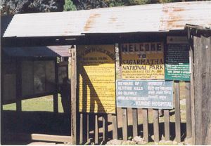
caption =
Entrance sign
locator_x =
locator_y =
location =Nepal
nearest_city =
lat_degrees = 27
lat_minutes = 57
lat_seconds = 55
lat_direction = N
long_degrees = 86
long_minutes = 54
long_seconds = 47
long_direction = E
area = 1,148 km²
established =July 19 ,1976
visitation_num =
visitation_year =
governing_body =Sagarmatha National Park, is located in eastern
Nepal , containing parts of theHimalaya s and the southern half ofMount Everest . The park was createdJuly 19 ,1976 and in 1979 was inscribed as a Natural World Heritage Site. Sagarmatha is Sanskrit for "Sagar = sky (not to be confused with sea/ocean) and matha = forehead or head " and is the modern Nepali name for Mount Everest.The park encompasses an area of 1,148 km² and ranges in elevation from its lowest point of 2,845 m (9,335 ft) at
Jorsalle to 8,850 m (29,035 ft) at the summit of Everest. Barren land above 5,000 m (16,400 ft) comprises 69% of the park while 28% is grazing land and the remaining 3% is forested. Most of the park area is very rugged and steep, with its terrain cut by deep rivers andglacier s. Unlike other parks, this park can be divided into four climate zones because of the rising altitude. The climatic zones include aforest ed lower zone, a zone of alpine scrub, the upper alpine zone which includes upper limit of vegetation growth, and theArctic zone where no plants can grow. The types of plants and animals that are found in the park depend on the altitude. The park contains the upper watershed of theDudh Kosi river basin system.The park's visitor centre is located at the top of a hill in
Namche Bazaar , also where a company of the Nepal Army is stationed for protecting the park. The park's southern entrance is a few hundred metres north of Mondzo at 2,835 m (9,300 ft), a one day hike fromLukla .Flora and fauna
In the lower forested zone, birch, juniper, blue pines, firs, bamboo and rhododendron grow. Above this zone all vegetation are found to be dwarf or shrubs. As the altitude increases, plant life is restricted to lichens and mosses. Plants cease to grow at about 5,750 m (18,690 ft), because this is the permanent snow line in the Himalayas.
Forests of pine and hemlock cover the lower elevations of the national park. At elevations of around 3500 meters and above, forests of silver fir,
birch ,rhododendron andjuniper trees are found. The forests provide habitat to at least 118 species of birds, includingDanphe ,Blood pheasant , Red-billed chough, and yellow-billed chough. Sagarmatha National Park is also home to a number of rare species, includingmusk deer , wildyak ,snow leopard , Himalayan black bear andred panda . Besides, many other animals such as Himalayan thars, deer, langur monkeys, hares, mountain foxes, martens, and Himalayan wolves are found in the park. However, their numbers are not very large and many visitors may not be able to see them.The partial pressure of oxygen falls with altitude. Therefore, the animals that are found here are adapted to living on less oxygen as well as a cold temperature. They have thick coats to retain body heat. Some of them have shortened limbs to prevent loss of body heat. The Himalayan bears go into hibernation in caves during the winter when there is no food available.
References
* http://www.wcmc.org.uk/protected_areas/data/wh/sagarmat.html
* [http://whc.unesco.org/en/list/120 Official UNESCO website entry]
* [http://www.south-asia.com/dnpwc/Sagarmatha%20national%20Park/park-regu.htm Park Regulations]
* Mount Everest National Park: Sagarmatha Mother of the Universe by Margaret Jefferies
Wikimedia Foundation. 2010.