- Durleigh reservoir
-
Durleigh reservoir 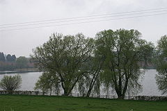
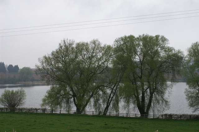
Location Somerset Coordinates 51°07′16″N 3°02′42″W / 51.12111°N 3.045°WCoordinates: 51°07′16″N 3°02′42″W / 51.12111°N 3.045°W Lake type reservoir Primary inflows Durleigh Brook Basin countries United Kingdom Surface area 80 acres (32 ha) Durleigh reservoir at Durleigh in Somerset, England covers 80 acres (32 ha) and was formed in 1938 when Durleigh brook, a tributary of the River Parrett, was dammed.
It is used for coarse fishing, particularly carp, roach, bream, perch, tench and pike.[1]
The reservoir provides facilities for dinghy sailing, sailboarding[2] and windsurfing through Durleigh Sailing Club.[1]
The wildlife includes several bird species including: ducks, great crested grebes, swans and geese.[1]
West Bower Manor (also known as Durleigh Manor), which stands on the shore of the reservoir, is all that remains of a large manorial property, the majority of which has been demolished. Parts of the building date from the 15th century though the core of the fabric may even be earlier, further parts were built in the 17th and 19th centuries.[3]
The principal surviving element from the Medieval manor is the gatehouse. This has been extensively restored, but is a good example of a former courtyard gatehouse with a pair of faceted turrets on either side of the former entrance passageway.
References
- ^ a b c "Durleigh reservoir". Wessex Water. http://www.wessexwater.co.uk/recreation/threecol.aspx?id=534. Retrieved 2009-07-12.
- ^ "Durleigh sailing club". Durleigh sailing club. http://www.durleighsc.org.uk/. Retrieved 2009-07-12.
- ^ "West Bower Manor". Images of England. English Heritage. http://www.imagesofengland.org.uk/Details/Default.aspx?id=269272. Retrieved 2009-01-06.
Categories:- Drinking water reservoirs in England
Wikimedia Foundation. 2010.