- Dollar, Ontario
-
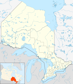
Dollar Settlement Country Canada Province Ontario Regional Municipality York Municipality Markham Elevation 200 m (656 ft) Coordinates 43°50′41″N 79°22′56″W / 43.84472°N 79.38222°W Timezone Eastern Time Zone (UTC-5) - summer (DST) Eastern Time Zone (UTC-4) Area code 905, 289, 365 Dollar is a former community of Markham Township, Ontario, Canada and was located near the corner of Leslie Street (3rd Line) and Highway 7. In 1869, Dollar was granted a post office, which was located on the north-west corner of Line 3 (Leslie) and Highway 7.[1] In 1871 Dollar also had general store, a blacksmith shop and a church. The Zion Wesleyan Methodist Church was built about 1870 on Lot 10, Concession 3, on the east side of Line 3, just south of the intersection.[2]
With the arrival of the railroad through Markham Village and Unionville in the 1870s, the importance of smaller communities like Dollar began to fade. When rural mail delivery was instituted in 1914, Dollar was put on Rural Route #2, Gormley.
In 1962 the name "Dollar" was rescinded and the hamlet ceased to exist. On January 1, 1971, the north side of Ontario Highway 7 was annexed to the Town of Richmond Hill. The last three historical homes were demolished in 1972 to prepare for the construction of the Best Western Parkway Hotel Toronto North (Richmond Hill). Today the former hamlet of Dollar is in close proximity to Ontario Highway 404. The Town of Markham is planning for significant future development on the south side of the intersection.
References
- ^ See the detailed 1878 map, "Township of Markham," Illustrated historical atlas of the county of York and the township of West Gwillimbury & town of Bradford in the county of Simcoe, Ont. (Toronto: Miles & Co., 1878).
- ^ See Isabel Champion, ed., Markham: 1793-1900 (Markham, ON: Markham Historical Society, 1979), pp. 233; 230; 225; 339; 158f., 180f.
Communities of Markham Angus Glen • Armadale • Berczy Village • Box Grove • Brown's Corners • Buttonville • Cachet • Cashel • Cathedraltown • Cedar Grove • Cornell • Dickson Hill • Dollar • Downtown Markham • German Mills • Greensborough • Hagerman's Corners • Langstaff • Legacy • Locust Hill • Markham • Markham Village • Milliken • Milnesville • Mongolia • Mount Joy • Quantztown • Raymerville - Markville East • Rouge Fairways • Sherwood - Amber Glen • Thornhill • Underwood • Unionville • Victoria Square • Vinegar Hill • Wismer Commons • Woodbine NorthCommunities in other York Region municipalities: King • Markham • Richmond Hill • Vaughan • Whitchurch–StouffvilleBayview Hill · Bayview North · East Beaver Creek · Dollar · Doncrest · Elgin Mills · Gormley · Jefferson · Jefferson Forest · Lake Wilcox · Langstaff · Oak Ridges · Richmond Hill · Richvale · Temperanceville · Tower HillCommunities in other York Region municipalities: King • Markham • Richmond Hill • Vaughan • Whitchurch–StouffvilleCategories:- Neighbourhoods in Markham, Ontario
- Neighbourhoods in Richmond Hill, Ontario
Wikimedia Foundation. 2010.

