- Unionville, Ontario
Infobox Settlement
official_name = Unionville
other_name =
native_name =
nickname =
settlement_type = Community
motto =
image_dot_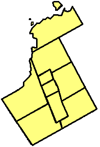
dot_mapsize = 120px
dot_map_caption = Unionville
dot_x = 92 |dot_y = 118
pushpin_
pushpin_label_position =
pushpin_map_caption =
pushpin_mapsize =
subdivision_type =Country
subdivision_name =
subdivision_type1 = Province
subdivision_name1 =
subdivision_type2 =Regional Municipality
subdivision_name2 = York
subdivision_type3 =Town
subdivision_name3 = Markham
subdivision_type4 =
subdivision_name4 =
leader_title = Founder
leader_name =William Berczy
area_magnitude =
unit_pref = Imperial
area_footnotes =
area_total_km2 =
area_land_km2 =
area_water_km2 =
area_total_sq_mi =
area_land_sq_mi =
area_water_sq_mi =
area_water_percent =
area_urban_km2 =
area_urban_sq_mi =
area_metro_km2 =
area_metro_sq_mi =
area_blank1_title =
area_blank1_km2 =
area_blank1_sq_mi =
population_note = Federal Electoral District Profile of Markham-Unionville, Ontario 2001 Census
population_total = 112,090
population_density_km2 =
population_density_sq_mi =
population_metro =
population_density_metro_km2 =
population_density_metro_sq_mi =
population_urban =
population_density_urban_km2 =
population_density_urban_sq_mi =
population_blank1_title =
population_blank1 =
population_density_blank1_km2 =
population_density_blank1_sq_mi =
timezone =Eastern Standard Time (EST)
utc_offset = -5
timezone_DST =Eastern Daylight Time (EDT)
utc_offset_DST = -4
latd= |latm= |lats= |latNS=
longd= |longm= |longs= |longEW=
elevation_footnotes =
elevation_m = 200
elevation_ft =
postal_code_type = Postal Code span
postal_code = L3R, L3S, L6G
area_code = 905, 289
blank_name =
blank_info =
blank1_name =
blank1_info =
website =
footnotes = Unionville is a suburban community in Markham,Ontario ,Canada . It is located 33 km northeast of downtownToronto and 4 km east of southern Richmond Hill. Main Street, which was Kennedy Road in the mid to late 20th century, runs through Unionville while the new Kennedy runs 300 m to the east. Buttonville is located in the west central part of Markham.The population is presently about 110,000 including the area of Denison. Rouge River runs north of the central part of Unionville and to the southeast. The highway (Highway 404) is to the west, the nearest interchange with the
407 ETR is 2 km south on Kennedy Rd. The population lives in almost all parts of Unionville except for the south central industrialized area. The railway line which links the area to Toronto viaGO Train Service once ran as far as Lindsay, a town near Peterborough.Tourism is a major part of Unionville'seconomy . The historic village or downtown section of Unionville is typical of a small town that developed over a century or so starting in the early 1840s through the middle to late 20th century. The historic Main Street Unionville attracts thousands of visitors each year - as of2006 it boasted 9 restaurants, including 3 pubs. Main Street also has a number of "century homes" dating back to the 1800s. Each year, thousands visit Unionville during theUnionville Festival .The main street has been used as a stand-in for fictional Connecticut town
Stars Hollow during the first season ofThe WB 's (nowThe CW ) "Gilmore Girls " television show, as well as other television and movie backdrops.Most of the historic buildings in Unionville are included in
List of historic buildings in Markham, Ontario .Geography
Once surrounded by farmlands, the village is now surrounded by suburban housing tracts. During the revival period in the 1970s a ban was placed on development for 25 years, but that time has now passed.
There is concern about how the village is now turning into a city, with all the new homes being build on farm lands, and heritage buildings being knocked down for new homes. Today Unionville has less then 10% of farm lands as there was in the mid 1990's.
History
Beginnings of the village
When the community that would come to be known as Unionville was in its infancy, it was located near the cross roads of the 16th Line (16th Ave) and the 6th Concession (Kennedy Rd.).
The earliest settlers in Unionville were
Germans who had come withWilliam Berczy from nearHamburg, Germany to theUnited States , and subsequently into Markham Township. Among the first to arrive in the Unionville area was Philip Eckardt, a Berczy settler, who settled on land at the corner of 16th Ave. and Kennedy Road in 1808. Eckardt, in 1794, was alloted land between Steeles Avenue and 14th Avenue. Later he acquired land where the current highway 407 crosses Kennedy Road. In the early years of the 19th century he and his family of 17 children had moved to the corner of 16th Avenue and Kennedy Road. This land had been granted to Frederick Westphalen, also a Berczy settler, in 1803. Thelog house , still standing behind the Berczy Cemetery on “Cemetery Hill” north of Unionville on Kennedy Road, was built either by Westphalen or Eckardt and is believed to be the oldest surviving house in the Town of Markham.In this early image, the original one-storey log structure has been raised above a later frame-clad ground level. In the 20th century, the house was modified yet again, with the lower storey removed, and the log structure returning to ground level.
Philip Eckardt (d. 1845) was a leading figure in the early days of Unionville. His log house on Cemetery Hill was used for
Lutheran worship until a church was built on the lot in 1819.Another example of pioneer housing in the Unionville area, this log cabin is believed to have been located on the slope of Hagerman’s Hill, lot 7, Concession 6 (east side of Kennedy Road, north of 14th Avenue). This land was part of the original Crown Grant to Berczy settler Philip Eckardt. The cabin may have been built prior to 1808 on the SW 50 acres of his grant. In the early days of settlement, log structures like this one dotted the landscape, set in small clearings surrounded by dense forest. As soon as settlers could afford it, they replaced the log cabin with a more sophisticated structure in frame, stone or brick, and demoted the cabin to service as alivestock barn or a farmyard storage shed. By the time of the 1851Census , only 7 log houses remained in Unionville Village, compared to 23 frame homes, 1 board, 2 mud, and one of brick. In this photograph taken circa 1909, the prairie-like landscape visible beyond the cabin is a reminder of the extensive clear-cutting practiced by early settlers.Early developments
In the 1840s Ira White built the
Union Mills south of the core of the village along the southwest bank of the Rouge River. The location of the mill in this area had the effect of drawing the centre of activity south from its original location. The laneway to the mill along the 6th concession from the south curved westward to avoid the low ground along the Rouge River. When lots were subdivided along this road, as the community began to centre around the mill, this curve was maintained and remains to this day.The Union Mills was the hub of village life until the coming of the
Toronto and Nipissing Railway in 1871. Even after the railway, it remained in business for many years, latterly as a chopping mill and feed store, until it burnt to the ground in 1934. Likely no other business had such a significant impact on the course and location of the early development of Unionville.One of the most distinctive buildings in Unionville, the Stiver Mill, built c. 1916 and used at various times both as a coal mill and as a flour mill, is now closed up, and the town would very much like to find some person or group to take it over and find a sustainable use for it. There is a local group of heritage enthusiasts who are researching this possibility, as they do not wish to see one of the last standing mills in Ontario go down, especially when the interior "mechanics" of the mill operation are still in working order.
What's in a name? The naming of Unionville
The name of Unionville is believed to have come from the Union Mills owned by Ira White, a miller, in the 1840s. Mr. White may have taken the name from the Act of Union, which united the provinces of Upper and
Lower Canada (nowOntario andQuebec ) in 1841.The name, at least officially, appears to have been given to the village sometime between 1846 and 1851. Smith’s Canadian Gazetteer of 1846 makes no mention of the name, however, The Canada [Ontario] Directory of 1851 refers to Unionville as; “A Village situated in the Township of Markham, County of York, C. W. [Canada West] – distant from Toronto, 19 miles.”
In 1851, Unionville appears to have reached a fair level of prosperity, supporting a mill, a doctor, a general store, a watchmaker, three blacksmiths and three wagonners; as well as three churches:
Methodist ,Lutheran , andChurch of England .Unionville Post Office
Sources conflict over the exact date when the Unionville Post Office was established. There is evidence of a short-term establishment beginning c. 1832, with E. H. Whitmarsh as
postmaster , which had disappeared by 1835. The establishment of a permanentpost office in Unionville appears to have occurred in 1851, with Andrew Eckardt, the son of Philip Eckardt, becoming postmaster. The “Canada [Ontario] Directory” of 1851 makes reference to “Eckartd, A., postmaster and general storekeeper.”The establishment of a post office was a significant development in any community. It symbolized its coming of age and literally put a community on the map. For the residents of the new postal community of Unionville it meant a stronger connection with the outside world had been created, where communication between friends and family would become faster and easier.
Unionville Library
The Unionville library, completed in 1984, serves as a major cultural facility in the historic village center. The 14,000 sf library plan is based on a traditional village square surrounded by eight houses of books expressed on the exterior as postmodern Victorian dormers. The library, which contains approximately 100,000 books and audiovisual materials, was designed by architect
Barton Myers .Recent history
In the 1960s, major housing development came to Unionville and continues through today. Having old buildings available at low cost, a number of antique businesses sprang up and for a while in the 1970s Unionville ranked high on the list of places to go to get antiques. After the commitment to a bypass was realised, in the 1970s, entrepreneurs appeared. The Old Country Inn opened for business and Old Firehall Sports brought a new clientele to the village. Over the next decades, the antique places disappeared being replaced by high-end antique and replica outlets, restaurants, pubs, and clothing establishments. Tourism was born. Starbucks appeared in the late 1990s. Many of the buildings have been spruced up, extended and upgraded to meet this new reality. The old original road, to the immediate east of Main Street, once considered to be swamp land, has been converted to a large parking lot.
Walking paths through the local conservation lands connect directly to the village roads. One of the most used being the path around Toogood Pond, the mill pond from the 1840s that powered the grist mill. In the early 20th century the pond was called Willow Pond or Willow Lake and was the home to several small summer cottages on north Main Street. Some had been cottages, for grist mill workers, in their earliest incarnation. Those cottages evolved into homes by the middle of the century, but are almost all gone now being replaced by large spacious expensive homes.
The Varley Art Gallery now stands at the north end of the commercial Main Street and is rapidly becoming a gallery of wide renown. It was started with the contributions of Mrs. McKay, who had supported Group of Seven artist Fred Varley for the later part of his life. Living in her home on Main Street Unionville, he did several paintings that are now part of the Art Gallery collection and the home is now part of the Art Gallery's holdings, being used for small art shows on a regular basis.
In the mid-1990s until the summer of 1999, Highway 407 was under construction. It is Ontario's first
toll road and was first opened the summer of 1998 atMcCowan Road . It was later extended to Brock Road.The Unionville Arms, a well known pub, burnt down on November 30th 2007. It had been in business for 19 years prior. The building itself was over a century old. The legendary building caught fire in the morning and the fire was put out 3 hours later. No one was hurt. Repairs seem possible as the façade is fairly intact, with most of the damage being to the back and roof.
Culture
The
Unionville Festival was first organized in 1969 to raise awareness and money to fight the provincial plan to run a four lane highway up the middle of the town and thus destroying it. An interest in history, spurred by the Canadian Centennial Year in 1967, awoke the long time residents and the new subdivision residents. Slowly, local politicians got on board, and a plan was drawn up to divert the road to the east of the little town center. Today the festival continues to offer visitors access to handcrafts, small vendors and community groups. Virtually none of the businesses from the mid 20th century still exist, having been replaced by restaurants and tourist outlets.The Unionville Business Improvement Area and its merchants, organize and operate numerous, year-round, admission free, festivals and events. The Merchants of Main Street Unionville BIA is the business association on Main Street Unionville, composed of volunteers from the business community, who work to preserve and promote the historical village of Unionville. [Main Street Unionville Official Guide, 2008]
* [http://www.unionvilleinfo.com/Events/EventPages/familyday2008.htm February 18 - Unionville Family Day]
* [http://www.unionvilleinfo.com/Events/marchevents2008.htm March 21-23 - Unionville Easter Weekend]
* [http://www.unionvilleinfo.com/Events/EventPages/weddingshow.htm March 22 - Unionville Wedding Show]
* [http://www.unionvilleinfo.com/Events/mayevents2008.htm May 11 - Mother's Day In Unionville]
* [http://www.unionvilleinfo.com/Events/mayevents2008.htm May 19 - Victoria Day in Unionville]
* [http://www.unionvilleinfo.com/Events/june2008events.htm June 7 & 8 - Unionville Festival]
* [http://www.unionvilleinfo.com/Events/juneevents.htm June 15 - Father's Day in Unionville]
* [http://www.unionvilleinfo.com/Events/july2008events.htm July 1 - September 1 - Unionville Summer Concert Series]
* [http://www.unionvilleinfo.com/Events/july2008events.htm July 1 - Unionville Canada Day]
*July 12 & 13 - Unionville Celtic Festival
*August 4 - Unionville Simcoe Day Festival
*August 8-10 & 14-7 - Unionville JAZZ ON MAIN Festival
*August 23 & 24 - Doors Open Markham & Heritage Train Rides
*September 1 - Unionville Heritage & Big Band Festival
*September & October - Unionville Heritage Harvest
*October 13 - Unionville Little Oktoberfest
*October 26 - Halloween on Main Street
*November 11 - Unionville Remembrance Day Service
*November 14 & 15 - Unionville Moonlight Madness
*December 5-7 - Unionville Olde Tyme Christmas
*December 6 & 7 - Unionville Santa Trains
*December 11-23 - Late Night Shopping
*December 26-31 - Boxing Day EventsThe Unionville BIA's Heritage Committee has seen its volunteers research and produce a self-guided walking tour. They also offer the official walking tours of Main Street Unionville.
Politics
Unionville is currently a part of the following districts:
* Ward 3, represented by Councilor Joe Virgilio
*Markham—Unionville , provincial electoral riding, represented by Michael Chan (Liberal)
*Markham-Unionville , federal electoral riding, represented byJohn McCallum (Liberal)Education
*
Aldergrove Public School
*Buttonville Public School
*Central Park Public School
*Coledale Public School
* James Robinson Public School
* John XXIII Catholic Elementary School
*Markville Secondary School
*Milliken Mills Public School
* Parkview Public School
* St. Matthew Catholic Elementary School
* St. Justin Martyr Catholic Elementary School
* Unionville High School
* Unionville Meadows Public School
* Unionville Public School
*William Berczy Public School
*Ramer Wood Public School
* St. Augustine Catholic High SchoolTransportation
*
*York Region Transit
* Viva
*
*Toronto Transit Commision Notable Residents
*
Hayden Christensen ofStar Wars fame attended Unionville High School.
*Emmanuelle Chriqui - Canadian actress currently ofEntourage (TV Series) fame and who also appeared in "On the Line", "Snow Day", and "In the Mix".
*Anna Russell - English–Canadiansinger andcomedienne - Anna Russell Way is named after her.
*Steven Stamkos a Canadian ice hockey player of theTampa Bay Lightning Nearest communities
*Buttonville, west
*Stouffville, north
*Markham, east
*Scarborough, southReferences
External links
*
List of historic buildings in Markham, Ontario Unionville websites
* [http://www.unionvilleinfo.com/ Unionville Main Street]
* [http://www.markham.ca/mpl/hot%20topics/ht_unionvillefestival.htm Unionville Festival]
* [http://www.markham.ca/mpl/history/unionville_150th.htm Unionville 150th: Origins of a Community]Map and aerial photos
** [http://www.mapquest.com/maps/map.adp?formtype=address&country=CA&pop
]
** [http://terraserver.microsoft.com/map.aspx?t=1&s=14&lon=43.9&lat=-79.575&w=750&h=500 Aerial photograph from Microsoft Terraserver]Canadian City Geographic Location
North=Cachet, Berczy Village
West=Buttonville
Center=Unionville
East=Markham
South=Scarborough
Wikimedia Foundation. 2010.