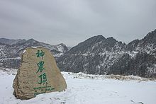
- Shennongjia
-
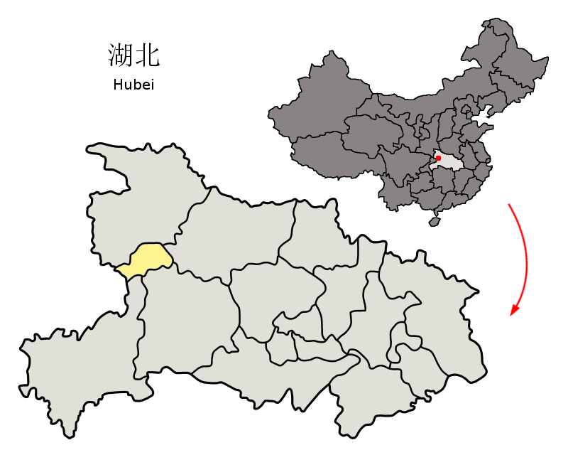
 Location of Shennongjia within China and within Hubei
Shennongjia Forestry District (simplified Chinese: 神农架林区; traditional Chinese: 神農架林區; pinyin: Shénnóngjià Línqū) is a county-level administrative unit (a "forestry district") in Hubei province, directly subordinated to the provincial government. It occupies 3,253 square kilometers in western Hubei, and, as of 2007 had the resident population estimated at 74,000 (with the registered population of 79,976).
The population is predominantly (95%) Han Chinese, the remaining 5% being mostly Tujia.
Contents
Administration
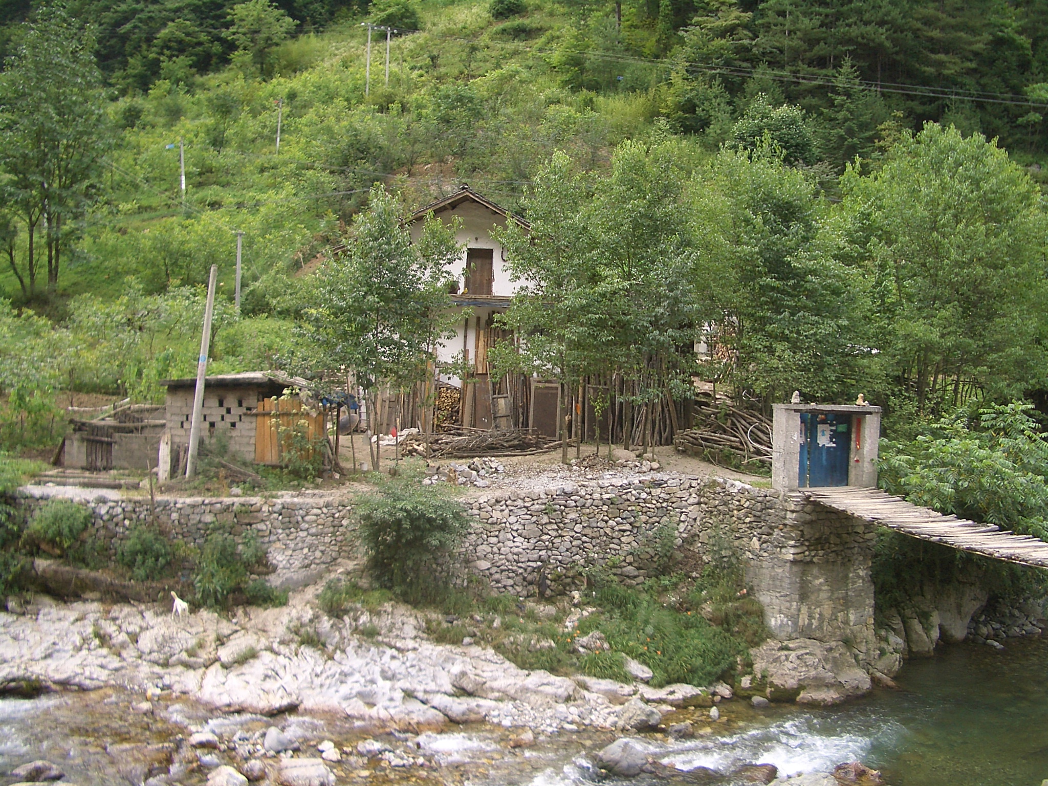
 An isolated farmhouse near Wenshui Village, Hongping Town
The administrative status of Shennongjia is rather unique, in that it is the only county-level administrative unit of the People's Republic of China that is designated a "forestry district" (林区), rather than a more usual county or county-level city.
Shennongjia's status within Hubei is also somewhat unusual, in that this county-level unit is directly administered by the provincial government as opposed to be part of a prefecture-level city or prefecture, as are Hubei's all "normal" counties. However, this arrangement is not unique to Shennongjia, as Hubei also has three county-level cities (Xiantao, Tianmen, Qianjiang) which are directly under the provincial government, without being part of a prefecture-level unit.
The district was created in 1970 from the adjacent areas of Badong County, Xingshan County, and Fang County.
Geography and nature
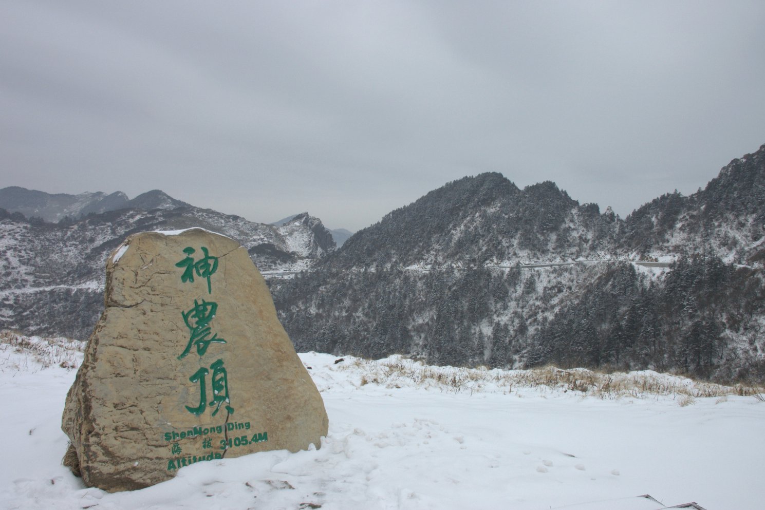
 On top of the Shennong Deng
Shennongjia Forestry District is named after the Shennongjia mountainous massif, which is usually considered to be the eastern (and the highest) section of the Daba Mountains (Daba Shan). It lies within the Daba Mountains evergreen forests ecoregion.[1] Some of Hubei's highest mountains - which are also the highest mountains of the Daba Shan - are located within the district. The three tallest peaks, located west of Muyu town, are Shennong Deng (3105 m elevation), Da Shennongjia (3052 m), and Xiao Shennongjia (3005 m, on the border with Badong County). Laojun Shan, 2936 m tall, is located northeast of Muyu.
The mountains of Shennongjia form a divide between two parts of the district: the central and northern part drains north, into the Han River (a tributary of the Yangtze which joins the Yangtze much further east, in Wuhan), while the southern section drains into the Yangtze in a more direct way, via a number of short streams flowing south, such as Shen Nong Stream.
 Entrance to Shennongjia National Nature Reserve
There are a number of conservation areas in the district's mountains and wetlands, in particular the world-famous Shennongjia National Nature Reserve (神农架国家自然保护区), listed on UNESCO's World Network of Biosphere Reserves.[2] The reserve includes 2,618 km² of forest,[3] and, due to a variety of natural conditions at different elevations, has high plant diversity. One survey by Chinese botanists reports 3,479 higher plant species found in a certain area.[4] The protected animal species include Golden Snub-nosed Monkey, whose population in the district was reported to have grown between 1990 and 2005 from 500 to over 1200. A specially protected 100-square-km area is designated for this endangered primate species.[5]
The county seat is in Songbai Town in the northern of the district; the main tourist center is Muyu Town, near the southern border of the district.
There are numerous tourist attractions throughout the district, but most of the district is closed to foreign tourists, with the exception of a narrow strip along its southern border (south of Yazikou Junction). The open area includes the Shennongjia National Nature Reserve.
Economy
 A hydroelectric dam under construction south of Hongping Town, Shennongjia
The district is mountainous and (as its name suggested) heavily forested, which, historically, made forestry the main industry. Over 100,000 cubic meters of timber was produced in the district annually from the 1960s to 1980s[5] (over 1,000,000 m³ in the 1970s[3]), but in the late 1990s the focus was switched from logging to forest conservation. [5] Officially, felling of natural forest completely ceased in March 2000.[3]
 Tea plantations on a valley slope north of Muyu
The district's low population, compared to a typical Hubei county of a similar size, means comparatively small amount of agriculture; nonetheless, the district tries to put itself on the world map as a tea producer. There are mining operations throughout the district.
As elsewhere in the mountainous western Hubei, numerous small hydroelectric plants utilize the energy of Shennongjia's rivers and streams.
Numerous tourist facilities operate along the China National Highway 209, in particular in and around Muyu Town.
On average, the area remains comparatively poor, with the GDP per capita lower than any of Hubei's prefecture-level units.[3] Of course, direct comparison between Shennongjia and a prefecture-level unit of Hubei such as Yichang or Huangshi can be misleading, since nearly all of Hubei's prefecture-level units have a large urbanized core (with corresponding higher incomes), while Shennongjia does not.
Transportation
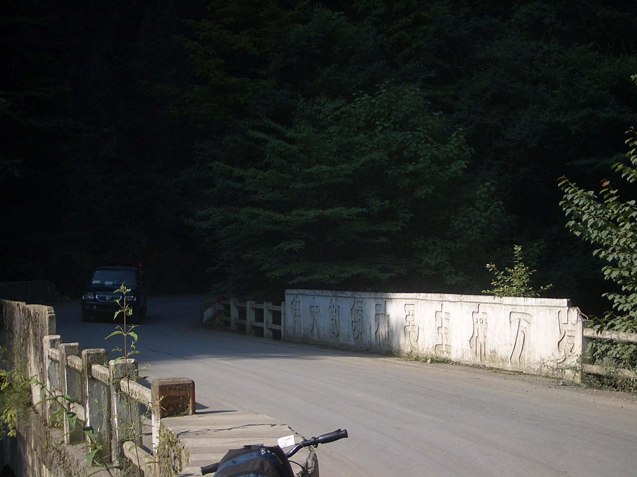
 A Cultural Revolution-era bridge on G209
The main north-south route throughout the district is China National Highway 209 (G209), which, however, is still "unimproved" in many places both within district (north of the national park entry at Yazikou) and in Badong County south of it. In practice most visitors enter the district from its southern border, traveling along a provincial highway from Yichang, which merges with G209 near Gaoyang in Xingshan County. This route is a good paved road, designated as the Yi-Shen (Yichang-Shennongjia) Route.
Hubei Provincial Route 307 (S307) runs through the northeastern part of the district, from G209 east to Songbai Town and on into the neighboring Baokang County (part of Xiangfan prefecture-level city).
Due to the mountainous terrain, the district has no rail or water transport. However, construction of Shennongjia Airport started in April 2011 with an investment of 1 billion yuan.[6]
References
- ^ Olson, D. M, E. Dinerstein, et al (2001). "Terrestrial Ecoregions of the World: A New Map of Life on Earth". BioScience 51 (11): 933–938. doi:10.1641/0006-3568(2001)051[0933:TEOTWA]2.0.CO;2. http://gis.wwfus.org/wildfinder/.
- ^ Shennongjia Nature Reserve (UNESCO World Heritage site)
- ^ a b c d What's wrong in Shennongjia?
- ^ Altitudinal Pattern of Plant Species Diversity in Shennongjia Mountains, Central China. Authors: ZHAO, Chang-Ming1; CHEN, Wei-Lie; TIAN, Zi-Qiang; XIE, Zong-Qiang. Source: Journal of Integrative Plant Biology, Volume 47, Number 12, December 2005 , pp. 1431-1449(19). Publisher: Blackwell Publishing
- ^ a b c Number of golden monkeys doubled (Xinhua, www.chinaview.cn, 2005-08-08)
- ^ 神农架机场4月正式动工 从武汉起飞50分钟航程
Hubei Province county-level divisions Wuhan: Jiang'an District · Jianghan District · Qiaokou District · Hanyang District · Wuchang District · Qingshan District · Hongshan District · Dongxihu District · Hannan District · Caidian District · Jiangxia District · Huangpi District · Xinzhou District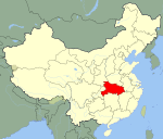 Hubei in China
Huangshi: Huangshigang District · Xisaishan District · Xialu District · Tieshan District · Daye City · Yangxin County
Shiyan: Zhangwan District · Maojian District · Danjiangkou City · Yun County · Zhushan County · Fang County · Yunxi County · Zhuxi County
Jingzhou: Shashi District · Jingzhou District · Shishou · Honghu City · Songzi City · Jiangling County · Gong'an County · Jianli County
Yichang: Xiling District · Wujiagang District · Dianjun District · Xiaoting District · Yiling District · Zhijiang City · Yidu City · Dangyang City · Yuan'an County · Xingshan County · Zigui County · Changyang Autonomous County · Wufeng Autonomous County
Xiangyang: Xiangcheng District · Fancheng District · Xiangzhou District · Laohekou City · Zaoyang City · Yicheng City · Nanzhang County · Gucheng County · Baokang County
Ezhou: Echeng District · Liangzihu District · Huarong District
Jingmen: Dongbao District · Duodao District · Zhongxiang City · Shayang County · Jingshan County
Xiaogan: Xiaonan District · Yingcheng City · Anlu City · Hanchuan City · Xiaochang County · Dawu County · Yunmeng County
Huanggang: Huangzhou District · Macheng City · Wuxue City · Hong'an County · Luotian County · Yingshan County · Xishui County · Qichun County · Huangmei County · Tuanfeng County
Xianning: Xian'an District · Chibi City · Jiayu County · Tongcheng County · Chongyang County · Tongshan County
Suizhou: Zengdu District · Guangshui City · Sui County
Enshi: Enshi City · Lichuan City · Jianshi County · Badong County · Xuan'en County · Xianfeng County · Laifeng County · Hefeng County
Xiantao: (no intermediate County-level divisions, see Administration of Xiantao.)
Tianmen: (no intermediate County-level divisions, see Administration of Tianmen.)
Qianjiang: (no intermediate County-level divisions, see Administration of Qianjiang.)
Shennongjia: (no intermediate County-level divisions, see Administration of Shennongjia.)■ = Sub-provincial city ■ = Prefecture-level city ■ = Autonomous prefectures ■ = Sub-prefecture-level divisionHubei Province county-level divisions Wuhan: Jiang'an District · Jianghan District · Qiaokou District · Hanyang District · Wuchang District · Qingshan District · Hongshan District · Dongxihu District · Hannan District · Caidian District · Jiangxia District · Huangpi District · Xinzhou District
Hubei in China
Huangshi: Huangshigang District · Xisaishan District · Xialu District · Tieshan District · Daye City · Yangxin County
Shiyan: Zhangwan District · Maojian District · Danjiangkou City · Yun County · Zhushan County · Fang County · Yunxi County · Zhuxi County
Jingzhou: Shashi District · Jingzhou District · Shishou · Honghu City · Songzi City · Jiangling County · Gong'an County · Jianli County
Yichang: Xiling District · Wujiagang District · Dianjun District · Xiaoting District · Yiling District · Zhijiang City · Yidu City · Dangyang City · Yuan'an County · Xingshan County · Zigui County · Changyang Autonomous County · Wufeng Autonomous County
Xiangyang: Xiangcheng District · Fancheng District · Xiangzhou District · Laohekou City · Zaoyang City · Yicheng City · Nanzhang County · Gucheng County · Baokang County
Ezhou: Echeng District · Liangzihu District · Huarong District
Jingmen: Dongbao District · Duodao District · Zhongxiang City · Shayang County · Jingshan County
Xiaogan: Xiaonan District · Yingcheng City · Anlu City · Hanchuan City · Xiaochang County · Dawu County · Yunmeng County
Huanggang: Huangzhou District · Macheng City · Wuxue City · Hong'an County · Luotian County · Yingshan County · Xishui County · Qichun County · Huangmei County · Tuanfeng County
Xianning: Xian'an District · Chibi City · Jiayu County · Tongcheng County · Chongyang County · Tongshan County
Suizhou: Zengdu District · Guangshui City · Sui County
Enshi: Enshi City · Lichuan City · Jianshi County · Badong County · Xuan'en County · Xianfeng County · Laifeng County · Hefeng County
Xiantao: (no intermediate County-level divisions, see Administration of Xiantao.)
Tianmen: (no intermediate County-level divisions, see Administration of Tianmen.)
Qianjiang: (no intermediate County-level divisions, see Administration of Qianjiang.)
Shennongjia: (no intermediate County-level divisions, see Administration of Shennongjia.)■ = Sub-provincial city ■ = Prefecture-level city ■ = Autonomous prefectures ■ = Sub-prefecture-level divisionCoordinates: 31°35′00″N 110°29′49″E / 31.5833333°N 110.49694°E
Categories:- County-level divisions of Hubei
- Biosphere reserves of China


Wikimedia Foundation. 2010.