- 2009 North Indian Ocean cyclone season
-
2009 North Indian Ocean cyclone season 
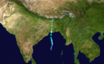
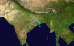
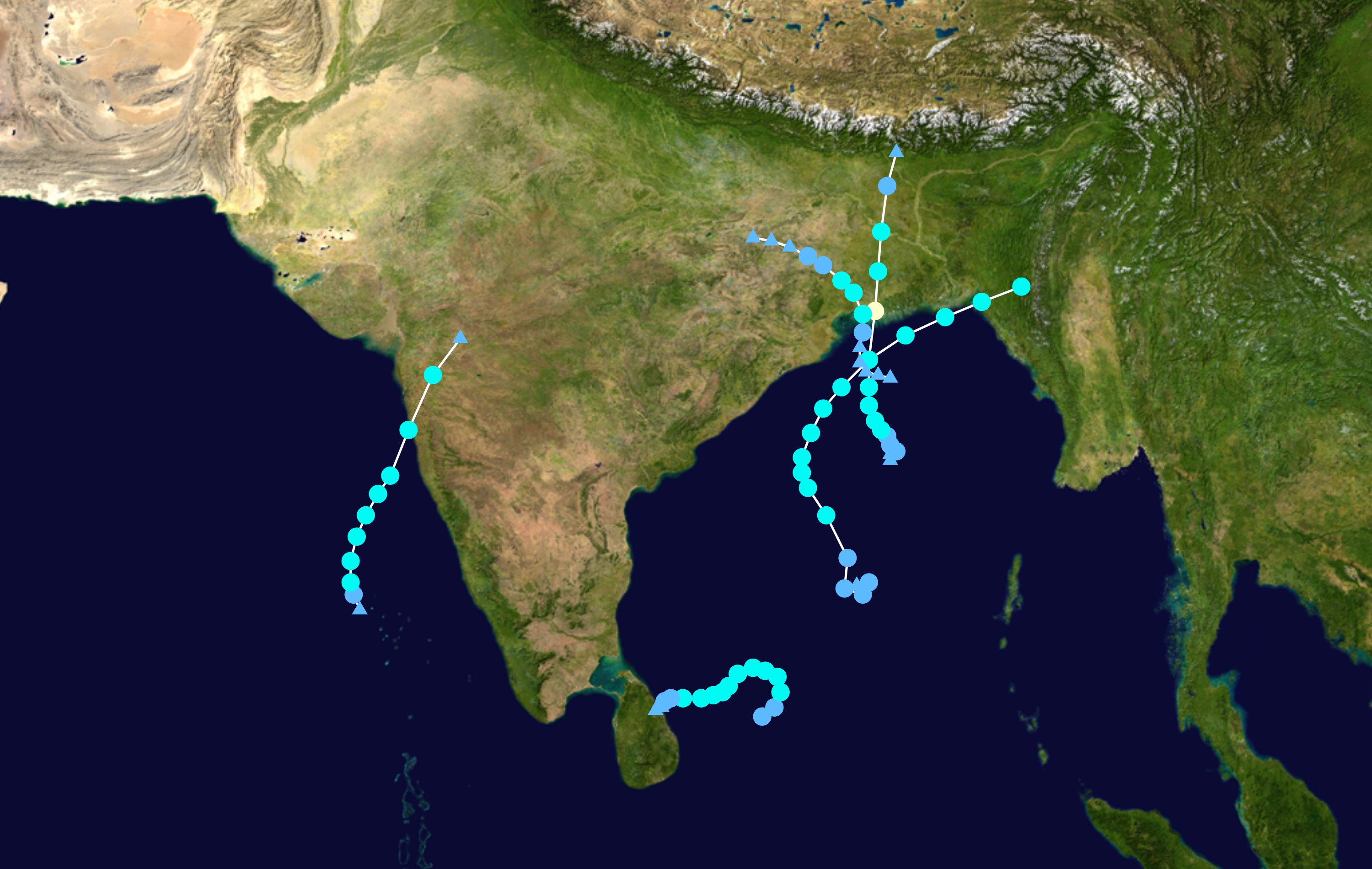
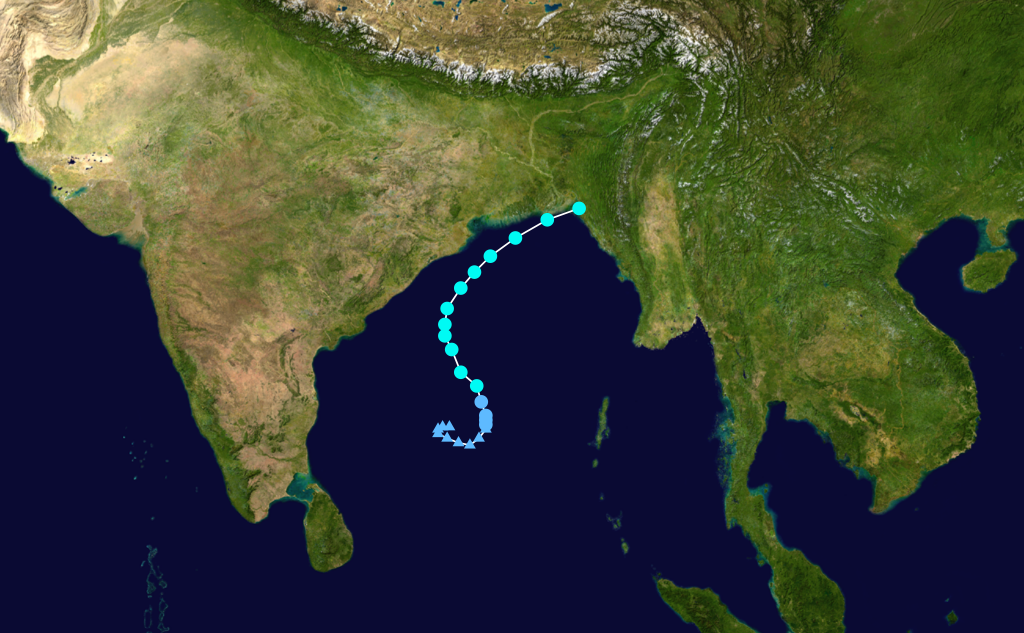
Season summary mapFirst storm formed: April 14, 2009 Last storm dissipated: December 16, 2009 Strongest storm: Aila – 968 hPa (mbar), 110 km/h (70 mph) (3-minute sustained) Depressions: 8 Deep depressions: 6 Cyclonic storms: 4 Severe cyclonic storms: 1 Very severe cyclonic storms: 0 Super cyclonic storms: 0 Total fatalities: 366 direct, 12 indirect, ~8,208 missing Total damage: $618.4 million (2009 USD) North Indian Ocean cyclone seasons
2007, 2008, 2009, 2010, 2011Related article: - Timeline of the 2009 North Indian Ocean cyclone season
The 2009 North Indian Ocean cyclone season was an event in the annual cycle of tropical cyclone formation. The North Indian Ocean cyclone season has no official bounds, but cyclones tend to form between April and December, with peaks in May and November. These dates conventionally delimit the period of each year when most tropical cyclones form in the northern Indian Ocean.
The scope of this article is limited to the Indian Ocean in the Northern Hemisphere, east of the Horn of Africa and west of the Malay Peninsula. There are two main seas in the North Indian Ocean — the Arabian Sea to the west of the Indian subcontinent, abbreviated ARB by the India Meteorological Department (IMD); and the Bay of Bengal to the east, abbreviated BOB by the IMD.
The official Regional Specialized Meteorological Centre in this basin is the India Meteorological Department (IMD), while the Joint Typhoon Warning Center releases unofficial advisories. The tropical cyclone scale for this basin is detailed on the right. On average, 4 to 6 storms form in this basin every season.[1]
Contents
Seasonal Summary

Storms
Cyclonic Storm Bijli
Cyclonic storm (IMD) Tropical storm (SSHS) 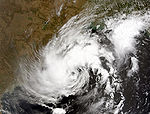

Duration April 14 – April 17 Intensity 75 km/h (45 mph) (3-min), 996 mbar (hPa) Main article: Cyclone BijliOn April 13, an area of shower and thunderstorms became slightly organized over the central Bay of Bengal.[2] Later that day, an area of low pressure developed underneath the convection as the system developed. Weak banding features also formed around the periphery of the storm.[3] By April 14, deep convection persisted around the center of circulation;[4] following the development the RSMC in New Delhi, India designated the system as Depression BOB 01.[5] Following further development, the Joint Typhoon Warning Center (JTWC) issued a Tropical Cyclone Formation Alert (TCFA) as they anticipated the system to develop into a tropical storm.[6] Early the next morning the JTWC reported that the depression had intensified into a tropical storm and designated it as Cyclone 01B. The storm tracked towards the west-northwest due to a mid-level ridge over India.[7] Later that morning RSMC New Delhi reported that the depression had intensified into a deep depression and reported it was expected to intensify into Cyclonic Storm Bijli.[8] Around 1500 UTC, the RSMC New Delhi upgraded the system to a cyclonic storm and gave it the name Bijli.[9] All four ports in Orissa were placed on high alert due to rough seas produced by the storm. A Local Cautionary Signal Number Three was issued for the Gopalpur, Puri, Paradeep and Chandabali ports.[10] On April 16, the storm turned towards the northeast, paralleling the eastern coast of India.[11] Around 0600 UTC, RSMC New Delhi reported that Bijli had reached its peak intensity with winds of 75 km/h (45 mph 3-minute winds).[12] Early on April 17, RSMC New Delhi reported that Bijli had weakened to a deep depression as it moved northwest. Later, RSMC New Delhi downgraded the deep depression to a depression.[13] Late on April 17, RSMC New Delhi reported that Depression ex-Bijli had made landfall near Chittagong, Bangladesh and had rapidly become an area of low pressure over Bangladesh. That night, the JTWC issued their final advisory on Tropical Cyclone 01B as it rapidly weakened over Bangladesh and Myammar.[14]
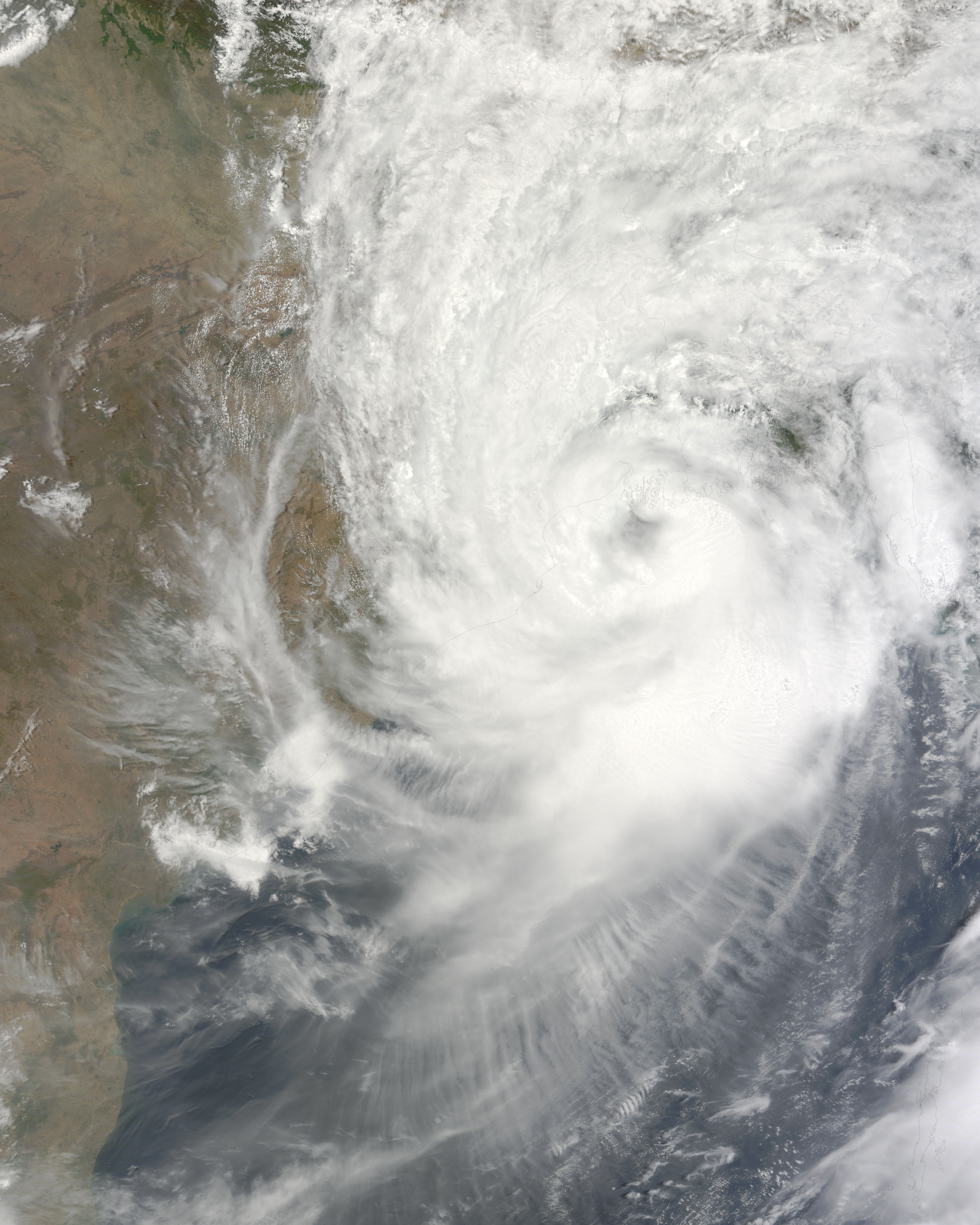
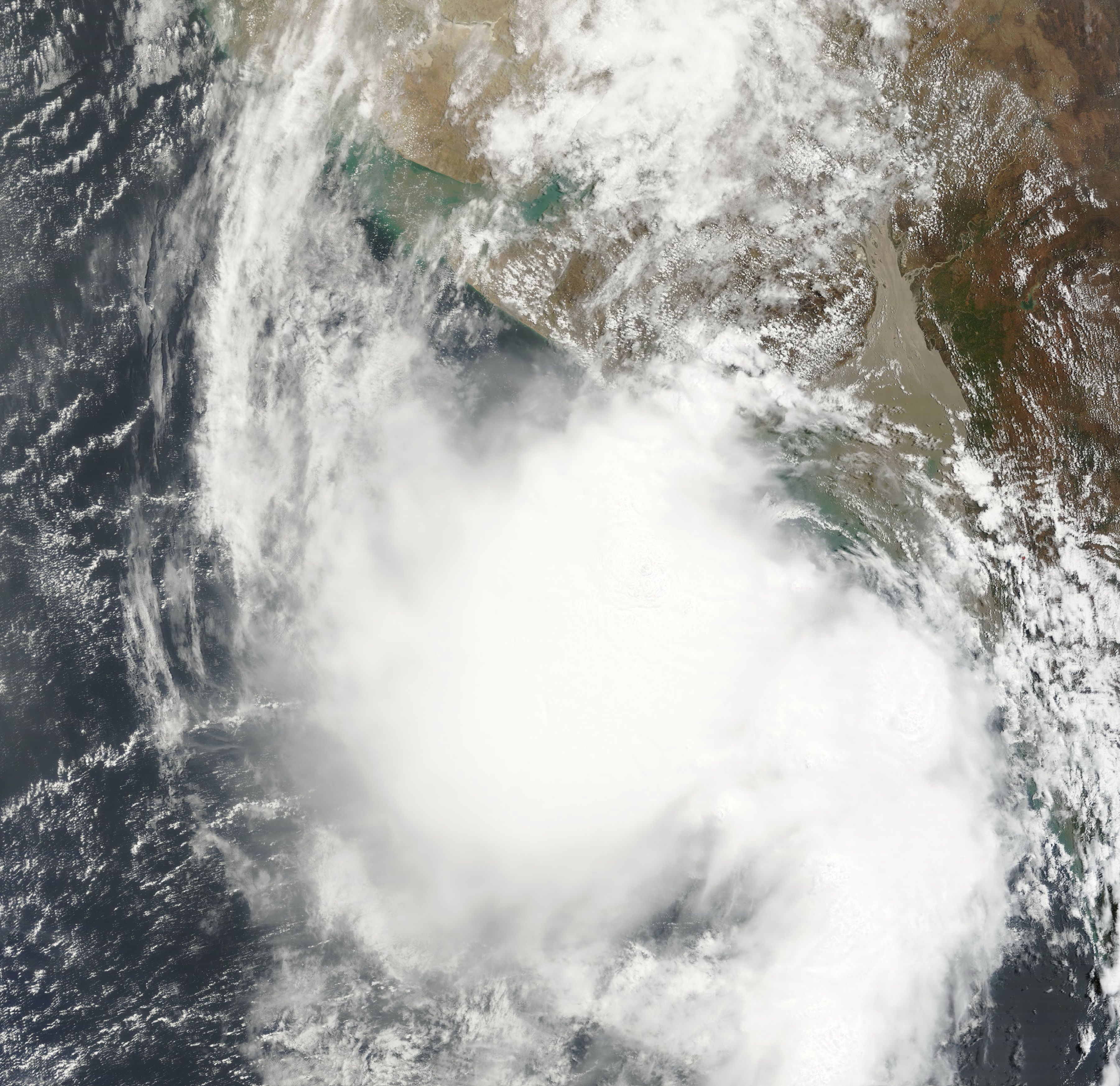
Severe Cyclonic Storm Aila
Severe cyclonic storm (IMD) Category 1 tropical cyclone (SSHS) 
Duration May 23 – May 26 Intensity 110 km/h (70 mph) (3-min), 968 mbar (hPa) Main article: Cyclone AilaLate on May 21, the JTWC reported that a Tropical Disturbance had persisted about 515 nm to the south of Kolkata, India.[15] The disturbance at this time had a broad and poorly orgainsed area of deep convection, which was located to the southeast of the low level circulation center which had consolidated into a single circulation during the previous 12 hours.[15] Environmental analysis indicated that the system was in an area of favorable conditions to develop with low vertical wind shear and warm sea surface temperatures.[15] During May 22 the disturbance developed further with a Tropical Cyclone Formation Alert being issued early the next day by the JTWC as the low level circulation center had become stronger and more defined. Later that morning RSMC New Delhi designated the disturbance as Depression BOB 02.
Depression ARB 01
Depression (IMD) 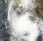
Duration June 23 – June 24 Intensity 45 km/h (30 mph) (3-min), 998 mbar (hPa) Early on June 21, the JTWC reported that an area of low pressure had persisted about 675 km, (420 miles), southwest of Mumbai, India. Multispectral imagery showed that the disturbance had a developing low level circulation center with convection flaring over it and was in an area of low vertical wind shear. Over the next couple of days the disturbance developed gradually with a Tropical Cyclone Formation Alert being issued early on June 23 as the disturbance had continued to organize and consolidated over the last couple of hours. RSMC New Delhi then reported later that morning that Depression ARB 01 had formed and was expected to intensify into a Deep Depression before making landfall, however the depression did not intensify any further before making landfall on the south Gujarat coast later that afternoon. The JTWC then cancelled their Tropical Cyclone Formation Alert, with the IMD issuing their final advisory later that day. It hovered over Gujarat as a well marked area of low pressure before moving towards the northeast and re-emerged into the Arabian sea and regenerated into a Depression. Tropical Depression ARB 01 dissipated early on June 26.
Unusually strong lightning storms associated with the depression killed at least nine people in Gujarat.[16][17] Officials in the region warned residents about the likelihood of severe flooding from the depression. On June 23, upwards of 100 mm (3.9 in) fell in Gujarat prior to landfall.[18]
Depression ARB 02
Depression (IMD) 
Duration June 25 – June 26 Intensity 45 km/h (30 mph) (3-min), 998 mbar (hPa) Early on June 25 at 0900 UTC, the remnants of Depression ARB 01 emerged into the Arabian Sea, and intensified into Depression ARB 02. The storm moved northward, weakened, and maintained its intensity, as a well marked low pressure area over Kutch, and neighbouring areas at 0000 UTC on 26 June 2009. Saurashtra and Kutch experienced active monsoon condition under the influence of this system. Like its parent system, it was mostly monitored by the synoptic and satellite analysis. It was short lived system with a life period of about 25 hours. As a result it did not have any significant impact on rainfall, except over Saurashtra & Kutch.
Moving in a north-northwesterly direction, the Depression, which was located over Saurashtra, Kutch, and neighbouring areas, which was the system, re-intensified into the depression over northeast Arabian Sea, and lay centred near lat. 22.50N/long. 68.50E about 50 km west-northwest of Dwarka and 300 km south-southeast of Karachi at 0900 UTC on 25 June. Moving slowing in a northerly direction, the system weakened into a well marked low pressure area at 0000 UTC on 26 June, over Kutch and its neighbouring regions.
As those places were under the influence of the system, heavy to very heavy rainfall occurred at isolated places Saurashtra & Kutch and isolated heavy rainfall occurred over Gujarat region. But later on June 26, Depression ARB 02 dissipated completely.
Deep Depression BOB 03
Deep depression (IMD) 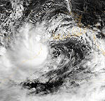

Duration July 20 – July 21 Intensity 55 km/h (35 mph) (3-min), 988 mbar (hPa) Early on July 20, RSMC New Delhi reported that Depression BOB 03 had formed about 120 km (75miles) to the southeast of Digha. Convection had been gradually organizing itself over the last 12 hours, and was in an area of low to moderate vertical wind shear. The Depression then intensified further and became a Deep Depression that afternoon before making landfall between the Orissa and West Bengal coast later that day. The Deep Depression gradually weakened before becoming a low pressure area early the next day.
The remnants of this storm caused heavy to very heavy downpour in coastal Pakistan.[19]
Deep Depression BOB 04
Deep depression (IMD) Tropical storm (SSHS) 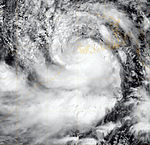
Duration September 5 – September 7 Intensity 55 km/h (35 mph) (3-min), 990 mbar (hPa) Early on September 3, the IMD reported that an area of low pressure had formed embedded within the monsoon off the Orissa coastline.[20] During the next day it developed further with the IMD reporting that the low pressure area had become well marked with deep convection starting to consolidate around a developing low level circulation center in an area of moderate vertical wind shear.[21][22] Early on September 5, as the area of low pressure was moving into an area of low vertical windshear the JTWC issued a Tropical Cyclone Formation Alert, whilst the IMD reported that the low pressure area had intensified into a Depression.[23][24] Later that day the IMD reported that the depression had intensified further and had become a Deep Depression, whilst the JTWC designated the depression as a Cyclone 03B, with winds equivalent to a tropical storm.[25][26] However the JTWC's first warning was also their final warning as the cyclone had made landfall near Digha in West Bengal and was expected to dissipate later that day.[26][27] However the IMD kept issuing advisories on the deep depression until early on September 7, when the IMD reported that it had weakened into a depression and then into a well marked low pressure area later that day when they stopped issuing advisories on the depression whilst it was located over Jharkhand and adjoining region of Chhattisgarh.
One person drowned in Digha after being swept away by high waters. Rainfall from the storm was expected to peak near 250 mm (9.8 in); however, the highest recorded total only reached 76 mm (3.0 in).[28]
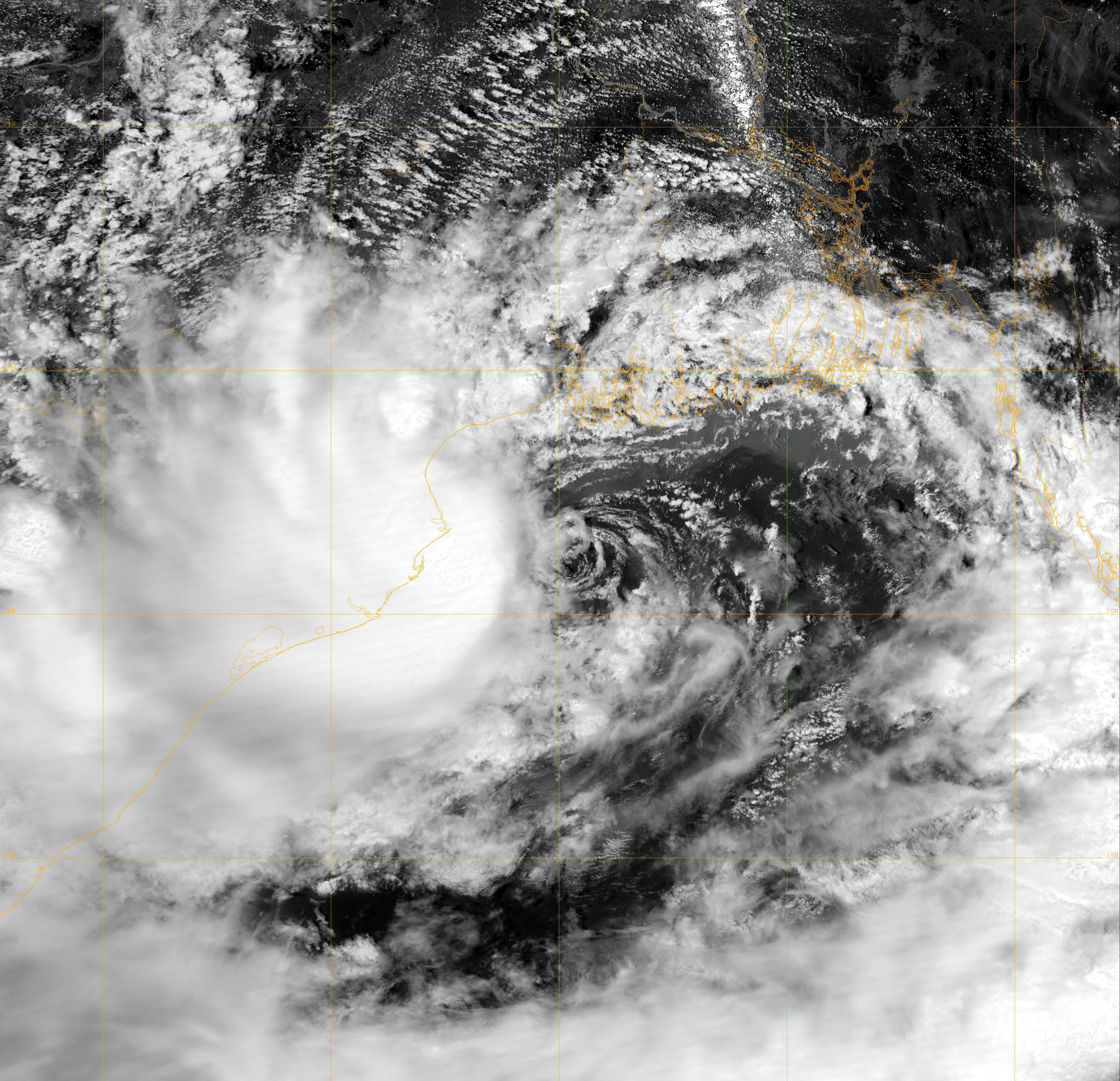
Cyclonic Storm Phyan
Cyclonic storm (IMD) Tropical storm (SSHS) 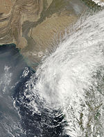
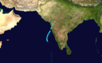
Duration November 4 – November 11 Intensity 85 km/h (50 mph) (3-min), 988 mbar (hPa) Main article: Cyclone PhyanCyclonic Storm Phyan developed as a tropical disturbance to the southwest of Colombo in Sri Lanka late on November 4, 2009. Over the next couple of days the disturbance gradually developed before weakening as it made landfall on Southern India on November 7. After the disturbance had emerged into the Arabian Sea late n November 8 it rapidly became more marked with the India Meteorological Department (IMD) reporting early on November 9 that the disturbance had intensified into a Depression and designated it as Depression ARB 03 whilst the Joint Typhoon Warning Center (JTWC) issued a Tropical Cyclone Formation Alert. Later that day the JTWC designated the system as Cyclone 04A. During the next day as the Depression turned towards the northeast the IMD reported that it had intensified into a Cyclonic Storm and named it as Phyan.
Phyan as a tropical disturbance gave heavy rainfall to Tamil Nadu.Kethi in Nilgiris district of Tamil Nadu got 82 cm in 24 hours,beating the previous 24 hour rainfall record for Tamil Nadu.
Cyclonic Storm Ward
Cyclonic storm (IMD) Tropical storm (SSHS) 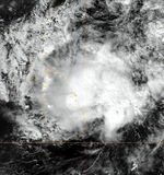
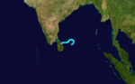
Duration December 10 – December 16 Intensity 85 km/h (50 mph) (3-min), 996 mbar (hPa) On December 10, RSMC New Delhi announced that Depression BOB 05 had formed, about 400 km east-southeast of Batticaloa, Sri Lanka.[29] The next day it strengthened to become Cyclonic Storm Ward.[30] After wandering some time to the east of Sri Lanka, the system made landfall near Trincomalee on December 14 as a Deep Depression.[31] Cyclonic Storm Ward dissipated completely on December 16.
Season effects
This is a table of the storms in 2009 and their landfall(s), if any; the table does not include storms that did not make landfall, which is defined as the center of the storm moving over a landmass. Deaths in parentheses are additional and indirect (an example of an indirect death would be a traffic accident), but are still storm-related. Damage and deaths include totals while the storm was extratropical or a wave or low.
IMD Tropical Cyclone Scale D DD CS SCS VSC SC 2009 North Indian statistics Storm name Active dates Storm category at peak intensity
Max wind
(mph)
Min. press.
(mbar)
Landfall(s) Damage (millions
USD)
Deaths Where When Wind (mph)
Bijli April 14 – April 17 Cyclonic storm 45 996 Chittagong, Bangladesh April 17 30 Unknown 4 (3) Aila May 23 – May 26 Severe cyclonic storm 70 968 Sagar Island, West Bengal May 25 70 552.6 330 ARB 01 June 23 – June 24 Depression 30 998 Diu, India June 23 30 None 9 ARB 02 June 25 – June 26 Depression 30 998 Kutch, India June 26 30 None None BOB 03 July 20 – July 21 Deep depression 35 988 Balasore, Orissa July 20 35 Unknown 0 BOB 04 September 5 – September 7 Deep depression 35 990 West Bengal, India September 5 35 Unknown 1 Phyan November 9 – November 12 Cyclonic storm 50 988 Maharashtra, India November 11 45 64.9 28 Ward December 10 – December 16 Cyclonic storm 50 996 Trincomalee, Sri Lanka December 14 30 Unknown 0 Season Aggregates 8 cyclones April 14 – December 16 70 968 8 landfalls 618.4 366 (12) See also
- List of North Indian Ocean cyclone seasons
- 2009 Atlantic hurricane season
- 2009 Pacific hurricane season
- 2009 Pacific typhoon season
- South-West Indian Ocean cyclone seasons: 2008-09, 2009-10
- Australian region cyclone seasons: 2008-09, 2009-10
- South Pacific cyclone seasons: 2008-09, 2009-10
References
- ^ "IMD Cyclone Warning Services: Tropical Cyclones". http://www.imd.ernet.in/services/cyclone/tropical-cyclone.htm.
- ^ "Tropical Weather Outlook for the Northern Indian Ocean". RSMC New Delhi. April 13, 2009. http://www.webcitation.org/5g0jqq9Fr. Retrieved April 14, 2009.
- ^ "Significant Tropical Weather Advisory for the Indian Ocean". Joint Typhoon Warning Center. April 13, 2009. http://www.webcitation.org/5g0jbn253. Retrieved April 14, 2009.
- ^ "Significant Tropical Weather Outlook for the Indian Ocean". Joint Typhoon Warning Center. April 14, 2009. http://www.webcitation.org/5g1PoffML. Retrieved April 14, 2009.
- ^ "Depression over southeast & adjoining central Bay of Bengal". RSMC New Delhi. April 14, 2009. http://www.webcitation.org/5g1jFsleG. Retrieved April 14, 2009.
- ^ "Tropical Cyclone Formation Alert". Joint Typhoon Warning Center. April 14, 2009. http://www.webcitation.org/5g21OVYOJ. Retrieved April 14, 2009.
- ^ "Tropical Cyclone 01B (One) Advisory Nr. 001". Joint Typhoon Warning Center. April 15, 2009. http://www.webcitation.org/5g2qS99yC. Retrieved April 15, 2009.
- ^ "Deep depression over central & adjoining southeast Bay of Bengal : - Pre cyclone watch". RSMC New Delhi. April 15, 2009. http://www.webcitation.org/5g3CLj1JK. Retrieved April 15, 2009.
- ^ "Tropical Storm Bijli Advisory No. One". RSMC New Delhi. April 15, 2009. http://www.webcitation.org/5g3ZigubA. Retrieved April 15, 2009.
- ^ Staff Writer (April 15, 2009). "Cyclone Bijli alert along Orissa coast". Sindh Today. http://www.sindhtoday.net/world/87283.htm. Retrieved April 15, 2009.[dead link]
- ^ "Tropical Cyclone 01B (Bijli) Advisory Nr. 006". Joint Typhoon Warning Center. 2009-04-16. http://www.webcitation.org/5g4cmQBvm. Retrieved 2009-04-17.
- ^ "Tropical Storm Bijli Advisory No. Six". India Meteorological Department. 2009-04-16. http://www.webcitation.org/5g4Zu1uEo. Retrieved 2009-04-17.
- ^ "RSMC New Delhi Advisory of Depression Bijli on April 17, 2009 at 1400 UTC". RSMC New Delhi. April 17, 2009. http://www.webcitation.org/5g76pDbwO. Retrieved 2009-05-15.
- ^ "Final JTWC Advisory of Tropical Cyclone 01B on April 17, 2009 at 2100 UTC". Joint Typhoon Warning Center. April 17, 2009. http://www.webcitation.org/5g74FMrQP. Retrieved 2009-05-15.
- ^ a b c "Significant Tropical Weather Advisory for the Indian Ocean 2009-05-21 18z". Joint Typhoon Warning Center. 2009-05-21. http://www.webcitation.org/5gwShKtMp. Retrieved 2009-05-23.
- ^ Staff Writer (June 24, 2009). "Lightning claims eight lives in Gujarat". The Hindu. http://www.hindu.com/thehindu/holnus/004200906240952.htm. Retrieved June 24, 2009.
- ^ Staff Writer (June 24, 2009). "Nine killed by lightning strikes across state". Indian Express. http://www.indianexpress.com/news/nine-killed-by-lightning-strikes-across-state/480529/. Retrieved June 24, 2009.
- ^ Staff Writer (June 24, 2009). "Downpour at Gujarat's doorstep". DNA. http://www.dnaindia.com/india/report_downpour-at-gujarat-s-doorstep_1267953. Retrieved June 24, 2009.
- ^ http://www.pakmet.com.pk/FFD/cp/fr2009.pdf
- ^ "Shipping Bulletin for Met area VIII 2009-09-03 0900 UTC". India Meteorological Department. 2009-09-03. http://www.webcitation.org/5jXNbXTg8. Retrieved 2009-09-05.
- ^ "Shipping Bulletin for Met area VIII 2009-09-03 1000 UTC". India Meteorological Department. 2009-09-03. http://www.webcitation.org/5jXNXze4P. Retrieved 2009-09-05.
- ^ "Significant Tropical Weather Advisory for the Indian Ocean 2009-09-04 12z". Joint Typhoon Warning Center. 2009-09-04. ftp://ftp.met.fsu.edu/pub/weather/tropical/GuamStuff/2009090412-ABIO.PGTW. Retrieved 2009-09-05.
- ^ "Tropical Cyclone Formation Alert 2009-09-05 00z". Joint Typhoon Warning Center. 2009-09-05. ftp://ftp.met.fsu.edu/pub/weather/tropical/GuamStuff/2009090500-WTIO.PGTW. Retrieved 2009-09-05.
- ^ "Special Tropical Weather Outlook 2009-09-05 03z". India Meteorological Department. 2009-09-05. http://www.webcitation.org/5jYT8l9mr. Retrieved 2009-09-05.
- ^ "Special Tropical Weather Outlook 2009-09-05 06z". India Meteorological Department. 2009-09-05. http://www.webcitation.org/5jYfzlzog. Retrieved 2009-09-05.
- ^ a b "Tropical Cyclone Warning 2009-09-05 09z". Joint Typhoon Warning Center. 2009-09-05. http://www.webcitation.org/5jZ0OJ5D6. Retrieved 2009-09-05.
- ^ "IMD: C-Wind Advisory 2009-09-05 12z". India Meteorological Department. 2009-09-05. http://www.webcitation.org/5jYuiVPuE. Retrieved 2009-09-05.
- ^ Staff Writer (2009-09-06). "Depression passes by". The Telegraph. http://www.telegraphindia.com/1090906/jsp/bengal/story_11457168.jsp. Retrieved 2009-09-06.
- ^ "Depression over southwest and adjoining southeast Bay of Bengal". RSMC New Delhi. December 10, 2009. http://www.webcitation.org/5luyfpekb. Retrieved December 10, 2009.
- ^ "Cyclonic storm WARD over the southwest and adjoining southeast Bay of Bengal". RSMC New Delhi. December 11, 2009. http://www.webcitation.org/5lwPV04zt. Retrieved December 11, 2009.
- ^ "Deep depression crossed Sri Lanka coast near Trincomalee". RSMC New Delhi. December 14, 2009. http://www.webcitation.org/5m12AMZSs. Retrieved December 14, 2009.
External links
Tropical cyclones of the 2009 North Indian Ocean cyclone season
IMD Tropical Cyclone Intensity scale D DD CS SCS VSC SC  Book ·
  Category ·
  Portal ·
  WikiProject ·
  Commons
2000–09 North Indian Ocean cyclone seasons Categories:


Wikimedia Foundation. 2010.